Area Overview for PE9 4EE
Photos of PE9 4EE
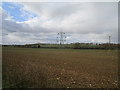
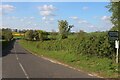
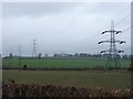

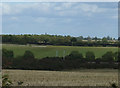
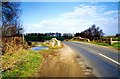

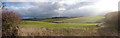
19 photos from this area
Area Information
Key information about the PE9 4EE including its size, population, and administrative classification.
- Area Type
- Postcode
- Area Size
- 3.8 km²
- Population
- 2184
- Population Density
- 32 people/km²
House Prices in PE9 4EE
14
Properties
£403,342
Average Sold Price
£120,000
Lowest Price
£625,000
Highest Price
Showing 14 properties
| Address | Type | Beds | Baths | Last Sale Price | Last Sale Date | |
|---|---|---|---|---|---|---|
| Glen Cottage, Stamford Road, Aunby, PE9 4EE | Land | 3 | 1 | £465,025 | Mar 2024 | |
| Vale Farm, Holywell Road, Ryhall, PE9 4EE | Detached | 5 | 3 | £625,000 | Jan 2019 | |
| Barbers Hill House, Stamford Road, Aunby, PE9 4EE | Detached | - | - | £120,000 | Apr 1996 | |
| Three Chimneys Mill View, Aunby Hamlet Road, Aunby, PE9 4EE | house | 4 | 3 | - | - | |
| Barbers Hill Farm, Stamford Road, Aunby, PE9 4EE | house | - | - | - | - | |
| Lodge Farm, Aunby Hamlet Road, Aunby, PE9 4EE | Terraced | - | - | - | - | |
| Manor Farm Cottage, Aunby Hamlet Road, Aunby, PE9 4EE | Detached | - | - | - | - | |
| Granary Cottage, Aunby Hamlet Road, Aunby, PE9 4EE | Semi-detached | - | - | - | - | |
| Aunby Manor, Aunby Hamlet Road, Aunby, PE9 4EE | office_workshop | - | - | - | - | |
| The Grange, Aunby Hamlet Road, Aunby, PE9 4EE | Detached | - | - | - | - |
Page 1 of 2
Energy Efficiency in PE9 4EE
Amenities
Schools
| Rank | School | Type | Entry gender | Ages |
|---|
Explore more schools in this area
Go to Schools tabDemographics
Household Size
Two person
most common
Accommodation Type
Houses
most common
Tenure
82
majority
Ethnic Group
White
most common
Religion
N/A
most common
Household Composition
N/A
most common
Age
47
median
Adults (30-64 years)
most common
Household Deprivation
N/A
with no deprivation
NS-SEC
46
in Lower managerial occupations
Explore more demographic insights in this area
Go to Demographics tabPlanning
Planning Constraints
- Flood RiskPremium
- Ramsar Wetland SitesPremium
- Area of Outstanding Natural BeautyPremium
- Protected Nature ReservePremium
- Protected WoodlandPremium