Area Overview for PE9 2SG
Photos of PE9 2SG
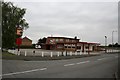
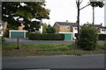
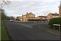
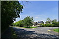
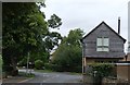
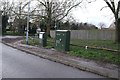
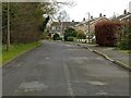
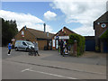
41 photos from this area
Area Information
Key information about the PE9 2SG including its size, population, and administrative classification.
- Area Type
- Postcode
- Area Size
- 1.1 hectares
- Population
- 2503
- Population Density
- 1444 people/km²
House Prices in PE9 2SG
26
Properties
£169,682
Average Sold Price
£59,999
Lowest Price
£340,000
Highest Price
Showing 26 properties
| Address | Type | Beds | Baths | Last Sale Price | Last Sale Date | |
|---|---|---|---|---|---|---|
| 91 Lonsdale Road, Stamford, PE9 2SG | Semi-detached | 3 | 1 | £297,000 | Dec 2024 | |
| 94 Lonsdale Road, Stamford, PE9 2SG | Semi-detached | 3 | 1 | £340,000 | Sep 2022 | |
| 93 Lonsdale Road, Stamford, PE9 2SG | house | - | - | £220,000 | Nov 2020 | |
| 97 Lonsdale Road, Stamford, PE9 2SG | Semi-detached | 3 | 1 | £230,000 | Jul 2019 | |
| 95 Lonsdale Road, Stamford, PE9 2SG | Semi-detached | 3 | 1 | £180,000 | Dec 2013 | |
| 92 Lonsdale Road, Stamford, PE9 2SG | house | 3 | - | £166,500 | May 2012 | |
| 98 Lonsdale Road, Stamford, PE9 2SG | Semi-detached | 3 | 1 | £164,000 | May 2005 | |
| 82 Lonsdale Road, Stamford, PE9 2SG | Semi-detached | - | - | £85,000 | Jun 2002 | |
| 80 Lonsdale Road, Stamford, PE9 2SG | Semi-detached | - | - | £64,000 | May 1998 | |
| 100 Lonsdale Road, Stamford, PE9 2SG | Semi-detached | - | - | £60,000 | Jun 1996 |
Page 1 of 3
Energy Efficiency in PE9 2SG
Amenities
Schools
| Rank | School | Type | Entry gender | Ages |
|---|
Explore more schools in this area
Go to Schools tabDemographics
Household Size
Two person
most common
Accommodation Type
Houses
most common
Tenure
84
majority
Ethnic Group
White
most common
Religion
N/A
most common
Household Composition
N/A
most common
Age
47
median
Adults (30-64 years)
most common
Household Deprivation
N/A
with no deprivation
NS-SEC
47
in Lower managerial occupations
Explore more demographic insights in this area
Go to Demographics tabPlanning
Planning Constraints
- Flood RiskPremium
- Ramsar Wetland SitesPremium
- Area of Outstanding Natural BeautyPremium
- Protected Nature ReservePremium
- Protected WoodlandPremium