Area Overview for PE9 2LE
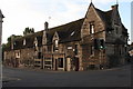
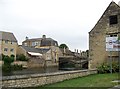
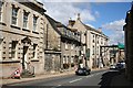
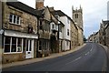
Photos of PE9 2LE


Area Information
Living in PE9 2LE offers a defined residential experience within a small, compact cluster of just over 1,100 square metres. This postcode covers a focused area where 1,844 people call home, creating a tight-knit environment rather than a sprawling suburb. The density stands at approximately 1,150 people per square kilometre, indicating a location where residents likely know one another and where community interactions are frequent. You will find this area functions as a specific residential hub, distinct from the wider Stamford town but deeply connected to it by proximity. The population consists primarily of adults between 30 and 64 years old, suggesting a community stabilised by established families and long-term professionals. Daily life here revolves around practical needs and established routines, accessible via local amenities in Stamford. The area does not boast vast open spaces, but its small size ensures that services and transport links are within a short reach. For those considering homes in PE9 2LE, the environment is characterised by efficiency and close proximity to essential services. The layout supports a steady pace, where the convenience of local town centres outweighs the need for extensive travel. This postcode represents a specific slice of the Stamford property market, catering to buyers who prioritise location and community stability over expansive surroundings. The character of PE9 2LE is defined by its density and the strong connection to the local town centre. The community profile in PE9 2LE reflects a mature demographic with a median age of 47 years. The majority of residents fall into the adult bracket ranging from 30 to 64 years, indicating a neighbourhood populated by working families and established professionals rather than young students or empty nesters. This age distribution shapes the social fabric, creating an environment where stability and long-term planning often guide local decisions. Housing preference aligns with this demographic, as houses dominate the accommodation type within this postcode. You will find a significant portion of the housing stock consists of detached or semi-detached family homes suitable for the typical household. Home ownership stands at 54%, meaning slightly more than half of the residents own their properties outright or have a mortgage, while the remainder reside in rental accommodation. This split suggests a market that includes both ambitious savers and those preferring the flexibility of renting. The area maintains a predominantly White ethnic composition, contributing to a relatively homogenous cultural atmosphere. There are no indicators of severe economic deprivation affecting the quality of life in this specific cluster, allowing residents to focus on standard living costs rather than struggling against financial hardship. The demographic data paints a picture of a settled community where life is balanced between work, home, and family, without the volatility often associated with younger, transient populations. The property landscape in PE9 2LE is defined by its residential focus, with houses forming the principal accommodation type for the 1,844 residents living here. A striking 54% of households in this postcode are owner-occupied, which signals a market driven by long-term stability and investment rather than transient renting. This high level of home ownership suggests that your neighbours are likely invested in the area's future and value permanence. Most properties will be tailored to adults between 30 and 64 years old, meaning the stock likely includes family-sized homes with gardens or larger living spaces suited to established households. Given the small physical size of the area, which covers only 1,146 square metres, the housing supply is limited and competition for suitable homes could be intense if you find a property you like. This is primarily an owner-occupied area, though 46% of residents still reside in rented accommodation, indicating a healthy balance in the local market. For buyers looking at homes in PE9 2LE, the environment offers the chance to join an established community rather than moving into a high-rise block or a rental farm. The dominance of houses ensures a consistent architectural style and a sense of privacy that apartments cannot always provide. Families living in PE9 2LE have access to two independent schooling options, both situated near Stamford. The area is served by Stamford Junior School and Stamford High School, both classified as independent institutions. These schools provide an alternative to the state sector, often featuring specific philosophies, smaller class sizes, and different fee structures that appeal to parents seeking tailored education. As both facilities are independent, the cost of education will vary depending on the family's financial situation and the specific fees of each institution. The presence of these schools reinforces the social makeup of the area, confirmed by the median age of 47 years and the prevalence of adults between 30 and 64 years. Choosing schools near PE9 2LE means you are opting for private education, which requires a significant budget but offers perceived benefits in flexibility and curriculum. The independent nature of both establishments means they operate outside standard government inspections, assessing their own standards of excellence. For parents considering homes in PE9 2LE, the school choices are clear and specific, removing the uncertainty sometimes found in areas with a mix of pupil referral units or unverified secondary options. Digital connectivity in PE9 2LE supports a modern, work-from-home lifestyle without significant hindrance. Fixed broadband quality scores an excellent 95 out of 100, meaning you can expect fast, reliable internet speeds suitable for video conferencing, large file uploads, and streaming. Mobile coverage scores an 83 out of 100, indicating good signal strength across the area for browsing and communication on the go. These high ratings ensure that remote work or remote study is a viable option for the 54% of residents who own homes and may work from the property. The physical transport network connects PE9 2LE directly to Stamford, where Stamford Railway Station provides access to the wider rail network. A single transport hub serves the local community, and a bus interchange offers additional flexibility for those without cars. The proximity to RAF Wittering, though an airport, does not dictate the primary transport mode, which remains road and rail based. Residents enjoy excellent connectivity; you will find that staying connected online is effortless, and travelling to nearby towns or cities is straightforward via the rail station. The combination of high-speed broadband and reliable rail links makes PE9 2LE well-suited for professionals who value connection over time. Daily life in PE9 2LE is supported by a cluster of amenities located immediately nearby, ensuring you do not need to travel far for essentials. The retail landscape includes five key shops or stands, with Tesco Stamford and Waitrose Stamford providing full-range supermarkets for groceries and household items. M&S Stamford offers additional shopping options for clothing and groceries, caterying to shoppers who require variety. Transport links are robust, with Stamford Railway Station providing easy access to the national rail network and a bus interchange serving local routes. For those with travel needs, RAF Wittering offers air connectivity, although this is less central to daily commuting than ground transport. The mix of high-street retailers like M&S and premium options like Waitrose elevates the convenience of living in this postcode. You can simply pick up essentials close to home or visit the train station for occasional trips out of town. The lifestyle is practical and efficient, where the need to venture into the main town for shopping is minimal. These amenities create a self-sufficient environment where residents can manage their daily needs comfortably. The proximity of these specific venues means you can enjoy a range of goods and services without the strain of long commutes, making PE9 2LE a functional and convenient place to live. Safety and environmental factors in PE9 2LE require a balanced view of the risks and protections present in your chosen home. The most pressing environmental concern is flood risk, which presents a critical level of threat to the area. With a score of 67.4, flood risk coverage is high, meaning residents must take seriously the potential for water to affect properties. This is a significant factor to weigh before purchasing, as it impacts insurance and future maintenance costs. Conversely, the area passes all planning constraint checks free of major restrictions. There is no Ramsar wetland coverage, no Area of Outstanding Natural Beauty designation, and no protected nature reserves or woodlands bordering the property. This absence of planning constraints allows for greater flexibility in certain development matters. Regarding personal safety, the crime risk assessment shows a medium level with a score of 39. Crime rates are around average compared to national or regional figures, meaning you face standard risks rather than extreme danger. Medium crime risk means you should adhere to standard security precautions, such as locking doors and being aware of your surroundings, but you should not expect unheard-of crime levels. While the flood risk demands attention, the lack of protected land and average crime stats provide a relatively stable backdrop for daily life. What is the community like in PE9 2LE, and who typically lives here? PE9 2LE hosts a mature community of 1,844 people, with a median age of 47. The majority of residents are adults between 30 and 64 years old. This demographic fact corresponds with a 54% home ownership rate and a housing stock dominated by houses. The environment supports families and professionals who value stability. Which schools are available for children living near PE9 2LE? Parents in this area have access to two independent schools: Stamford Junior School and Stamford High School. Both institutions are located near Stamford. This choice offers an alternative to state education, appealing to families seeking specific educational philosophies for their children. How reliable are the internet and transport links in PE9 2LE? The area enjoys excellent digital connectivity with a fixed broadband score of 95 and mobile coverage of 83. For physical transport, residents can access Stamford Railway Station via a local interchange. The nearest airport is RAF Wittering. These links ensure strong connectivity for work and travel. What are the main safety and environmental concerns for PE9 2LE? The area carries a critical flood risk with a score of 67.4, which is the primary environmental concern. However, crime risk is considered medium with a score of 39. There are no protected woodlands or nature reserves nearby, and the area is free from Ramsar or AONB constraints.
- Area Type
- Postcode
- Area Size
- 1146 m²
- Population
- 1844
- Population Density
- 1150 people/km²
The property landscape in PE9 2LE is defined by its residential focus, with houses forming the principal accommodation type for the 1,844 residents living here. A striking 54% of households in this postcode are owner-occupied, which signals a market driven by long-term stability and investment rather than transient renting. This high level of home ownership suggests that your neighbours are likely invested in the area's future and value permanence. Most properties will be tailored to adults between 30 and 64 years old, meaning the stock likely includes family-sized homes with gardens or larger living spaces suited to established households. Given the small physical size of the area, which covers only 1,146 square metres, the housing supply is limited and competition for suitable homes could be intense if you find a property you like. This is primarily an owner-occupied area, though 46% of residents still reside in rented accommodation, indicating a healthy balance in the local market. For buyers looking at homes in PE9 2LE, the environment offers the chance to join an established community rather than moving into a high-rise block or a rental farm. The dominance of houses ensures a consistent architectural style and a sense of privacy that apartments cannot always provide. Families living in PE9 2LE have access to two independent schooling options, both situated near Stamford. The area is served by Stamford Junior School and Stamford High School, both classified as independent institutions. These schools provide an alternative to the state sector, often featuring specific philosophies, smaller class sizes, and different fee structures that appeal to parents seeking tailored education. As both facilities are independent, the cost of education will vary depending on the family's financial situation and the specific fees of each institution. The presence of these schools reinforces the social makeup of the area, confirmed by the median age of 47 years and the prevalence of adults between 30 and 64 years. Choosing schools near PE9 2LE means you are opting for private education, which requires a significant budget but offers perceived benefits in flexibility and curriculum. The independent nature of both establishments means they operate outside standard government inspections, assessing their own standards of excellence. For parents considering homes in PE9 2LE, the school choices are clear and specific, removing the uncertainty sometimes found in areas with a mix of pupil referral units or unverified secondary options. Digital connectivity in PE9 2LE supports a modern, work-from-home lifestyle without significant hindrance. Fixed broadband quality scores an excellent 95 out of 100, meaning you can expect fast, reliable internet speeds suitable for video conferencing, large file uploads, and streaming. Mobile coverage scores an 83 out of 100, indicating good signal strength across the area for browsing and communication on the go. These high ratings ensure that remote work or remote study is a viable option for the 54% of residents who own homes and may work from the property. The physical transport network connects PE9 2LE directly to Stamford, where Stamford Railway Station provides access to the wider rail network. A single transport hub serves the local community, and a bus interchange offers additional flexibility for those without cars. The proximity to RAF Wittering, though an airport, does not dictate the primary transport mode, which remains road and rail based. Residents enjoy excellent connectivity; you will find that staying connected online is effortless, and travelling to nearby towns or cities is straightforward via the rail station. The combination of high-speed broadband and reliable rail links makes PE9 2LE well-suited for professionals who value connection over time. Daily life in PE9 2LE is supported by a cluster of amenities located immediately nearby, ensuring you do not need to travel far for essentials. The retail landscape includes five key shops or stands, with Tesco Stamford and Waitrose Stamford providing full-range supermarkets for groceries and household items. M&S Stamford offers additional shopping options for clothing and groceries, caterying to shoppers who require variety. Transport links are robust, with Stamford Railway Station providing easy access to the national rail network and a bus interchange serving local routes. For those with travel needs, RAF Wittering offers air connectivity, although this is less central to daily commuting than ground transport. The mix of high-street retailers like M&S and premium options like Waitrose elevates the convenience of living in this postcode. You can simply pick up essentials close to home or visit the train station for occasional trips out of town. The lifestyle is practical and efficient, where the need to venture into the main town for shopping is minimal. These amenities create a self-sufficient environment where residents can manage their daily needs comfortably. The proximity of these specific venues means you can enjoy a range of goods and services without the strain of long commutes, making PE9 2LE a functional and convenient place to live. Safety and environmental factors in PE9 2LE require a balanced view of the risks and protections present in your chosen home. The most pressing environmental concern is flood risk, which presents a critical level of threat to the area. With a score of 67.4, flood risk coverage is high, meaning residents must take seriously the potential for water to affect properties. This is a significant factor to weigh before purchasing, as it impacts insurance and future maintenance costs. Conversely, the area passes all planning constraint checks free of major restrictions. There is no Ramsar wetland coverage, no Area of Outstanding Natural Beauty designation, and no protected nature reserves or woodlands bordering the property. This absence of planning constraints allows for greater flexibility in certain development matters. Regarding personal safety, the crime risk assessment shows a medium level with a score of 39. Crime rates are around average compared to national or regional figures, meaning you face standard risks rather than extreme danger. Medium crime risk means you should adhere to standard security precautions, such as locking doors and being aware of your surroundings, but you should not expect unheard-of crime levels. While the flood risk demands attention, the lack of protected land and average crime stats provide a relatively stable backdrop for daily life. What is the community like in PE9 2LE, and who typically lives here? PE9 2LE hosts a mature community of 1,844 people, with a median age of 47. The majority of residents are adults between 30 and 64 years old. This demographic fact corresponds with a 54% home ownership rate and a housing stock dominated by houses. The environment supports families and professionals who value stability. Which schools are available for children living near PE9 2LE? Parents in this area have access to two independent schools: Stamford Junior School and Stamford High School. Both institutions are located near Stamford. This choice offers an alternative to state education, appealing to families seeking specific educational philosophies for their children. How reliable are the internet and transport links in PE9 2LE? The area enjoys excellent digital connectivity with a fixed broadband score of 95 and mobile coverage of 83. For physical transport, residents can access Stamford Railway Station via a local interchange. The nearest airport is RAF Wittering. These links ensure strong connectivity for work and travel. What are the main safety and environmental concerns for PE9 2LE? The area carries a critical flood risk with a score of 67.4, which is the primary environmental concern. However, crime risk is considered medium with a score of 39. There are no protected woodlands or nature reserves nearby, and the area is free from Ramsar or AONB constraints.
House Prices in PE9 2LE
Showing 3 properties
| Address | Type | Beds | Baths | Last Sale Price | Last Sale Date | |
|---|---|---|---|---|---|---|
| Flat 2, 1 High Street, St Martins, Stamford, PE9 2LE | Flat | - | - | - | - | |
| Pizza Express, 1 High Street, St Martins, Stamford, PE9 2LE | Industrial | - | - | - | - | |
| Flat 1, 1 High Street, St Martins, Stamford, PE9 2LE | Flat | - | - | - | - |
Energy Efficiency in PE9 2LE
Daily life in PE9 2LE is supported by a cluster of amenities located immediately nearby, ensuring you do not need to travel far for essentials. The retail landscape includes five key shops or stands, with Tesco Stamford and Waitrose Stamford providing full-range supermarkets for groceries and household items. M&S Stamford offers additional shopping options for clothing and groceries, caterying to shoppers who require variety. Transport links are robust, with Stamford Railway Station providing easy access to the national rail network and a bus interchange serving local routes. For those with travel needs, RAF Wittering offers air connectivity, although this is less central to daily commuting than ground transport. The mix of high-street retailers like M&S and premium options like Waitrose elevates the convenience of living in this postcode. You can simply pick up essentials close to home or visit the train station for occasional trips out of town. The lifestyle is practical and efficient, where the need to venture into the main town for shopping is minimal. These amenities create a self-sufficient environment where residents can manage their daily needs comfortably. The proximity of these specific venues means you can enjoy a range of goods and services without the strain of long commutes, making PE9 2LE a functional and convenient place to live. Safety and environmental factors in PE9 2LE require a balanced view of the risks and protections present in your chosen home. The most pressing environmental concern is flood risk, which presents a critical level of threat to the area. With a score of 67.4, flood risk coverage is high, meaning residents must take seriously the potential for water to affect properties. This is a significant factor to weigh before purchasing, as it impacts insurance and future maintenance costs. Conversely, the area passes all planning constraint checks free of major restrictions. There is no Ramsar wetland coverage, no Area of Outstanding Natural Beauty designation, and no protected nature reserves or woodlands bordering the property. This absence of planning constraints allows for greater flexibility in certain development matters. Regarding personal safety, the crime risk assessment shows a medium level with a score of 39. Crime rates are around average compared to national or regional figures, meaning you face standard risks rather than extreme danger. Medium crime risk means you should adhere to standard security precautions, such as locking doors and being aware of your surroundings, but you should not expect unheard-of crime levels. While the flood risk demands attention, the lack of protected land and average crime stats provide a relatively stable backdrop for daily life. What is the community like in PE9 2LE, and who typically lives here? PE9 2LE hosts a mature community of 1,844 people, with a median age of 47. The majority of residents are adults between 30 and 64 years old. This demographic fact corresponds with a 54% home ownership rate and a housing stock dominated by houses. The environment supports families and professionals who value stability. Which schools are available for children living near PE9 2LE? Parents in this area have access to two independent schools: Stamford Junior School and Stamford High School. Both institutions are located near Stamford. This choice offers an alternative to state education, appealing to families seeking specific educational philosophies for their children. How reliable are the internet and transport links in PE9 2LE? The area enjoys excellent digital connectivity with a fixed broadband score of 95 and mobile coverage of 83. For physical transport, residents can access Stamford Railway Station via a local interchange. The nearest airport is RAF Wittering. These links ensure strong connectivity for work and travel. What are the main safety and environmental concerns for PE9 2LE? The area carries a critical flood risk with a score of 67.4, which is the primary environmental concern. However, crime risk is considered medium with a score of 39. There are no protected woodlands or nature reserves nearby, and the area is free from Ramsar or AONB constraints.
Amenities
Schools
Families living in PE9 2LE have access to two independent schooling options, both situated near Stamford. The area is served by Stamford Junior School and Stamford High School, both classified as independent institutions. These schools provide an alternative to the state sector, often featuring specific philosophies, smaller class sizes, and different fee structures that appeal to parents seeking tailored education. As both facilities are independent, the cost of education will vary depending on the family's financial situation and the specific fees of each institution. The presence of these schools reinforces the social makeup of the area, confirmed by the median age of 47 years and the prevalence of adults between 30 and 64 years. Choosing schools near PE9 2LE means you are opting for private education, which requires a significant budget but offers perceived benefits in flexibility and curriculum. The independent nature of both establishments means they operate outside standard government inspections, assessing their own standards of excellence. For parents considering homes in PE9 2LE, the school choices are clear and specific, removing the uncertainty sometimes found in areas with a mix of pupil referral units or unverified secondary options. Digital connectivity in PE9 2LE supports a modern, work-from-home lifestyle without significant hindrance. Fixed broadband quality scores an excellent 95 out of 100, meaning you can expect fast, reliable internet speeds suitable for video conferencing, large file uploads, and streaming. Mobile coverage scores an 83 out of 100, indicating good signal strength across the area for browsing and communication on the go. These high ratings ensure that remote work or remote study is a viable option for the 54% of residents who own homes and may work from the property. The physical transport network connects PE9 2LE directly to Stamford, where Stamford Railway Station provides access to the wider rail network. A single transport hub serves the local community, and a bus interchange offers additional flexibility for those without cars. The proximity to RAF Wittering, though an airport, does not dictate the primary transport mode, which remains road and rail based. Residents enjoy excellent connectivity; you will find that staying connected online is effortless, and travelling to nearby towns or cities is straightforward via the rail station. The combination of high-speed broadband and reliable rail links makes PE9 2LE well-suited for professionals who value connection over time. Daily life in PE9 2LE is supported by a cluster of amenities located immediately nearby, ensuring you do not need to travel far for essentials. The retail landscape includes five key shops or stands, with Tesco Stamford and Waitrose Stamford providing full-range supermarkets for groceries and household items. M&S Stamford offers additional shopping options for clothing and groceries, caterying to shoppers who require variety. Transport links are robust, with Stamford Railway Station providing easy access to the national rail network and a bus interchange serving local routes. For those with travel needs, RAF Wittering offers air connectivity, although this is less central to daily commuting than ground transport. The mix of high-street retailers like M&S and premium options like Waitrose elevates the convenience of living in this postcode. You can simply pick up essentials close to home or visit the train station for occasional trips out of town. The lifestyle is practical and efficient, where the need to venture into the main town for shopping is minimal. These amenities create a self-sufficient environment where residents can manage their daily needs comfortably. The proximity of these specific venues means you can enjoy a range of goods and services without the strain of long commutes, making PE9 2LE a functional and convenient place to live. Safety and environmental factors in PE9 2LE require a balanced view of the risks and protections present in your chosen home. The most pressing environmental concern is flood risk, which presents a critical level of threat to the area. With a score of 67.4, flood risk coverage is high, meaning residents must take seriously the potential for water to affect properties. This is a significant factor to weigh before purchasing, as it impacts insurance and future maintenance costs. Conversely, the area passes all planning constraint checks free of major restrictions. There is no Ramsar wetland coverage, no Area of Outstanding Natural Beauty designation, and no protected nature reserves or woodlands bordering the property. This absence of planning constraints allows for greater flexibility in certain development matters. Regarding personal safety, the crime risk assessment shows a medium level with a score of 39. Crime rates are around average compared to national or regional figures, meaning you face standard risks rather than extreme danger. Medium crime risk means you should adhere to standard security precautions, such as locking doors and being aware of your surroundings, but you should not expect unheard-of crime levels. While the flood risk demands attention, the lack of protected land and average crime stats provide a relatively stable backdrop for daily life. What is the community like in PE9 2LE, and who typically lives here? PE9 2LE hosts a mature community of 1,844 people, with a median age of 47. The majority of residents are adults between 30 and 64 years old. This demographic fact corresponds with a 54% home ownership rate and a housing stock dominated by houses. The environment supports families and professionals who value stability. Which schools are available for children living near PE9 2LE? Parents in this area have access to two independent schools: Stamford Junior School and Stamford High School. Both institutions are located near Stamford. This choice offers an alternative to state education, appealing to families seeking specific educational philosophies for their children. How reliable are the internet and transport links in PE9 2LE? The area enjoys excellent digital connectivity with a fixed broadband score of 95 and mobile coverage of 83. For physical transport, residents can access Stamford Railway Station via a local interchange. The nearest airport is RAF Wittering. These links ensure strong connectivity for work and travel. What are the main safety and environmental concerns for PE9 2LE? The area carries a critical flood risk with a score of 67.4, which is the primary environmental concern. However, crime risk is considered medium with a score of 39. There are no protected woodlands or nature reserves nearby, and the area is free from Ramsar or AONB constraints.
| Rank | School | Type | Entry gender | Ages |
|---|
Explore more schools in this area
Go to Schools tabDemographics
The community profile in PE9 2LE reflects a mature demographic with a median age of 47 years. The majority of residents fall into the adult bracket ranging from 30 to 64 years, indicating a neighbourhood populated by working families and established professionals rather than young students or empty nesters. This age distribution shapes the social fabric, creating an environment where stability and long-term planning often guide local decisions. Housing preference aligns with this demographic, as houses dominate the accommodation type within this postcode. You will find a significant portion of the housing stock consists of detached or semi-detached family homes suitable for the typical household. Home ownership stands at 54%, meaning slightly more than half of the residents own their properties outright or have a mortgage, while the remainder reside in rental accommodation. This split suggests a market that includes both ambitious savers and those preferring the flexibility of renting. The area maintains a predominantly White ethnic composition, contributing to a relatively homogenous cultural atmosphere. There are no indicators of severe economic deprivation affecting the quality of life in this specific cluster, allowing residents to focus on standard living costs rather than struggling against financial hardship. The demographic data paints a picture of a settled community where life is balanced between work, home, and family, without the volatility often associated with younger, transient populations. The property landscape in PE9 2LE is defined by its residential focus, with houses forming the principal accommodation type for the 1,844 residents living here. A striking 54% of households in this postcode are owner-occupied, which signals a market driven by long-term stability and investment rather than transient renting. This high level of home ownership suggests that your neighbours are likely invested in the area's future and value permanence. Most properties will be tailored to adults between 30 and 64 years old, meaning the stock likely includes family-sized homes with gardens or larger living spaces suited to established households. Given the small physical size of the area, which covers only 1,146 square metres, the housing supply is limited and competition for suitable homes could be intense if you find a property you like. This is primarily an owner-occupied area, though 46% of residents still reside in rented accommodation, indicating a healthy balance in the local market. For buyers looking at homes in PE9 2LE, the environment offers the chance to join an established community rather than moving into a high-rise block or a rental farm. The dominance of houses ensures a consistent architectural style and a sense of privacy that apartments cannot always provide. Families living in PE9 2LE have access to two independent schooling options, both situated near Stamford. The area is served by Stamford Junior School and Stamford High School, both classified as independent institutions. These schools provide an alternative to the state sector, often featuring specific philosophies, smaller class sizes, and different fee structures that appeal to parents seeking tailored education. As both facilities are independent, the cost of education will vary depending on the family's financial situation and the specific fees of each institution. The presence of these schools reinforces the social makeup of the area, confirmed by the median age of 47 years and the prevalence of adults between 30 and 64 years. Choosing schools near PE9 2LE means you are opting for private education, which requires a significant budget but offers perceived benefits in flexibility and curriculum. The independent nature of both establishments means they operate outside standard government inspections, assessing their own standards of excellence. For parents considering homes in PE9 2LE, the school choices are clear and specific, removing the uncertainty sometimes found in areas with a mix of pupil referral units or unverified secondary options. Digital connectivity in PE9 2LE supports a modern, work-from-home lifestyle without significant hindrance. Fixed broadband quality scores an excellent 95 out of 100, meaning you can expect fast, reliable internet speeds suitable for video conferencing, large file uploads, and streaming. Mobile coverage scores an 83 out of 100, indicating good signal strength across the area for browsing and communication on the go. These high ratings ensure that remote work or remote study is a viable option for the 54% of residents who own homes and may work from the property. The physical transport network connects PE9 2LE directly to Stamford, where Stamford Railway Station provides access to the wider rail network. A single transport hub serves the local community, and a bus interchange offers additional flexibility for those without cars. The proximity to RAF Wittering, though an airport, does not dictate the primary transport mode, which remains road and rail based. Residents enjoy excellent connectivity; you will find that staying connected online is effortless, and travelling to nearby towns or cities is straightforward via the rail station. The combination of high-speed broadband and reliable rail links makes PE9 2LE well-suited for professionals who value connection over time. Daily life in PE9 2LE is supported by a cluster of amenities located immediately nearby, ensuring you do not need to travel far for essentials. The retail landscape includes five key shops or stands, with Tesco Stamford and Waitrose Stamford providing full-range supermarkets for groceries and household items. M&S Stamford offers additional shopping options for clothing and groceries, caterying to shoppers who require variety. Transport links are robust, with Stamford Railway Station providing easy access to the national rail network and a bus interchange serving local routes. For those with travel needs, RAF Wittering offers air connectivity, although this is less central to daily commuting than ground transport. The mix of high-street retailers like M&S and premium options like Waitrose elevates the convenience of living in this postcode. You can simply pick up essentials close to home or visit the train station for occasional trips out of town. The lifestyle is practical and efficient, where the need to venture into the main town for shopping is minimal. These amenities create a self-sufficient environment where residents can manage their daily needs comfortably. The proximity of these specific venues means you can enjoy a range of goods and services without the strain of long commutes, making PE9 2LE a functional and convenient place to live. Safety and environmental factors in PE9 2LE require a balanced view of the risks and protections present in your chosen home. The most pressing environmental concern is flood risk, which presents a critical level of threat to the area. With a score of 67.4, flood risk coverage is high, meaning residents must take seriously the potential for water to affect properties. This is a significant factor to weigh before purchasing, as it impacts insurance and future maintenance costs. Conversely, the area passes all planning constraint checks free of major restrictions. There is no Ramsar wetland coverage, no Area of Outstanding Natural Beauty designation, and no protected nature reserves or woodlands bordering the property. This absence of planning constraints allows for greater flexibility in certain development matters. Regarding personal safety, the crime risk assessment shows a medium level with a score of 39. Crime rates are around average compared to national or regional figures, meaning you face standard risks rather than extreme danger. Medium crime risk means you should adhere to standard security precautions, such as locking doors and being aware of your surroundings, but you should not expect unheard-of crime levels. While the flood risk demands attention, the lack of protected land and average crime stats provide a relatively stable backdrop for daily life. What is the community like in PE9 2LE, and who typically lives here? PE9 2LE hosts a mature community of 1,844 people, with a median age of 47. The majority of residents are adults between 30 and 64 years old. This demographic fact corresponds with a 54% home ownership rate and a housing stock dominated by houses. The environment supports families and professionals who value stability. Which schools are available for children living near PE9 2LE? Parents in this area have access to two independent schools: Stamford Junior School and Stamford High School. Both institutions are located near Stamford. This choice offers an alternative to state education, appealing to families seeking specific educational philosophies for their children. How reliable are the internet and transport links in PE9 2LE? The area enjoys excellent digital connectivity with a fixed broadband score of 95 and mobile coverage of 83. For physical transport, residents can access Stamford Railway Station via a local interchange. The nearest airport is RAF Wittering. These links ensure strong connectivity for work and travel. What are the main safety and environmental concerns for PE9 2LE? The area carries a critical flood risk with a score of 67.4, which is the primary environmental concern. However, crime risk is considered medium with a score of 39. There are no protected woodlands or nature reserves nearby, and the area is free from Ramsar or AONB constraints.
Household Size
Accommodation Type
Tenure
Ethnic Group
Religion
Household Composition
Age
Household Deprivation
NS-SEC
Explore more demographic insights in this area
Go to Demographics tabPlanning
Planning Constraints
- Flood RiskPremium
- Ramsar Wetland SitesPremium
- Area of Outstanding Natural BeautyPremium
- Protected Nature ReservePremium
- Protected WoodlandPremium