Area Overview for PE9 2LD
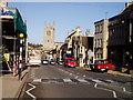
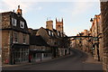
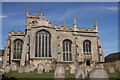
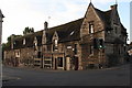
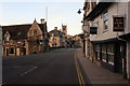
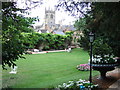
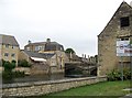
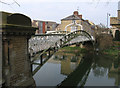
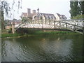
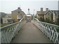
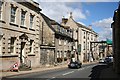
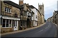
Photos of PE9 2LD
Area Information
Residents of PE9 2LD occupy a highly compact residential cluster covering just 4373 square metres. With a population of 1844 people, this area supports a density of 1150 individuals per square kilometre, creating an intimate neighbourhood rather than a sprawling suburb. You will find a distinct lack of large-scale developments typical of broader urban sprawl, instead experiencing a tightly knit community where proximity defines daily life. The environment is characterised by houses rather than high-density blocks, fostering a setting where neighbours are often within hearing distance. This specific postcode area offers a grounded lifestyle where the distinction between private gardens and shared green spaces feels porous due to the high population concentration. Living in PE9 2LD means accepting a bustling environment within a very small footprint. The area avoids the isolation of the countryside while retaining the relative quiet of a residential zone far from major city centres. Your day-to-day existence revolves around this concentrated community, where local interactions are frequent and convenient. The small area size ensures that a short walk typically encompasses the majority of residential activity, shopping, and social hubs. This density creates a sense of community that larger districts often struggle to replicate, but it also means you share very little private street space with your neighbours.
- Area Type
- Postcode
- Area Size
- 4373 m²
- Population
- 1844
- Population Density
- 1150 people/km²
The property market in PE9 2LD is characterised entirely by detached or semi-detached houses, with no apartment blocks or converted flats present in this specific postcode data. Residents achieve a home ownership rate of 54%, indicating that the majority of dwellings are privately held rather than part of a large rental development. This statistic suggests a stable market where buyers often purchase to remain rather than viewing the area as a temporary rental base. The predominance of houses over flats aligns with the population density of 1150 people per square kilometre, which, while high for a residential cluster, supports garden-style living rather than high-rise density. You are likely to find standard family homes in this area, catering to the median age of 47 years. The housing stock reflects the needs of adults in their thirties and forties who prioritise space and ownership status. Searching for homes in PE9 2LD means looking for property that suits a settled lifestyle rather than a transient one. The low presence of alternative accommodation types means competition for rental units is likely focused on these specific housing styles. For buyers, this translates to a market where transaction values may reflect the scarcity of new builds or large developments in such a compact zone. The 54% ownership figure implies a healthy turnover of existing properties rather than speculative investment housing dominating the streets.
House Prices in PE9 2LD
Showing 11 properties
| Address | Type | Beds | Baths | Last Sale Price | Last Sale Date | |
|---|---|---|---|---|---|---|
| 9, Merged With 10, Lord Burghleys Hospital, Station Road, Stamford, PE9 2LD | Detached | - | - | - | - | |
| 5, Lord Burghleys Hospital, Station Road, Stamford, PE9 2LD | Terraced | - | - | - | - | |
| 10, Lord Burghleys Hospital, Station Road, Stamford, PE9 2LD | Terraced | - | - | - | - | |
| 4, Lord Burghleys Hospital, Station Road, Stamford, PE9 2LD | Terraced | - | - | - | - | |
| 1, Lord Burghleys Hospital, Station Road, Stamford, PE9 2LD | Terraced | - | - | - | - | |
| 12, Lord Burghleys Hospital, Station Road, Stamford, PE9 2LD | Terraced | - | - | - | - | |
| 2, Lord Burghleys Hospital, Station Road, Stamford, PE9 2LD | Terraced | - | - | - | - | |
| 7, Lord Burghleys Hospital, Station Road, Stamford, PE9 2LD | Terraced | - | - | - | - | |
| 11, Lord Burghleys Hospital, Station Road, Stamford, PE9 2LD | Terraced | - | - | - | - | |
| 3, Lord Burghleys Hospital, Station Road, Stamford, PE9 2LD | Terraced | - | - | - | - |
Energy Efficiency in PE9 2LD
Daily life in PE9 2LD is serviced by a distinct cluster of amenities reachable within a short distance. Shops are represented by five key retail locations, including major names such as Tesco Stamford, M&S Stamford SF, and Waitrose Stamford. These venues provide comprehensive shopping needs, from groceries to fashion, meaning you do not need to travel far for essential goods. Transport connectivity is enhanced by the presence of one bus service stopping at a dedicated Bus Interchange and one rail option via Stamford Railway Station. For unique travel needs, RAF Wittering offers airport facilities nearby, adding a layer of convenience for business or leisure flights. These ten amenities collectively create a self-sufficient retail and transport hub for the local population. You can expect to find your weekly shop, laundry services, and dining options without venturing into the wider city district. The concentration of these facilities supports the high population density of 1150 people per square kilometre, ensuring that demand for goods is met promptly. Residents benefit from the immediate availability of high-street brands alongside essential supermarkets. This commercial ecosystem reduces the time spent travelling for routine errands, freeing up time for leisure or family activities within the neighbourhood.
Amenities
Schools
| Rank | School | Type | Entry gender | Ages |
|---|
Explore more schools in this area
Go to Schools tabDemographics
The community in PE9 2LD is defined by a mature demographic, with a median age of 47 years. Adults aged between 30 and 64 years constitute the most common age range, indicating a population with established lives and careers. House ownership stands at 54%, suggesting a balanced mix of owner-occupiers and those living in rented accommodation. The prevailing accommodation type is houses, aligning with the preference for family or larger single-unit dwellings typical of this age group. Ethnically, the predominant group is White, reflecting a homogeneous demographic structure. This diversity profile paints a picture of a settled community where long-term residents form the backbone of the local fabric. The high home ownership rate of 54% implies financial stability among many households, making this area attractive to commuters who have downsized from larger homes or those seeking affordable entry into the property market. The age profile suggests a demand for spacious living rather than compact urban apartments. Data confirms that the area does not cater to the ultra-young or the elderly, focusing instead on the core working and retirement ages of the adult population. This demographic concentration affects local service demand and community engagement, fostering environments suited to established families rather than transient student populations or young professionals in their twenties.
Household Size
Accommodation Type
Tenure
Ethnic Group
Religion
Household Composition
Age
Household Deprivation
NS-SEC
Explore more demographic insights in this area
Go to Demographics tabPlanning
Planning Constraints
- Flood RiskPremium
- Ramsar Wetland SitesPremium
- Area of Outstanding Natural BeautyPremium
- Protected Nature ReservePremium
- Protected WoodlandPremium