Area Overview for PE22 0PJ
Photos of PE22 0PJ
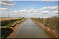
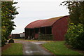
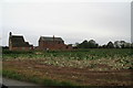
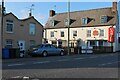
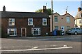

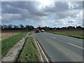
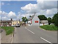
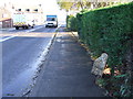
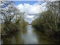
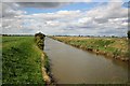
17 photos from this area
Area Information
Key information about the PE22 0PJ including its size, population, and administrative classification.
- Area Type
- Postcode
- Area Size
- 33.5 hectares
- Population
- 1605
- Population Density
- 75 people/km²
House Prices in PE22 0PJ
26
Properties
£184,063
Average Sold Price
£24,000
Lowest Price
£315,000
Highest Price
Showing 26 properties
| Address | Type | Beds | Baths | Last Sale Price | Last Sale Date | |
|---|---|---|---|---|---|---|
| Prospect House, Oak House Lane, Freiston, Boston, PE22 0PJ | house | - | - | £250,000 | Jan 2024 | |
| Fox Holme, Oak House Lane, Freiston, Boston, PE22 0PJ | Detached | 3 | 2 | £315,000 | Jan 2019 | |
| Oakleigh, Oak House Lane, Freiston, Boston, PE22 0PJ | house | - | - | £245,000 | May 2017 | |
| Holly Cottage, Oak House Lane, Freiston, Boston, PE22 0PJ | Detached | 3 | 1 | £195,000 | Jan 2014 | |
| Ghianda, Oak House Lane, Freiston, Boston, PE22 0PJ | Bungalow | 3 | - | £130,000 | Mar 2012 | |
| Danesfield, Oak House Lane, Freiston, Boston, PE22 0PJ | Bungalow | 3 | 1 | £150,000 | Mar 2012 | |
| Hob House, Oak House Lane, Freiston, Boston, PE22 0PJ | Semi-detached | - | - | £163,500 | Oct 2003 | |
| Dunromin, Oak House Lane, Freiston, Boston, PE22 0PJ | Detached | 4 | 2 | £24,000 | Sep 1998 | |
| The Cottage, Oak House Lane, Freiston, Boston, PE22 0PJ | Bungalow | 3 | 1 | - | - | |
| Country House, Oak House Lane, Freiston, Boston, PE22 0PJ | Detached | 3 | - | - | - |
Page 1 of 3
Energy Efficiency in PE22 0PJ
Amenities
Schools
| Rank | School | Type | Entry gender | Ages |
|---|
Explore more schools in this area
Go to Schools tabDemographics
Household Size
Two person
most common
Accommodation Type
Houses
most common
Tenure
73
majority
Ethnic Group
White
most common
Religion
N/A
most common
Household Composition
N/A
most common
Age
47
median
Adults (30-64 years)
most common
Household Deprivation
N/A
with no deprivation
NS-SEC
22
in Lower managerial occupations
Explore more demographic insights in this area
Go to Demographics tabPlanning
Planning Constraints
- Flood RiskPremium
- Ramsar Wetland SitesPremium
- Area of Outstanding Natural BeautyPremium
- Protected Nature ReservePremium
- Protected WoodlandPremium