Area Overview for PE22 0PG
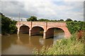
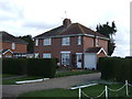
Photos of PE22 0PG
Area Information
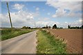
Living in PE22 0PG offers a quiet residential experience within a defined cluster just 16.6 hectares in size. This postcode serves a compact population of 1,605 residents, creating an environment that feels insular and established rather than sprawling. Daily life here revolves around proximity to familiar surroundings, with the 75 people per square kilometre density suggesting ample open space between homes. You will find yourself in a setting where neighbourly interactions are likely common due to the concentrated nature of the housing. The area lacks extensive shopping districts or multi-layered transport hubs internally, meaning your routine will depend on what lies within the immediate vicinity or a short drive away. This postcodes covers a small residential cluster typical of the rural Lincolnshire countryside, far removed from urban congestion. Residents here value the subdued atmosphere and the direct relationship with the local environment. It is an area defined by stability and household longevity rather than rapid development or transient populations. When you visit, you will notice the distinct lack of high-density infrastructure, which defines the pace of life for those calling PE22 0PG home.
- Area Type
- Postcode
- Area Size
- 16.6 hectares
- Population
- 1605
- Population Density
- 75 people/km²
The property market in PE22 0PG is characterised by stability and a strong preference for ownership. With a home ownership rate of 73%, the area functions primarily as an owner-occupied market rather than a rental hub. This dynamic creates a neighbourhood where landlords are a minority and investment properties designed for short-term lets are unlikely to dominate the streets. The stock consists mainly of houses, which suits the local demographic of adults and families seeking to build equity. Buying homes in PE22 0PG means you are part of a community where turnover is generally low, as residents have established deep roots. This simplicity offers predictability for buyers who prefer conventional transactions over the complexities of renting to students or corporate tenants. The 16.6 hectare footprint implies limited new construction, meaning supply is dictated by existing stock rather than speculative development. When you look at properties here, you are likely viewing established dwellings that have stood the test of time. This market structure removes the uncertainty associated with areas where rental yields drive transaction volume.
House Prices in PE22 0PG
Showing 24 properties
| Address | Type | Beds | Baths | Last Sale Price | Last Sale Date | |
|---|---|---|---|---|---|---|
| La Bassee, Wainfleet Road, Freiston, Boston, PE22 0PG | Bungalow | - | - | £160,000 | Nov 2021 | |
| Waterville, Wainfleet Road, Freiston, Boston, PE22 0PG | Detached | 4 | 2 | £255,000 | Jun 2021 | |
| Spring Dawn, Wainfleet Road, Freiston, Boston, PE22 0PG | Bungalow | 2 | 1 | £139,950 | Aug 2020 | |
| Diadem, Wainfleet Road, Freiston, Boston, PE22 0PG | Detached | 3 | 2 | £295,000 | Jul 2019 | |
| Chez Nous, Wainfleet Road, Freiston, Boston, PE22 0PG | house | - | - | £121,000 | Oct 2017 | |
| North Fields, Wainfleet Road, Freiston, Boston, PE22 0PG | Detached | 3 | - | £215,000 | Mar 2017 | |
| Mariazell, Wainfleet Road, Freiston, Boston, PE22 0PG | Bungalow | 3 | 1 | £95,000 | Feb 2012 | |
| Lindis, Wainfleet Road, Freiston, Boston, PE22 0PG | Bungalow | - | - | £150,000 | Dec 2011 | |
| Beechcroft, Wainfleet Road, Freiston, Boston, PE22 0PG | Detached | 5 | 4 | £238,000 | Jun 2011 | |
| Haltoft End House, Wainfleet Road, Freiston, Boston, PE22 0PG | Semi-detached | - | - | £156,000 | Apr 2009 |
Energy Efficiency in PE22 0PG
Daily life in PE22 0PG centres on access to essential SERVICES located just outside the residential core. You have immediate access to five key retail locations, including Spar, Lincolnshire Co-operative Co, and Iceland Boston. These venues form the backbone of local shopping, allowing you to manage household needs without travelling far. Beyond retail, rail transport is accessible through two nearby stations: Boston Railway Station and Hubberts Bridge Railway Station. These stations provide your main link to the wider region, although the specific travel times and routes depend on your destination. The character of this lifestyle is defined by close quarters and practical convenience. You do not need to navigate complex districts to find your shops. The presence of Iceland Boston in the immediate radius highlights the sufficiency of the retail provision for a population of 1,605.
Amenities
Schools
Your options for education near PE22 0PG are limited to two specific institutions, both holding good Ofsted ratings. The Butterwick Pinchbeck's Endowed CofE Primary School serves the early years, offering a good standard of education for children entering the system. Further along the educational path, Aspiration House School provides specialist education for grateful children, also distinguished by a good rating. As of Aspiration House School operates, the presence of a specialist school indicates that the local authority considers inclusive education a priority for the region. You will not find comprehensive secondary schools listed within the immediate data for this postcode, which means older children may require travel further afield for their secondary education needs. The mix of primary and special education facilities shapes the daily routine for families residing in PE22 0PG. Parents relying on local schooling have access to two venues with verified quality standards. Understanding this constraint is vital for planning school runs.
| Rank | School | Type | Entry gender | Ages |
|---|
Explore more schools in this area
Go to Schools tabDemographics
The community in PE22 0PG reflects a mature profile with a median age of 47 years. Most residents fall into the adult bracket of 30 to 64 years, indicating a population that has settled down and likely prioritises family stability or retirement planning over the dynamism of student housing. There is a strong sense of permanence in the neighbourhood, underscored by a 73% home ownership rate. This high figure suggests that the majority of households have long-term ties to their properties, contributing to community cohesion and lower tenant turnover. Accommodation types are predominantly houses, aligning with the demographic age structure and ownership levels. The area is largely white, which speaks to its established historical roots in Lincolnshire. You will not find large groups of young professionals renting temporarily or transient urban workers populating the streets. The demographic makeup supports a quiet, domestic pace of life where residents know their neighbours and understand the local rhythms. This steady population structure means you should expect a consistent community feel without the volatility found in university towns or temporary worker villages.
Household Size
Accommodation Type
Tenure
Ethnic Group
Religion
Household Composition
Age
Household Deprivation
NS-SEC
Explore more demographic insights in this area
Go to Demographics tabPlanning
Planning Constraints
- Flood RiskPremium
- Ramsar Wetland SitesPremium
- Area of Outstanding Natural BeautyPremium
- Protected Nature ReservePremium
- Protected WoodlandPremium