Area Overview for PE21 9PB
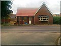
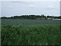
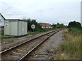
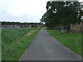
Photos of PE21 9PB


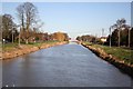
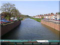
Area Information
Living in PE21 9PB offers a grounded experience within a compact residential cluster. This specific postcode covers just 1.5 hectares, creating a tight-knit environment where you are close to your neighbours. With a population of 1,439 people, the area maintains an intimate scale while retaining the conveniences of established local infrastructure. You will find that daily life here is defined by proximity rather than sprawl. The small land footprint means a high population density of 964 people per square kilometre, which creates a lived-in atmosphere without the chaos of larger urban centres. Residents enjoy the benefits of a defined community where streets have character and local services are within easy reach. The area functions as a self-contained residential hub where you can access everything from shops to transport links without excessive travel time. It is a place where space is at a premium, ensuring that facilities are not far away. Life in this postcode is practical and straightforward, focusing on the quality of the immediate surroundings.
- Area Type
- Postcode
- Area Size
- 1.5 hectares
- Population
- 1439
- Population Density
- 964 people/km²
The housing market in PE21 9PB is defined by a high degree of stability and private ownership. You will find that 69% of homes are owned outright or with a mortgage, making this an area where residents generally buy rather than rent. This contrasts sharply with high-turnover rental districts, offering a more predictable living environment. The accommodation type is strictly houses, so you can expect brick-built homes rather than modern developments or flats. This means the streetscape is uniform and established, likely featuring mature gardens and mature trees. Potential buyers looking at this small area should anticipate a market dominated by second-hand stock rather than new builds. The 100% house composition implies that properties are likely detached or semi-detached, offering more space than you might find in urban centres. This demographic picture suggests you are buying into a traditional residential setting where transactions move at a steady pace. There are no indications of speculative development or transient occupiers in this specific cluster.
House Prices in PE21 9PB
No properties found in this postcode.
Energy Efficiency in PE21 9PB
Your daily routine in PE21 9PB is supported by a cluster of practical amenities within practical reach. For shopping needs, you have five retail outlets nearby, including major supermarkets like Asda Boston, Iceland Boston, and Lidl Langrick. These venues are close enough for weekly grocery runs and general household shopping. Transport links are equally accessible, with two railway stations serving the area. Boston Railway Station and Hubberts Bridge Railway Station are both within reach, offering connections to the wider region. You do not need to travel far to access public transport, which complements the pedestrian-friendly nature of the postcode. The presence of national retailers and key transport hubs means you can handle most of your errands, work commutes, and leisure trips without venturing deep into the city. This blend of retail availability and rail access creates a convenient lifestyle for those who prefer a low-car suburb.
Amenities
Schools
Families living in PE21 9PB have access to a diverse mix of educational institutions nearby. The most prominent secondary option is Haven High Academy, which currently holds an inadequate Ofsted rating. This school is an academy and serves the educational needs of older children in the vicinity. For earlier years, you have the option of Haven High Technology College, which functions as a primary school for younger pupils. If you are specifically looking for special education needs, Kitwood County Secondary School for Girls is located close by. This provides a range of educational pathways for children of different ages. While the mix includes a primary academy and a secondary without current cautionary ratings, the presence of an inadequate-rated academy is a significant factor for any parent. The variety of school types means you can explore different curriculums and teaching styles, but due diligence on performance is essential when moving this area.
| Rank | School | Type | Entry gender | Ages |
|---|---|---|---|---|
| 1 | Haven High Technology College | primary | N/A | N/A |
| 2 | Kitwood County Secondary School for Girls | secondary | N/A | N/A |
| 3 | Haven High Academy | academy | N/A | N/A |
Explore more schools in this area
Go to Schools tabDemographics
The community in PE21 9PB reflects a mature profile with significant stability. Residents are predominantly adults between the ages of 30 and 64 years, evidenced by a median age of 47. This age distribution suggests a neighbourhood where families and established households remain for the long term. You will notice that 69% of homes are owner-occupied, indicating a strong sense of attachment to the locality. The housing stock is almost exclusively made up of houses, meaning you will see traditional domestic properties rather than apartments or flats. The predominant ethnic group is White, mirroring the broader character of many established English postcodes. There is no significant data on deprivation indices, so you should focus on the stability indicated by the high ownership rate. The consistent age profile and high ownership percentage point to a quiet, settled environment where long-term residents form the backbone of the social fabric.
Household Size
Accommodation Type
Tenure
Ethnic Group
Religion
Household Composition
Age
Household Deprivation
NS-SEC
Explore more demographic insights in this area
Go to Demographics tabPlanning
Planning Constraints
- Flood RiskPremium
- Ramsar Wetland SitesPremium
- Area of Outstanding Natural BeautyPremium
- Protected Nature ReservePremium
- Protected WoodlandPremium
- Crime RiskPremium