Area Overview for PE20 2DB
Photos of PE20 2DB
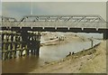
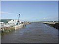
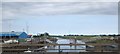
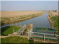
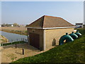


100 photos from this area
Area Information
Key information about the PE20 2DB including its size, population, and administrative classification.
- Area Type
- Postcode
- Area Size
- 90.5 hectares
- Population
- 1637
- Population Density
- 59 people/km²
House Prices in PE20 2DB
11
Properties
£156,999
Average Sold Price
£35,000
Lowest Price
£365,000
Highest Price
Showing 11 properties
| Address | Type | Beds | Baths | Last Sale Price | Last Sale Date | |
|---|---|---|---|---|---|---|
| Field View, Main Road, Fosdyke, Boston, PE20 2DB | Bungalow | - | - | £145,000 | Jan 2022 | |
| Myrtle Cottage, Main Road, Fosdyke, Boston, PE20 2DB | house | 4 | 1 | £160,000 | Jun 2019 | |
| Bridge House, Main Road, Fosdyke, Boston, PE20 2DB | Detached | 4 | - | £157,000 | Oct 2015 | |
| The Moorings, Main Road, Fosdyke, Boston, PE20 2DB | Detached | 3 | 2 | £365,000 | Nov 2007 | |
| Sunkyst, Main Road, Fosdyke, Boston, PE20 2DB | Detached | - | - | £79,995 | Jun 2003 | |
| Bramlea, Main Road, Fosdyke, Boston, PE20 2DB | Detached | - | - | £35,000 | Apr 1995 | |
| Cafe, The Moorings, Main Road, Fosdyke, Boston, PE20 2DB | Bungalow | - | - | - | - | |
| 2, Graves Farm, Main Road, Algarkirk, Boston, PE20 2DB | house | - | - | - | - | |
| 1, Graves Farm, Main Road, Algarkirk, Boston, PE20 2DB | Detached | - | - | - | - | |
| Lloyds Farm, Main Road, Fosdyke, Boston, PE20 2DB | house | - | - | - | - |
Page 1 of 2
Energy Efficiency in PE20 2DB
Amenities
Schools
| Rank | School | Type | Entry gender | Ages |
|---|
Explore more schools in this area
Go to Schools tabDemographics
Household Size
Two person
most common
Accommodation Type
Houses
most common
Tenure
65
majority
Ethnic Group
White
most common
Religion
N/A
most common
Household Composition
N/A
most common
Age
47
median
Adults (30-64 years)
most common
Household Deprivation
N/A
with no deprivation
NS-SEC
22
in Lower managerial occupations
Explore more demographic insights in this area
Go to Demographics tabPlanning
Planning Constraints
- Flood RiskPremium
- Ramsar Wetland SitesPremium
- Area of Outstanding Natural BeautyPremium
- Protected Nature ReservePremium
- Protected WoodlandPremium