Area Overview for PE20 2BU
Photos of PE20 2BU


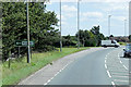

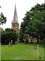


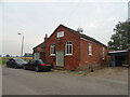
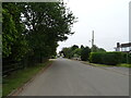
27 photos from this area
Area Information
Key information about the PE20 2BU including its size, population, and administrative classification.
- Area Type
- Postcode
- Area Size
- 16.1 hectares
- Population
- 1637
- Population Density
- 59 people/km²
House Prices in PE20 2BU
55
Properties
£163,166
Average Sold Price
£35,000
Lowest Price
£317,500
Highest Price
Showing 55 properties
| Address | Type | Beds | Baths | Last Sale Price | Last Sale Date | |
|---|---|---|---|---|---|---|
| Rovinj, 42 Old Main Road, Fosdyke, Boston, PE20 2BU | Bungalow | 2 | - | £165,000 | May 2024 | |
| Cornerways, Old Main Road, Fosdyke, Boston, PE20 2BU | Bungalow | 3 | 1 | £215,000 | May 2024 | |
| Bonnyside, 68 Old Main Road, Fosdyke, Boston, PE20 2BU | Detached | 4 | 3 | £317,500 | May 2024 | |
| Hillsborough, 50 Old Main Road, Fosdyke, Boston, PE20 2BU | Detached | 3 | 2 | £295,000 | Dec 2023 | |
| 1 Old Main Road, Fosdyke, Boston, PE20 2BU | Bungalow | 3 | 1 | £202,000 | Oct 2023 | |
| Canonbury, 66 Old Main Road, Fosdyke, Boston, PE20 2BU | Bungalow | - | - | £218,000 | Mar 2022 | |
| Summer Place, 19 Old Main Road, Fosdyke, Boston, PE20 2BU | Bungalow | - | - | £190,000 | Feb 2022 | |
| Apple Tree House, 70 Old Main Road, Fosdyke, Boston, PE20 2BU | Detached | 3 | - | £280,000 | Apr 2021 | |
| Sandpipers, 47 Old Main Road, Fosdyke, Boston, PE20 2BU | Detached | 2 | 2 | £265,000 | Mar 2021 | |
| 22 Old Main Road, Fosdyke, Boston, PE20 2BU | Bungalow | - | - | £195,000 | Nov 2020 |
Page 1 of 6
Energy Efficiency in PE20 2BU
Amenities
Schools
| Rank | School | Type | Entry gender | Ages |
|---|
Explore more schools in this area
Go to Schools tabDemographics
Household Size
Two person
most common
Accommodation Type
Houses
most common
Tenure
65
majority
Ethnic Group
White
most common
Religion
N/A
most common
Household Composition
N/A
most common
Age
47
median
Adults (30-64 years)
most common
Household Deprivation
N/A
with no deprivation
NS-SEC
22
in Lower managerial occupations
Explore more demographic insights in this area
Go to Demographics tabPlanning
Planning Constraints
- Flood RiskPremium
- Ramsar Wetland SitesPremium
- Area of Outstanding Natural BeautyPremium
- Protected Nature ReservePremium
- Protected WoodlandPremium