Area Overview for PE20 1AR
Photos of PE20 1AR
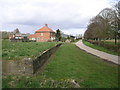
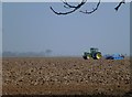
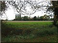
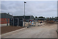
12 photos from this area
Area Information
Key information about the PE20 1AR including its size, population, and administrative classification.
- Area Type
- Postcode
- Area Size
- 12.7 hectares
- Population
- 1714
- Population Density
- 57 people/km²
House Prices in PE20 1AR
20
Properties
£242,250
Average Sold Price
£63,000
Lowest Price
£585,000
Highest Price
Showing 20 properties
| Address | Type | Beds | Baths | Last Sale Price | Last Sale Date | |
|---|---|---|---|---|---|---|
| 144 Middlegate Road East, Frampton, Boston, PE20 1AR | house | - | - | £230,000 | May 2024 | |
| 138 Middlegate Road East, Frampton, Boston, PE20 1AR | house | - | - | £297,500 | Oct 2023 | |
| The Parks, Middlegate Road East, Frampton, Boston, PE20 1AR | house | - | - | £585,000 | Apr 2017 | |
| 148 Middlegate Road East, Frampton, Boston, PE20 1AR | Semi-detached | 4 | 2 | £160,000 | Jul 2015 | |
| 146 Middlegate Road East, Frampton, Boston, PE20 1AR | house | - | - | £118,000 | Feb 2012 | |
| 133 Middlegate Road East, Frampton, Boston, PE20 1AR | Bungalow | 3 | 2 | £63,000 | Oct 2001 | |
| Rose Cottage, 127 Middlegate Road East, Frampton, Boston, PE20 1AR | Detached | 4 | 2 | - | - | |
| School House, 136 Middlegate Road East, Frampton, Boston, PE20 1AR | Detached | 4 | 2 | - | - | |
| Crow Green, Middlegate Road East, Frampton, Boston, PE20 1AR | Detached | 4 | 1 | - | - | |
| Holly Tree Lodge, 129 Middlegate Road East, Frampton, Boston, PE20 1AR | Detached | 4 | 2 | - | - |
Page 1 of 2
Energy Efficiency in PE20 1AR
Amenities
Schools
| Rank | School | Type | Entry gender | Ages |
|---|
Explore more schools in this area
Go to Schools tabDemographics
Household Size
Two person
most common
Accommodation Type
Houses
most common
Tenure
86
majority
Ethnic Group
White
most common
Religion
N/A
most common
Household Composition
N/A
most common
Age
47
median
Adults (30-64 years)
most common
Household Deprivation
N/A
with no deprivation
NS-SEC
30
in Lower managerial occupations
Explore more demographic insights in this area
Go to Demographics tabPlanning
Planning Constraints
- Flood RiskPremium
- Ramsar Wetland SitesPremium
- Area of Outstanding Natural BeautyPremium
- Protected Nature ReservePremium
- Protected WoodlandPremium