Area Overview for PE11 4EZ
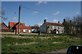
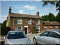
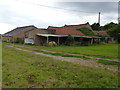
Photos of PE11 4EZ


Area Information
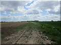
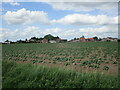
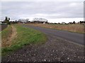
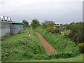
PE11 4EZ is a small residential cluster located in Lincolnshire, England, covering an area of 9.9 hectares. Despite its compact size, the postcode serves a defined population of 2,334 people, creating a close-knit community environment. Residents here experience a quiet, suburban lifestyle typical of rural England, with low population density averaging just 66 people per square kilometre. This setting offers a slower pace of life compared to larger urban centres, allowing families to enjoy generous garden spaces and proximity to the surrounding countryside. Living in PE11 4EZ means prioritising space and tranquility over the convenience of high-density housing developments. The area acts as a functional neighbourhood where daily routines revolve around local amenities and nearby transport links rather than extensive city infrastructure.
- Area Type
- Postcode
- Area Size
- 9.9 hectares
- Population
- 2334
- Population Density
- 66 people/km²
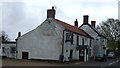
Homes in PE11 4EZ are defined by their structural type and ownership patterns, with 81% of dwellings being owner-occupied properties. The accommodation type is exclusively houses, meaning you will not find flats or apartments within this specific postcode boundary. This homogeneous housing stock creates a consistent architectural character typical of the English countryside, where properties are often detached or semi-detached with private gardens. The high level of home ownership indicates that most families have settled for the long term, often passing properties through generations or purchasing as an investment in local stability. For buyers considering this area, the lack of rental stock means the market focuses entirely on置换 or new purchases. Prices likely reflect the scarcity of such housing within a small 9.9 hectare zone. The market here is distinct from urban let-to-buy schemes, offering a transaction environment focused on permanent residence within a rural setting.
House Prices in PE11 4EZ
Showing 19 properties
| Address | Type | Beds | Baths | Last Sale Price | Last Sale Date | |
|---|---|---|---|---|---|---|
| 18 Risegate Road, Gosberton Risegate, Spalding, PE11 4EZ | Bungalow | 3 | 2 | £450,000 | Feb 2024 | |
| 32 Risegate Road, Gosberton Risegate, Spalding, PE11 4EZ | Detached | 4 | 3 | £390,000 | Jun 2021 | |
| The Acorns, 10A Risegate Road, Gosberton Risegate, Spalding, PE11 4EZ | house | - | - | £650,000 | Feb 2020 | |
| 24 Risegate Road, Gosberton Risegate, Spalding, PE11 4EZ | Bungalow | 3 | 1 | £249,995 | Dec 2019 | |
| 14 Risegate Road, Gosberton Risegate, Spalding, PE11 4EZ | Bungalow | 2 | 1 | £165,000 | Dec 2019 | |
| 4 Risegate Road, Gosberton Risegate, Spalding, PE11 4EZ | Detached | - | - | £20,750 | Aug 1999 | |
| 12 Risegate Road, Gosberton Risegate, Spalding, PE11 4EZ | Semi-detached | - | - | £47,000 | Nov 1996 | |
| Derelict Cottage, Risegate Road, Gosberton Risegate, Spalding, PE11 4EZ | Detached | - | - | - | - | |
| 22 Risegate Road, Gosberton Risegate, Spalding, PE11 4EZ | Detached | - | - | - | - | |
| 36 Risegate Road, Gosberton Risegate, Spalding, PE11 4EZ | Detached | - | - | - | - |
Energy Efficiency in PE11 4EZ
Daily life in PE11 4EZ centres on a small selection of retail and transport options that are practically reachable for residents. You can access five local retail outlets, including branches of Lincolnshire Co-operative Co, Spar, and another Spar store, ensuring basic necessities are within easy reach without requiring extended travel. For commuting, Spalding Railway Station stands as the nearest rail hub, offering a direct link to wider Lincolnshire and national networks. While there are no major shopping centres or leisure complexes listed, this setup suits the quiet lifestyle of an area with low population density. The proximity of these amenities allows for efficient errand running while maintaining the privacy of rural living. Residents do not need to venture far for groceries or daily essentials, which supports the self-sufficient nature of households in this small residential cluster. The lack of commercial density means weekends tend to be quieter, focusing on local engagement rather than vibrant high-street activity.
Amenities
Schools
Families living in PE11 4EZ have access to several educational facilities within the immediate vicinity. Clough and Risegate Community Primary School holds a Good Ofsted rating, providing parents with a verified standard of education for their younger children. Surfleet Primary School also operates in the area, offering another option for local primary education alongside the rated institution. The presence of multiple primary schools suggests that the catchment areas serve a wide radius, essential for a postcode with a population of 2,334. Both institutions focus on English primary education, fitting the demographic profile of an area with a median age of 47. You will not find secondary schools listed directly within PE11 4EZ, meaning older children usually commute to larger towns like Spalding or Grantham. This arrangement is typical for rural postcodes where local provision stops at the primary stage.
| Rank | School | Type | Entry gender | Ages |
|---|
Explore more schools in this area
Go to Schools tabDemographics
The community profile in PE11 4EZ reflects an established population with a median age of 47 years. Most residents fall within the 30 to 64-year age range, indicating a settlement that caters to adult households and families in their peak earning years. You will find that the area is predominantly owner-occupied, with home ownership standing at 81%, suggesting long-term stability within the neighbourhood. Almost all accommodation consists of detached or semi-detached houses, contributing to the extensive footprint of individual gardens noted in the area's physical layout. The ethnic composition is predominantly White, aligning with the broader demographic trends of rural Lincolnshire. This demographic makeup supports local schools and shops that cater specifically to families with school-aged children. The high rate of home ownership also means that property values are often driven by local caretaker communities and shared local services rather than short-term rental turnover.
Household Size
Accommodation Type
Tenure
Ethnic Group
Religion
Household Composition
Age
Household Deprivation
NS-SEC
Explore more demographic insights in this area
Go to Demographics tabPlanning
Planning Constraints
- Flood RiskPremium
- Ramsar Wetland SitesPremium
- Area of Outstanding Natural BeautyPremium
- Protected Nature ReservePremium
- Protected WoodlandPremium