Area Overview for PE11 4ET
Photos of PE11 4ET
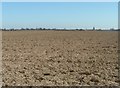
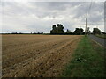
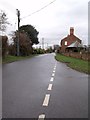
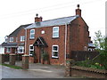
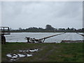
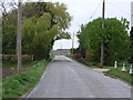
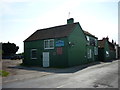
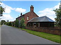

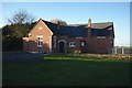
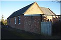
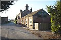
20 photos from this area
Area Information
Key information about the PE11 4ET including its size, population, and administrative classification.
- Area Type
- Postcode
- Area Size
- 37.5 hectares
- Population
- 2334
- Population Density
- 66 people/km²
House Prices in PE11 4ET
69
Properties
£183,204
Average Sold Price
£36,000
Lowest Price
£450,000
Highest Price
Showing 69 properties
| Address | Type | Beds | Baths | Last Sale Price | Last Sale Date | |
|---|---|---|---|---|---|---|
| 38 Siltside, Gosberton Risegate, Spalding, PE11 4ET | house | - | - | £220,000 | Aug 2023 | |
| 80 Siltside, Gosberton Risegate, Spalding, PE11 4ET | Detached | 4 | 2 | £180,000 | Jun 2023 | |
| 44 Siltside, Gosberton Risegate, Spalding, PE11 4ET | Bungalow | - | - | £245,000 | Nov 2022 | |
| 40 Siltside, Gosberton Risegate, Spalding, PE11 4ET | Detached | 2 | 1 | £290,000 | Sep 2022 | |
| 70 Siltside, Gosberton Risegate, Spalding, PE11 4ET | Retail | 3 | 1 | £450,000 | May 2022 | |
| 16 Siltside, Gosberton Risegate, Spalding, PE11 4ET | Detached | - | - | £189,950 | May 2022 | |
| 124 Siltside, Gosberton Risegate, Spalding, PE11 4ET | house | - | - | £300,000 | Dec 2021 | |
| Lyndhurst, 24 Siltside, Gosberton Risegate, Spalding, PE11 4ET | Detached | 3 | 2 | £400,000 | Dec 2021 | |
| 36 Siltside, Gosberton Risegate, Spalding, PE11 4ET | house | - | - | £210,000 | Sep 2021 | |
| 110 Siltside, Gosberton Risegate, Spalding, PE11 4ET | Bungalow | - | - | £220,000 | Oct 2020 |
Page 1 of 7
Energy Efficiency in PE11 4ET
Amenities
Schools
| Rank | School | Type | Entry gender | Ages |
|---|
Explore more schools in this area
Go to Schools tabDemographics
Household Size
Two person
most common
Accommodation Type
Houses
most common
Tenure
81
majority
Ethnic Group
White
most common
Religion
N/A
most common
Household Composition
N/A
most common
Age
47
median
Adults (30-64 years)
most common
Household Deprivation
N/A
with no deprivation
NS-SEC
28
in Lower managerial occupations
Explore more demographic insights in this area
Go to Demographics tabPlanning
Planning Constraints
- Flood RiskPremium
- Ramsar Wetland SitesPremium
- Area of Outstanding Natural BeautyPremium
- Protected Nature ReservePremium
- Protected WoodlandPremium