Area Overview for PE11 2BY
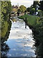
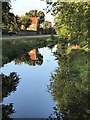
Photos of PE11 2BY


Area Information
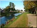
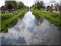
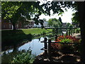
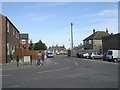
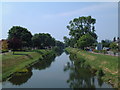
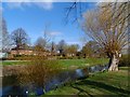
Living in PE11 2BY means settling into a compact residential cluster within England, defined by its specific postcode rather than a broad district name. This small area covers just 1,969 square metres and is home to a population of 1,369 residents. You will find yourself living in a community where space is defined by density rather than expansive town planning. The population density reaches 761 people per square kilometre, indicating a tight-knit environment where neighbours are likely close at hand. Most properties here accommodate residents seeking stability, evidenced by a high rate of long-term settlement. The area functions as a distinct pocket of the wider local network, serving a specific group of people who value proximity and established routines. Daily life here revolves around the immediate surroundings of this postcode cluster, with access to wider facilities dependent on short journeys to Spalding. You are buying into a defined space where every resident knows their boundaries and the local rhythm is set by this specific concentration of homes and people.
- Area Type
- Postcode
- Area Size
- 1969 m²
- Population
- 1369
- Population Density
- 761 people/km²
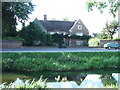
The property market in PE11 2BY is characterised by a high concentration of owner-occupied homes. With 81 per cent of the population owning their dwellings, the area is not a rental hub but a place where residents have chosen to buy and settle. Houses serve as the primary accommodation type, meaning you will find traditional detached or semi-detached properties rather than flats or purpose-built blocks. This mix suggests a market driven by family buyers and those seeking space for established households. The small size of the area, covering only 1,969 square metres, limits the sheer volume of stock available within the immediate postcode boundary. Consequently, competition for available homes may be focused on a smaller number of properties. Buyers looking at the immediate surroundings will find an inventory dominated by existing ownership structures rather than new builds or high-density rentals. This stability creates a predictable market environment where price fluctuations are often tied to the local housing supply rather than speculative investment trends.
House Prices in PE11 2BY
No properties found in this postcode.
Energy Efficiency in PE11 2BY
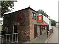
Your lifestyle in PE11 2BY revolves around convenient access to essential retail and transport links just beyond the immediate residential cluster. Within practical reach, you will find three major supermarkets: Iceland Spalding, Sainsburys Spalding, and Heron Spalding. These venues provide comprehensive shopping options for groceries and household essentials without the need for lengthy travels. Transport connectivity is anchored by Spalding Railway Station, a single rail facility serving the area. This station offers a direct link to the broader transport network, allowing you to commute efficiently to larger cities. The proximity of these specific amenities defines the ease of living here, ensuring that daily necessities are always available. You do not need to burden yourself with long communts for a basic weekly shop. The combination of nearby retail giants and a dedicated railway station creates a practical framework for your daily routine, balancing the quiet of your home with the convenience of established local services.
Amenities
Schools
Families considering PE11 2BY must understand that specific educational options are limited to within the immediate vicinity. The nearest school to this area is The Garth School, which operates as a special school. This institution caters to students with specific educational needs rather than serving the mainstream primary or secondary curriculum for most families. Because The Garth School is the only facility listed in the data for this postcode, families with children attending standard state schools will likely need to look further afield for their primary education choices. The mix of school types in the immediate area is unique due to the presence of a special needs institution, which offers tailored support for vulnerable students. Residents should note that this distinct educational provision does not represent a typical primary or secondary school zone for the general population. Your school choices will depend largely on your child's individual needs and how far you are willing to travel to access a wider range of educational providers in surrounding towns.
| Rank | School | Type | Entry gender | Ages |
|---|
Explore more schools in this area
Go to Schools tabDemographics
The community in PE11 2BY reflects a mature demographic profile dominated by adults aged between 30 and 64 years. The median age is 47, which signals a neighbourhood where young families and older children may be less visible compared to established households. There is a strong emphasis on stability, confirmed by the fact that 81 per cent of residents are homeowners. Only 19 per cent of homes are rented, showing that property ownership is the norm rather than the exception. Houses form the predominant accommodation type, consistent with the age profile of the adults living here. The population is predominantly White, mirroring the broader national composition for this part of the country. High home ownership levels suggest that the area attracts buyers who are settling down rather than renting temporarily. You can expect a community where long-term investment and local knowledge are common traits among the people on the street. The age distribution indicates that services catering to children and the very young might be less prevalent than those supporting working-age adults and their families.
Household Size
Accommodation Type
Tenure
Ethnic Group
Religion
Household Composition
Age
Household Deprivation
NS-SEC
Explore more demographic insights in this area
Go to Demographics tabPlanning
Planning Constraints
- Flood RiskPremium
- Ramsar Wetland SitesPremium
- Area of Outstanding Natural BeautyPremium
- Protected Nature ReservePremium
- Protected WoodlandPremium