Area Overview for Colwick
Photos of Colwick


Area Information
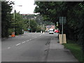
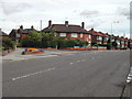
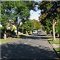
Colwick is a civil parish in England covering an area of 64.4 hectares. This small footprint defines a tightly packed residential environment rather than a sprawling suburb. Living in Colwick means adopting a lifestyle where nature and domestic life intersect closely within a limited geographical boundary. The community reflects this scale through its demographic composition, dominated by a significantly older population. With a median age of 70 years, the neighbourhood functions as a retirement hub or a destination for those seeking a retirement village atmosphere. Daily life here revolves around the immediate surroundings because the village lacks the expansive infrastructure of larger towns. Homeownership is the prevailing model, with three quarters of residents owning their property outright or with a mortgage. This high ownership rate creates a stable, established community where long-term residents are the majority. You will find that buying homes in Colwick secures a slice of this singular demographic character. The area does not boast large commercial centres, so your daily activities likely centre on local amenities and perhaps commuting to nearby larger towns. Understanding the specific size of Colwick helps you appreciate the quietness and exclusivity of life here. It is a place for those who value low-density living over city conveniences.
- Area Type
- Parish
- Area Size
- 64.4 hectares
- Population
- Not available
- Population Density
- Not available
Demographics
The community in Colwick is defined by a singular and advanced age profile. Your neighbours are predominantly over 70 years old, making this the most common age range in the area. This demographic reality shapes everything from social interactions to the pace of village life. Homeownership stands at 74 per cent, indicating that most households are owned by people who chose to settle here permanently. Accommodation types in Colwick reflect this demographic, likely favouring single-storey homes or properties modified for older residents. The household composition data suggests families with young children are rare; instead, you will encounter single-person households or couples. Ethnic diversity within Colwick is notably low, as the predominant ethnic group is white British, reflecting the area's established history. Religious affiliation appears muted, though alternative religious groups may be present. The absence of data on deprivation specifically limits rigid analysis, but the age profile itself suggests a community focused on stability rather than transient youth culture. You should expect a quiet atmosphere where generations coexist primarily within the home. This homogeneity creates a predictable environment, ideal for retirees but potentially isolating for those seeking a multi-generational mix.
Household Size
Accommodation Type
Tenure
Ethnic Group
Religion
Household Composition
Age
Household Deprivation
NS-SEC
Explore more demographic insights in this area
Go to Demographics tabPlanning
Planning Constraints
- Flood RiskPremium
- Ramsar Wetland SitesPremium
- Area of Outstanding Natural BeautyPremium
- Protected Nature ReservePremium
- Protected WoodlandPremium