Area Overview for Carlton (Gedling)
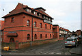
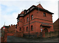
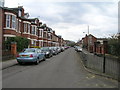
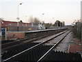
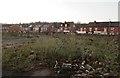
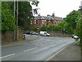
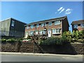
Photos of Carlton (Gedling)

Area Information
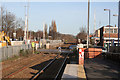
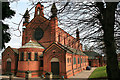
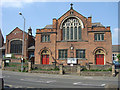
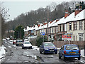
Carlton sits as a built-up residential area within the Borough of Gedling, nestled in Nottinghamshire. The location covers an area of 12.2 square kilometres and is home to a population of 23,498 residents. You will find this settlement lies to the east of Nottingham, forming a suburban extension for those working in the city. The area functions as a distinct community with its own housing, churches, and schools, having evolved from a farming and knitting township into a modern residential zone by the late 19th century. Daily life here revolves around proximity to Nottingham, approximately 2.5 miles away, which has historically driven growth through strategic transport links dating back to the 1840s. The neighbourhood maintains a clear identity as a suburban settlement where families and professionals live. Your morning commute likely benefits from the legacy of the tram route that opened in 1914, alongside rail connections that supported the community's expansion. The area is bounded by Gedling to the north and Stoke Bardolph to the east, creating a defined geographic boundary for residents. As you explore local streets, you encounter a landscape shaped by early 20th-century architecture and nineteenth-century industrial heritage. The sense of place is grounded in specific landmarks like Gedling House and St James' Church, which anchor the community's historical narrative. Living in Carlton means enjoying a settled environment where the town's character remains visible amidst its expansion. The area supports a recorded history reaching back to the Domesday Book, yet the current atmosphere reflects its primary role as a residential hub. You access practical amenities and leisure facilities without needing to travel far to the central city. This balance of local independence and city access defines the experience of owning or renting a home in this specific sector of Gedling.
- Area Type
- Built Up Area 250
- Area Size
- 12.2 km²
- Population
- 23498
- Population Density
- 1927 people/km²
Your daily life in Carlton is supported by a practical range of amenities within practical reach. Retail options include Farmfoods Carlton, Tesco Nottingham, and Co-op Carlton, giving you three major supermarkets for weekly shopping. You can access Groceries, fresh produce, and household essentials without travelling far. Leisure facilities are nearby, benefiting from the proximity to Nottingham's entertainment offerings. The area also features five rail stations and five metro stops, integrating transport into your lifestyle routine along with shopping. Nottingham Airport sits one station away, allowing for occasional business trips or leisure travel. The mix of high-street retail and local shops means you can make errands quickly and efficiently. Public transport connections ensure you remain connected to the wider region while enjoying a quieter local environment. You do not have to live in the city centre to enjoy its conveniences as Carlton provides immediate access to these services. The presence of these specific venues supports an independent and convenient lifestyle. Your morning coffee might be at a local café before heading to the station, and your evening walk could start near one of the school grounds. This accessibility makes the area attractive for those who value convenience. The balance between quiet residential streets and easy access to services defines the character of living here.
Amenities
Schools
Families considering schools near Carlton will find several options listed within the local vicinity. The area hosts a dedicated network of primary education institutions that serve the community's children. You can choose from Haddon Primary and Nursery School, which provides early education services in the local district. Another option is Carlton Central Junior School, specifically catering to younger learners within its catchment. For infants seeking their initial education, Central Infant and Nursery School serves as a primary choice for local families. Netherfield Primary School stands nearby, offering another established option for elementary education. Carlton Netherfield Infant and Nursery School completes this local cluster of primary providers, ensuring multiple routes for early schooling. All these institutions are located within the Greater Nottingham area, close to the built-up zone of Carlton. The presence of these specific schools suggests a neighbourhood supported by local educational infrastructure. You do not need to travel far for elementary education, which is a practical advantage for residents. The existence of separate nursery and primary facilities indicates a traditional approach to school organisation. These schools collectively provide the foundational education for the children growing up in Carlton. The choice between these institutions allows parents to select based on proximity and specific educational philosophies.
| Rank | School | Type | Entry gender | Ages |
|---|
Explore more schools in this area
Go to Schools tabDemographics
The community profile in Carlton reveals a settled population with a median age of 70 years. This high average indicates an area dominated by older homeowners rather than young families moving in. Specifically, the most common age bracket recorded is simply Age: Total, suggesting the data highlights the overall ageing trend across the region. With 72 per cent of residents owning their homes, the area has a very strong owner-occupier culture. This high level of home ownership aligns with the older demographic, suggesting few people are currently looking to move away from established properties. The household composition data reflects a total population structure that mirrors these older, stable living arrangements. You will find that accommodation types similarly reflect this demographic shift, supporting long-term living rather than transient housing markets. The diversity within the area is defined by historical settlement patterns, though specific ethnic group breakdowns are not detailed in current records. Religious affiliations also follow broad regional norms without specific local statistics provided. This demographic picture paints a clear image of a quiet, mature neighbourhood. The population density reaches 1,927 people per square kilometre, indicating a fairly compact settlement. You are not part of a sparse rural community, nor do you face the congestion of a dense city centre. Instead, the density supports local shops and community facilities while remaining comfortable. The stability of the population means established routines and long-term friendships often characterise social life here.