Area Overview for Upton
Photos of Upton


Area Information
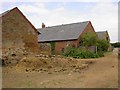
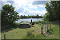
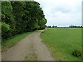
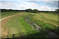
Upton is a civil parish covering an area of 5.7 km² in England. It is a distinct locality with a resident population standing at 2,550 people. The community size creates a relatively compact living environment where residents know their neighbours. This is a settled area where daily life revolves around local routines and established patterns. The total population and small land size mean that distances between homes and amenities are generally short. People living in Upton experience a lifestyle defined by this manageable scale. The parish functions as a self-contained unit within the wider region. You can expect a quiet rhythm here compared to larger urban centres. The specific demographic profile of 2,550 residents shapes the character of local shops and services. Homebuyers approaching Upton find a space that prioritises stability over rapid growth. The civil parish status indicates a degree of local governance focused on these specific boundaries. Your daily commute and leisure activities will be influenced by this defined, small footprint. It is a place where the community centre and primary street are within easy reach for most households.
- Area Type
- Parish
- Area Size
- 5.7 km²
- Population
- 2550
- Population Density
- 448 people/km²
Demographics
The community within Upton reflects an older resident base with a median age of 70 years. This statistic signals a significant proportion of seniors calling this parish home. Most families in this area consist of older individuals rather than young adults or active families with school-age children. The home ownership rate reaches 63%, which places Upton well above the national average for owner-occupation. This high percentage indicates a stable area where residents have long-term ties to their properties. Almost two-thirds of households own their homes outright or with a mortgage, reducing the typical pressures of a high-rent market. The accommodation types reflect this ownership-heavy structure, though the specific breakdown between detached, semi-detached, terraced, and flats is not detailed in available records. You are likely to meet long-term residents who have planned their moves carefully. The low population density of 2,550 people across 5.7 km² creates a residential atmosphere without the overcrowding found in denser suburbs. Living in Upton means navigating a demographic landscape dominated by mature homeowners.
Household Size
Accommodation Type
Tenure
Ethnic Group
Religion
Household Composition
Age
Household Deprivation
NS-SEC
Explore more demographic insights in this area
Go to Demographics tabPlanning
Planning Constraints
- Flood RiskPremium
- Ramsar Wetland SitesPremium
- Area of Outstanding Natural BeautyPremium
- Protected Nature ReservePremium
- Protected WoodlandPremium