Area Overview for West Northamptonshire
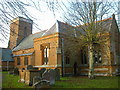
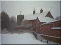
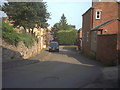
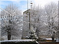
Photos of West Northamptonshire
Area Information
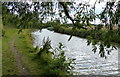
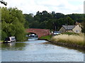
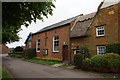
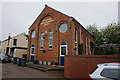
Living in West Northamptonshire offers a distinct lifestyle defined by its substantial rural character and significant geographical spread. This local authority district covers 1,381.2 square kilometres, creating a vast area where daily life often involves travelling further between destinations than in denser urban environments. The region maintains a strong sense of place, balancing open spaces with settled communities scattered across the landscape. You will find that life here moves at a different pace compared to major metropolitan centres, promoting a quieter existence while still providing access to essential amenities. The district serves as a home for residents who value space and relative affordability outside the high-pressure corridors of the wider county. Your daily routine will likely involve navigating this large footprint, which means planning commutes to schools, work, or services requires foresight. The area does not offer the walkability of a compact city centre, but it compensates with extensive open land and a low-density residential feel. Whether you are establishing a permanent home or seeking a retirement residence, the sheer size of the district ensures varied neighbourhoods, though you must be prepared for distances that demand reliable transport options.
- Area Type
- District/Borough
- Area Size
- 1381.2 km²
- Population
- Not available
- Population Density
- Not available
Demographics
The community profile of West Northamptonshire reveals a population skewed significantly towards older individuals. Your neighbourhoods are likely to echo this trend, with a median age of 70 years, indicating that retirement homes and established families dominate the social fabric. The most common age range reflects this senior-heavy demographic, meaning the district functions primarily as a destination for later life rather than young professionals or families with school-age children. This shape influences local services, catering more to the needs of retirees, such as pharmacies, social clubs, and accessible healthcare facilities, rather than playgroups or university extensions. Home ownership stands as a defining feature of the area, with 66% of households owning their accommodation. This high figure suggests a stable, long-term community where residents have built a deep-rooted connection to their properties. You will encounter fewer absentee landlords or temporary tenants compared to high-rental districts, fostering a sense of permanence among neighbours. While specific data on household composition types and predominant ethnic groups are not detailed in current records, the high home ownership rate implies that residents have chosen this location for its character rather than market trends. The demographic reality points to a quiet, established community where the average resident has likely lived in the same area for decades.
Household Size
Accommodation Type
Tenure
Ethnic Group
Religion
Household Composition
Age
Household Deprivation
NS-SEC
Explore more demographic insights in this area
Go to Demographics tabPlanning
Planning Constraints
- Flood RiskPremium
- Area of Outstanding Natural BeautyPremium
- Protected Nature ReservePremium
- Protected WoodlandPremium