Area Overview for NN9 6NQ
Photos of NN9 6NQ
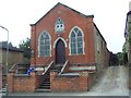
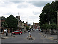
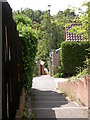
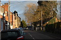

41 photos from this area
Area Information
Key information about the NN9 6NQ including its size, population, and administrative classification.
- Area Type
- Postcode
- Area Size
- 6111 m²
- Population
- 2087
- Population Density
- 4533 people/km²
House Prices in NN9 6NQ
24
Properties
£127,391
Average Sold Price
£20,000
Lowest Price
£325,000
Highest Price
Showing 24 properties
| Address | Type | Beds | Baths | Last Sale Price | Last Sale Date | |
|---|---|---|---|---|---|---|
| 17 Clare Street, Raunds, NN9 6NQ | Terraced | 3 | 1 | £242,500 | Aug 2025 | |
| 19 Clare Street, Raunds, NN9 6NQ | Semi-detached | 3 | 2 | £230,000 | Jun 2025 | |
| 3 Clare Street, Raunds, NN9 6NQ | Terraced | 2 | - | £215,000 | Dec 2022 | |
| 7 Clare Street, Raunds, NN9 6NQ | Bungalow | 4 | 3 | £325,000 | Oct 2022 | |
| 15 Clare Street, Raunds, NN9 6NQ | Terraced | 2 | 1 | £152,000 | Feb 2020 | |
| 11 Clare Street, Raunds, NN9 6NQ | house | 2 | - | £173,500 | Dec 2017 | |
| 6 Clare Street, Raunds, NN9 6NQ | Terraced | 3 | 1 | £145,000 | Dec 2016 | |
| 21 Clare Street, Raunds, NN9 6NQ | house | - | - | £128,000 | Dec 2013 | |
| 13 Clare Street, Raunds, NN9 6NQ | Semi-detached | 3 | 1 | £60,250 | Jan 2012 | |
| 9 Clare Street, Raunds, NN9 6NQ | house | - | - | £125,000 | Jan 2007 |
Page 1 of 3
Energy Efficiency in NN9 6NQ
Amenities
Schools
| Rank | School | Type | Entry gender | Ages |
|---|
Explore more schools in this area
Go to Schools tabDemographics
Household Size
Two person
most common
Accommodation Type
Houses
most common
Tenure
62
majority
Ethnic Group
White
most common
Religion
N/A
most common
Household Composition
N/A
most common
Age
47
median
Adults (30-64 years)
most common
Household Deprivation
N/A
with no deprivation
NS-SEC
32
in Lower managerial occupations
Explore more demographic insights in this area
Go to Demographics tabPlanning
Planning Constraints
- Flood RiskPremium
- Ramsar Wetland SitesPremium
- Area of Outstanding Natural BeautyPremium
- Protected Nature ReservePremium
- Protected WoodlandPremium