Area Overview for NN8 5FD
Photos of NN8 5FD
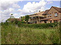
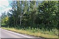

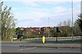
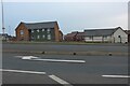
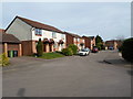
7 photos from this area
Area Information
Key information about the NN8 5FD including its size, population, and administrative classification.
- Area Type
- Postcode
- Area Size
- 1.5 hectares
- Population
- 1494
- Population Density
- 689 people/km²
House Prices in NN8 5FD
36
Properties
£187,698
Average Sold Price
£47,000
Lowest Price
£460,000
Highest Price
Showing 36 properties
| Address | Type | Beds | Baths | Last Sale Price | Last Sale Date | |
|---|---|---|---|---|---|---|
| 67 Chatsworth Drive, Wellingborough, NN8 5FD | Detached | 4 | 2 | £375,000 | Jul 2025 | |
| 73 Chatsworth Drive, Wellingborough, NN8 5FD | Retail | 5 | 2 | £460,000 | Aug 2022 | |
| 19 Chatsworth Drive, Wellingborough, NN8 5FD | house | - | - | £398,000 | Dec 2021 | |
| 53 Chatsworth Drive, Wellingborough, NN8 5FD | Semi-detached | 2 | 1 | £190,000 | Jul 2021 | |
| 75 Chatsworth Drive, Wellingborough, NN8 5FD | house | - | - | £301,500 | Jun 2021 | |
| 55 Chatsworth Drive, Wellingborough, NN8 5FD | Semi-detached | 2 | 1 | £165,000 | Aug 2020 | |
| 23 Chatsworth Drive, Wellingborough, NN8 5FD | Detached | 4 | 2 | £270,000 | Aug 2019 | |
| 61 Chatsworth Drive, Wellingborough, NN8 5FD | Semi-detached | 3 | 1 | £205,000 | Apr 2018 | |
| 51 Chatsworth Drive, Wellingborough, NN8 5FD | Detached | 4 | 1 | £268,000 | Jan 2018 | |
| 17 Chatsworth Drive, Wellingborough, NN8 5FD | Detached | 4 | 1 | £296,000 | Jul 2017 |
Page 1 of 4
Energy Efficiency in NN8 5FD
Amenities
Schools
| Rank | School | Type | Entry gender | Ages |
|---|
Explore more schools in this area
Go to Schools tabDemographics
Household Size
Family (3-5 people)
most common
Accommodation Type
Houses
most common
Tenure
82
majority
Ethnic Group
White
most common
Religion
N/A
most common
Household Composition
N/A
most common
Age
47
median
Adults (30-64 years)
most common
Household Deprivation
N/A
with no deprivation
NS-SEC
34
in Lower managerial occupations
Explore more demographic insights in this area
Go to Demographics tabPlanning
Planning Constraints
- Flood RiskPremium
- Ramsar Wetland SitesPremium
- Area of Outstanding Natural BeautyPremium
- Protected Nature ReservePremium
- Protected WoodlandPremium