Area Overview for NN8 5FB
Photos of NN8 5FB
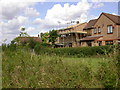
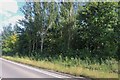

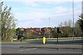
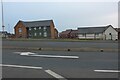
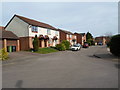
7 photos from this area
Area Information
Key information about the NN8 5FB including its size, population, and administrative classification.
- Area Type
- Postcode
- Area Size
- 5.2 hectares
- Population
- 1494
- Population Density
- 689 people/km²
House Prices in NN8 5FB
96
Properties
£177,157
Average Sold Price
£22,000
Lowest Price
£396,000
Highest Price
Showing 96 properties
| Address | Type | Beds | Baths | Last Sale Price | Last Sale Date | |
|---|---|---|---|---|---|---|
| 140 Chatsworth Drive, Wellingborough, NN8 5FB | Semi-detached | 2 | 1 | £227,500 | May 2025 | |
| 54 Chatsworth Drive, Wellingborough, NN8 5FB | Detached | 3 | 3 | £280,000 | Jan 2025 | |
| 94 Chatsworth Drive, Wellingborough, NN8 5FB | Semi-detached | 2 | 1 | £190,000 | Nov 2024 | |
| 38 Chatsworth Drive, Wellingborough, NN8 5FB | Detached | 4 | 3 | £297,000 | Oct 2024 | |
| 170 Chatsworth Drive, Wellingborough, NN8 5FB | Semi-detached | 2 | 1 | £220,000 | Aug 2024 | |
| 86 Chatsworth Drive, Wellingborough, NN8 5FB | Semi-detached | 3 | 1 | £210,000 | May 2024 | |
| 2 Chatsworth Drive, Wellingborough, NN8 5FB | Retail | 4 | 1 | £312,000 | Feb 2023 | |
| 114 Chatsworth Drive, Wellingborough, NN8 5FB | Terraced | 2 | 1 | £225,000 | Dec 2022 | |
| 102 Chatsworth Drive, Wellingborough, NN8 5FB | Retail | 3 | 2 | £240,000 | Sep 2022 | |
| 152 Chatsworth Drive, Wellingborough, NN8 5FB | house | 3 | 1 | £265,000 | Aug 2022 |
Page 1 of 10
Energy Efficiency in NN8 5FB
Amenities
Schools
| Rank | School | Type | Entry gender | Ages |
|---|
Explore more schools in this area
Go to Schools tabDemographics
Household Size
Family (3-5 people)
most common
Accommodation Type
Houses
most common
Tenure
82
majority
Ethnic Group
White
most common
Religion
N/A
most common
Household Composition
N/A
most common
Age
47
median
Adults (30-64 years)
most common
Household Deprivation
N/A
with no deprivation
NS-SEC
34
in Lower managerial occupations
Explore more demographic insights in this area
Go to Demographics tabPlanning
Planning Constraints
- Flood RiskPremium
- Ramsar Wetland SitesPremium
- Area of Outstanding Natural BeautyPremium
- Protected Nature ReservePremium
- Protected WoodlandPremium