Area Overview for NN6 9DN
Photos of NN6 9DN
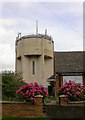
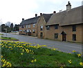
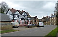
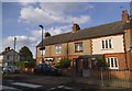
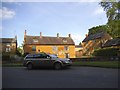
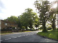
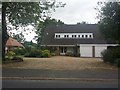

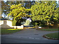

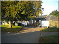
35 photos from this area
Area Information
Key information about the NN6 9DN including its size, population, and administrative classification.
- Area Type
- Postcode
- Area Size
- 1.6 hectares
- Population
- 1488
- Population Density
- 456 people/km²
House Prices in NN6 9DN
24
Properties
£216,324
Average Sold Price
£71,000
Lowest Price
£480,000
Highest Price
Showing 24 properties
| Address | Type | Beds | Baths | Last Sale Price | Last Sale Date | |
|---|---|---|---|---|---|---|
| Spring Cottage, 26 Newlands, Brixworth, NN6 9DN | house | - | - | £230,000 | May 2022 | |
| Reidon Cottage, 16 Newlands, Brixworth, NN6 9DN | house | - | - | £480,000 | Sep 2021 | |
| 4 Newlands, Brixworth, NN6 9DN | Cottage | 3 | 2 | £317,000 | Mar 2021 | |
| 12 Newlands, Brixworth, NN6 9DN | house | - | - | £205,000 | Jan 2021 | |
| Clayhill Cottage, 24 Newlands, Brixworth, NN6 9DN | house | 2 | - | £243,000 | Jun 2018 | |
| 8 Newlands, Brixworth, NN6 9DN | house | 1 | 1 | £242,000 | Apr 2017 | |
| Grange Cottage, 11 Newlands, Brixworth, NN6 9DN | Detached | 4 | - | £415,000 | Nov 2016 | |
| 6 Newlands, Brixworth, NN6 9DN | Terraced | 2 | - | £210,000 | Jul 2014 | |
| The Haven, 20 Newlands, Brixworth, NN6 9DN | house | - | - | £280,000 | Apr 2014 | |
| 3A Newlands, Brixworth, NN6 9DN | house | - | - | £176,000 | Dec 2010 |
Page 1 of 3
Energy Efficiency in NN6 9DN
Amenities
Schools
| Rank | School | Type | Entry gender | Ages |
|---|
Explore more schools in this area
Go to Schools tabDemographics
Household Size
Family (3-5 people)
most common
Accommodation Type
Houses
most common
Tenure
67
majority
Ethnic Group
White
most common
Religion
N/A
most common
Household Composition
N/A
most common
Age
47
median
Adults (30-64 years)
most common
Household Deprivation
N/A
with no deprivation
NS-SEC
35
in Lower managerial occupations
Explore more demographic insights in this area
Go to Demographics tabPlanning
Planning Constraints
- Flood RiskPremium
- Ramsar Wetland SitesPremium
- Area of Outstanding Natural BeautyPremium
- Protected Nature ReservePremium
- Protected WoodlandPremium