Area Overview for NN6 9DJ
Photos of NN6 9DJ
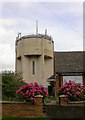
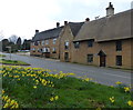
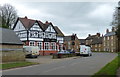
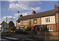
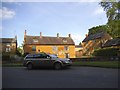
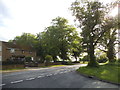
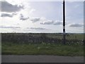
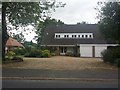


35 photos from this area
Area Information
Key information about the NN6 9DJ including its size, population, and administrative classification.
- Area Type
- Postcode
- Area Size
- 2.0 hectares
- Population
- 1488
- Population Density
- 456 people/km²
House Prices in NN6 9DJ
10
Properties
£228,571
Average Sold Price
£38,000
Lowest Price
£485,000
Highest Price
Showing 10 properties
| Address | Type | Beds | Baths | Last Sale Price | Last Sale Date | |
|---|---|---|---|---|---|---|
| Kermits Lodge, Froghall, Brixworth, NN6 9DJ | Detached | 3 | 2 | £485,000 | Mar 2025 | |
| 4, Swedish Houses, Froghall, Brixworth, NN6 9DJ | Semi-detached | 2 | - | £155,000 | Nov 2020 | |
| 2, Swedish Houses, Froghall, Brixworth, NN6 9DJ | Semi-detached | 2 | 1 | £150,000 | Dec 2016 | |
| Rosemary Cottage, Froghall, Brixworth, NN6 9DJ | Detached | - | - | £315,000 | Mar 2011 | |
| The Cottage, Froghall, Brixworth, NN6 9DJ | Detached | - | - | £207,000 | Jul 2006 | |
| The Bungalow, Froghall, Brixworth, NN6 9DJ | Detached | - | - | £250,000 | May 2003 | |
| 3, Swedish Houses, Froghall, Brixworth, NN6 9DJ | Semi-detached | - | - | £38,000 | Jun 1998 | |
| The Old Hay Barn, Froghall, Brixworth, NN6 9DJ | Semi-detached | 5 | 4 | - | - | |
| The Old White House, Froghall, Brixworth, NN6 9DJ | Detached | - | - | - | - | |
| 1, Swedish Houses, Froghall, Brixworth, NN6 9DJ | house | - | - | - | - |
Energy Efficiency in NN6 9DJ
Amenities
Schools
| Rank | School | Type | Entry gender | Ages |
|---|
Explore more schools in this area
Go to Schools tabDemographics
Household Size
Family (3-5 people)
most common
Accommodation Type
Houses
most common
Tenure
67
majority
Ethnic Group
White
most common
Religion
N/A
most common
Household Composition
N/A
most common
Age
47
median
Adults (30-64 years)
most common
Household Deprivation
N/A
with no deprivation
NS-SEC
35
in Lower managerial occupations
Explore more demographic insights in this area
Go to Demographics tabPlanning
Planning Constraints
- Flood RiskPremium
- Ramsar Wetland SitesPremium
- Area of Outstanding Natural BeautyPremium
- Protected Nature ReservePremium
- Protected WoodlandPremium