Area Overview for NN4 7AT
Photos of NN4 7AT


Area Information
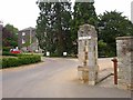
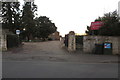
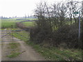
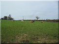
The NN4 7AT postcode covers a specific residential cluster in England that spans 5.3 hectares, making it a compact living space for 1,590 people. This small area holds a population density of 184 people per square kilometre, creating a distinct neighbourhood feel where residents know their immediate surroundings. Daily life here is defined by proximity; the community is contained within a tiny footprint compared to larger urban districts. The location sits in a recognised area characterised by its density and limited spatial expansion. Homebuyers looking at NN4 7AT expect a tight-knit environment where the boundary between private homes and public spaces is minimal. This postcode does not feature open countryside or vast green belts within its definition, focusing instead on clustered housing solutions. The scale of the area means that noise from neighbours and local streets is more immediate than in sprawling suburbs. Despite its small size, the site accommodates nearly 1,600 individuals who rely on external amenities rather than internal infrastructure for major services. Understanding this compact nature is essential before considering a purchase here. The area functions as a self-contained unit requiring residents to travel short distances to access the wider town centre and transport links found in Northampton. The character of NN4 7AT reflects this concentration, prioritising convenience within a very small geographical boundary.
- Area Type
- Postcode
- Area Size
- 5.3 hectares
- Population
- 1590
- Population Density
- 184 people/km²
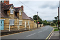
The property market in NN4 7AT is defined by a stock composed entirely of houses with a 73% home ownership rate. Buyers looking at homes in this area should anticipate purchasing fully occupied properties where the majority of owners have already secured their titles. The absence of rental data or flat listings within this specific postcode suggests a traditional, owner-occupied market rather than a commuter hub for renters. Since the area covers only 5.3 hectares, there are no large developments or builder-led projects visible in the immediate vicinity. The housing stock is likely a mix of Victorian, Edwardian, or interwar detached and semi-detached properties given the all-house specification. High ownership rates often correlate with higher transaction values as sellers have lived in their homes for decades. Potential buyers must understand that competition in such a small cluster can be fierce when suitable properties hit the market. The market dynamics here are driven by replacement demand from locals upgrading or downsizing rather than an influx of new employees. Because the area lacks large new-build clusters, the period of construction for any home is usually deep in the past. This means structural integrity and maintenance history are key factors in the purchase decision. The dominance of houses over apartments eliminates the void or shared maintenance expenses typical of block living.
House Prices in NN4 7AT
Showing 12 properties
| Address | Type | Beds | Baths | Last Sale Price | Last Sale Date | |
|---|---|---|---|---|---|---|
| April Cottage, 2 Cherry Tree Lane, Northampton, NN4 7AT | Semi-detached | 2 | 1 | £212,000 | May 2025 | |
| 4A Cherry Tree Lane, Northampton, NN4 7AT | Cottage | 3 | 2 | £542,500 | May 2023 | |
| The Coach House, 1A Cherry Tree Lane, Northampton, NN4 7AT | house | 4 | 2 | £600,000 | Feb 2018 | |
| Stonelea, 5 Cherry Tree Lane, Northampton, NN4 7AT | Flat | - | - | £595,000 | Apr 2006 | |
| 3 Cherry Tree Lane, Northampton, NN4 7AT | Detached | 3 | 2 | £595,000 | Aug 2004 | |
| Pour Nos Pieds, 7 Cherry Tree Lane, Northampton, NN4 7AT | Detached | - | - | £560,000 | Aug 2004 | |
| 4 Cherry Tree Lane, Northampton, NN4 7AT | Land | - | - | £132,500 | Sep 2000 | |
| 9 Cherry Tree Lane, Northampton, NN4 7AT | Detached | - | - | £215,000 | Jul 1999 | |
| Chartlands, 1 Cherry Tree Lane, Northampton, NN4 7AT | Detached | 5 | 4 | - | - | |
| Cherry Cottage, 10 Cherry Tree Lane, Northampton, NN4 7AT | Detached | 3 | - | - | - |
Energy Efficiency in NN4 7AT
Residents of NN4 7AT enjoy immediate access to three major retail destinations within practical reach. These include Aldi Headlands, Co-op Barry, and Tesco Northampton, providing a robust selection of groceries and daily essentials. The area also benefits from two major bus interchanges, the Northampton Bus Interchange and University Bus Interchange, facilitating easy travel across the region. One railway link, Northampton Railway Station, offers rail connectivity for longer-distance commutes. This combination of retail and transport hubs ensures that daily errands and weekly shopping trips are resolved without needing a personal vehicle. The concentration of supermarkets means fresh food, household goods, and budget options are always available. While the residential cluster itself is compact, the surrounding amenities network is extensive. There are no parks, leisure centres, or dining venues listed as direct features of the immediate postcode, forcing residents to rely on the nearby town centres for these experiences. The lifestyle is commuter-led, utilising public transport to reach slightly larger hubs for entertainment and recreation. Convenience defines the daily rhythm, with shops and stations located just a short journey away.
Amenities
Schools
Families residing in NN4 7AT have access to Great Houghton School, which functions as an independent institution within the locality. This single nearby school option represents the primary formal education setting for children living in close proximity to the postcode. The independent nature of the school offers a private education pathway distinct from the state and comprehensive school sector. Residents looking for public schools near NN4 7AT would need to travel beyond the immediate 5.3-hectare boundary to find state-funded alternatives outside the scope of this dataset. The presence of an independent school often implies a specific catchment area or application process rather than automatic local assignment. For those prioritising state education, Greater Houghton does not sit within the primary data set for local comprehensive or primary colleges. This configuration means families must align their housing choices with the specific requirements of the independent sector or commute to other areas for state schooling. The educational landscape is narrow, focusing exclusively on one type of institution. This limits diversity in specialisms across different sectors.
| Rank | School | Type | Entry gender | Ages |
|---|
Explore more schools in this area
Go to Schools tabDemographics
The community within NN4 7AT features a mature population with a median age of 47 years. Most residents fall into the adult age range of 30 to 64 years, suggesting a household dynamic focused on stability and family life rather than student occupancy. This age profile indicates that the area attracts those who have established careers or are nearing retirement. Home ownership stands at a high 73% rate, confirming that the majority of occupants own their residences outright or with significant equity. Very few properties are rented, which typically leads to long-term tenure and less frequent population turnover. The accommodation type is exclusively houses, with no apartments or flats recorded within the dataset for this postcode. This distinction shapes the street scene and noise levels compared to multi-unit developments. Diversity is not a marked feature here, as the predominant ethnic group identifies as White. The demographic stability correlates with the high ownership rate, creating a settled environment where neighbours have lived through various life stages. This consistency removes the transient element often found in rental-heavy zones. Families and established professionals form the backbone of this community, seeking the predictability offered by house ownership in a densely populated yet small footprint. The lack of young adults under 30 suggests limited single-person households or student living arrangements.
Household Size
Accommodation Type
Tenure
Ethnic Group
Religion
Household Composition
Age
Household Deprivation
NS-SEC
Explore more demographic insights in this area
Go to Demographics tabPlanning
Planning Constraints
- Flood RiskPremium
- Ramsar Wetland SitesPremium
- Area of Outstanding Natural BeautyPremium
- Protected Nature ReservePremium
- Protected WoodlandPremium