Area Overview for NN4 6AS
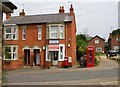
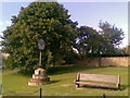
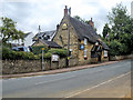
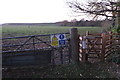
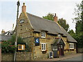
Photos of NN4 6AS


Area Information
Living in NN4 6AS means being part of a small, tightly knit residential cluster in England. The area spans 5,662 square metres and is home to 1,590 people, giving it a population density of 184 people per square kilometre. This compact community is defined by its mix of mature residents and stable housing stock. With 73% of homes owned by occupants, the area leans towards long-term residency rather than transient tenancies. Daily life is shaped by proximity to key services: the Northampton Bus Interchange and Railway Station provide reliable transport links, while nearby shops like Co-op Barry and Tesco Northampton cater to everyday needs. The broadband score of 99 ensures seamless digital connectivity, ideal for remote work or streaming. However, the area’s safety profile is mixed: while flood risk is negligible, crime rates are above average, requiring residents to remain vigilant. NN4 6AS offers a quiet, manageable lifestyle for those prioritising convenience over urban vibrancy.
- Area Type
- Postcode
- Area Size
- 5662 m²
- Population
- 1590
- Population Density
- 184 people/km²
The property market in NN4 6AS is dominated by owner-occupied homes, with 73% of properties in private hands. This contrasts with areas where rental demand drives market dynamics, suggesting a focus on long-term residency rather than short-term investment. The prevalence of houses over flats indicates a preference for traditional, family-friendly housing stock. Given the area’s small size and limited development, property availability is constrained, making it a niche market for buyers seeking stability. The compact nature of NN4 6AS means proximity to amenities like schools and transport hubs is a key selling point. However, buyers should consider the area’s safety profile, particularly the high crime risk, when evaluating long-term viability. The housing stock’s age and type may also influence maintenance costs and modernisation needs. For those prioritising security and convenience, NN4 6AS offers a manageable, low-density alternative to larger urban centres.
House Prices in NN4 6AS
Showing 4 properties
| Address | Type | Beds | Baths | Last Sale Price | Last Sale Date | |
|---|---|---|---|---|---|---|
| High View, The Cross, Northampton, NN4 6AS | Bungalow | 3 | 1 | £334,000 | Aug 2018 | |
| Bay Tree Cottage, The Cross, Northampton, NN4 6AS | house | 2 | 2 | £360,000 | Mar 2018 | |
| Hillside Bungalow, The Cross, Northampton, NN4 6AS | Detached | 3 | 3 | £455,000 | Feb 2018 | |
| The Manor House, The Cross, Northampton, NN4 6AS | Detached | 4 | - | £630,000 | Apr 2015 |
Energy Efficiency in NN4 6AS
Daily life in NN4 6AS is shaped by its proximity to essential amenities. Within practical reach are shops such as Co-op Barry, M&S Northampton Hospital SF, and Tesco Northampton, offering a range of retail and grocery options. The area’s transport links, including the Northampton Bus Interchange and Railway Station, provide access to leisure, healthcare, and employment opportunities in the city. While the postcode itself is small, its integration with Northampton’s infrastructure ensures residents are not isolated from broader services. The presence of a single independent school, Great Houghton School, and the absence of other major facilities suggest a focus on private provision over public amenities. For those valuing convenience and connectivity, NN4 6AS offers a quiet base with easy access to urban resources.
Amenities
Schools
The nearest school to NN4 6AS is Great Houghton School, an independent institution. While no Ofsted rating is provided, its independent status suggests it may cater to families seeking alternative educational pathways. The absence of state schools in the immediate vicinity means residents must travel beyond the postcode to access public education options. This could be a consideration for families prioritising affordability or specific curricula. The single school listed highlights a limited selection of educational institutions within the area, requiring careful planning for school admissions. However, the proximity to Northampton’s transport network, including the Bus Interchange and Railway Station, may ease access to broader schooling options in nearby towns.
| Rank | School | Type | Entry gender | Ages |
|---|
Explore more schools in this area
Go to Schools tabDemographics
The population of NN4 6AS is predominantly adults aged 30–64, with a median age of 47. This suggests a mature, settled community with strong ties to local amenities and services. Home ownership is high at 73%, indicating a stable housing market with limited rental activity. The area is characterised by houses rather than flats, reflecting a preference for traditional residential properties. The predominant ethnic group is White, though specific data on diversity or deprivation is not provided. The age profile implies a low demand for childcare facilities but a higher need for services catering to middle-aged residents, such as healthcare or leisure activities. The relatively low population density of 184 people per square kilometre suggests a balance between private space and community interaction. This demographic profile aligns with a quiet, low-traffic environment where residents are likely to prioritise comfort and convenience over fast-paced urban living.
Household Size
Accommodation Type
Tenure
Ethnic Group
Religion
Household Composition
Age
Household Deprivation
NS-SEC
Explore more demographic insights in this area
Go to Demographics tabPlanning
Planning Constraints
- Flood RiskPremium
- Ramsar Wetland SitesPremium
- Area of Outstanding Natural BeautyPremium
- Protected Nature ReservePremium
- Protected WoodlandPremium