Area Overview for NN4 0UD
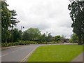
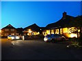
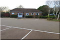
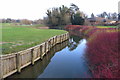
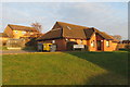
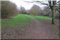
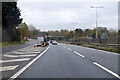
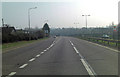
Photos of NN4 0UD
Area Information
Living in NN4 0UD offers a compact, tightly knit residential experience within a small cluster of homes. The area covers 9,862 square metres and is home to 1,343 residents, creating a high population density of 136,181 people per square kilometre. This suggests a closely connected community where daily life is shaped by proximity to essential services. The area’s demographic profile is dominated by adults aged 30–64, with a median age of 47, indicating a mature, stable population. Home ownership is high at 88%, with most properties being houses rather than flats. While the area lacks large-scale amenities, its strategic location near Northampton Railway Station and nearby retail hubs like Tesco and Waitrose ensures practical connectivity. For families, the presence of East Hunsbury Primary School provides a local education option. NN4 0UD is a quiet, residential enclave where convenience and community coexist, though its small size means residents must look beyond the immediate postcode for broader facilities.
- Area Type
- Postcode
- Area Size
- 9862 m²
- Population
- 1343
- Population Density
- 1925 people/km²
The property market in NN4 0UD is characterised by high home ownership (88%) and a predominance of houses over flats. This suggests a mature, owner-occupied market with limited rental activity. The small area size and high population density imply a scarcity of available properties, making the local housing stock highly sought after. Given the compact nature of the postcode, buyers should consider the immediate surroundings for additional options, as the area itself offers limited expansion. The focus on houses indicates a preference for family-friendly, long-term living, though the lack of flats may limit choices for first-time buyers or those seeking smaller properties. The high home ownership rate also suggests a stable market with low turnover, which could benefit investors seeking secure, long-term assets. However, the small size of NN4 0UD means that property searches must extend beyond the postcode to find comparable listings.
House Prices in NN4 0UD
Showing 19 properties
| Address | Type | Beds | Baths | Last Sale Price | Last Sale Date | |
|---|---|---|---|---|---|---|
| 57 Frosty Hollow, Northampton, NN4 0UD | Detached | 4 | 2 | £435,000 | Aug 2025 | |
| 52 Frosty Hollow, Northampton, NN4 0UD | Detached | 4 | 2 | £415,000 | Feb 2025 | |
| 58 Frosty Hollow, Northampton, NN4 0UD | Detached | 4 | 2 | £423,750 | May 2024 | |
| 55 Frosty Hollow, Northampton, NN4 0UD | house | - | - | £339,995 | Jan 2022 | |
| 68 Frosty Hollow, Northampton, NN4 0UD | house | - | - | £385,000 | Jun 2021 | |
| 60 Frosty Hollow, Northampton, NN4 0UD | Detached | 4 | - | £332,500 | Mar 2017 | |
| 62 Frosty Hollow, Northampton, NN4 0UD | Detached | 5 | 1 | £337,500 | Oct 2015 | |
| 64 Frosty Hollow, Northampton, NN4 0UD | Detached | 4 | - | £307,000 | Feb 2015 | |
| 59 Frosty Hollow, Northampton, NN4 0UD | Detached | 4 | - | £290,000 | Oct 2014 | |
| 56 Frosty Hollow, Northampton, NN4 0UD | house | 3 | - | £216,000 | May 2012 |
Energy Efficiency in NN4 0UD
Residents of NN4 0UD have access to a range of practical amenities within reach. The area is near five retail outlets, including Tesco East, Waitrose Wootton, and Tesco Northampton, ensuring everyday shopping needs are met. The proximity to Northampton Railway Station and two bus interchanges—Northampton Bus Interchange and University Bus Interchange—facilitates travel to nearby towns and universities. While the data does not mention parks or leisure facilities, the presence of multiple retail and transport options suggests a focus on convenience over large-scale recreation. The compact nature of the area means that residents may need to travel slightly further for specialised services, but the immediate vicinity offers sufficient daily essentials. This mix of retail and transport infrastructure supports a lifestyle that balances local convenience with broader connectivity.
Amenities
Schools
The nearest school to NN4 0UD is East Hunsbury Primary School, which serves the local community with primary education. The data lists this school twice, but it is the only educational institution mentioned. As a primary school, it caters to younger children, though no secondary schools or further education providers are noted in the area. This means families with children requiring secondary education may need to look beyond NN4 0UD for options. The absence of additional schools suggests a reliance on nearby towns or districts for comprehensive schooling. For those prioritising proximity to a primary school, East Hunsbury Primary School offers a local solution, but the lack of diversity in school types may necessitate planning for longer commutes or alternative educational pathways.
| Rank | School | Type | Entry gender | Ages |
|---|
Explore more schools in this area
Go to Schools tabDemographics
The community in NN4 0UD is predominantly composed of adults aged 30–64, reflecting a mature population with a median age of 47. This age group suggests a stable demographic, likely with established careers and families. Home ownership is exceptionally high at 88%, with the majority of properties being houses rather than flats. The predominant ethnic group is White, though specific data on diversity or deprivation is not provided. The high home ownership rate indicates a long-term presence of residents, with limited turnover. The absence of detailed diversity statistics means the area’s cultural composition remains unquantified, but the demographic profile points to a community prioritising stability and property investment. The compact size of the area, combined with its adult-centric population, suggests a focus on family life and long-term residency rather than transient or younger demographics.
Household Size
Accommodation Type
Tenure
Ethnic Group
Religion
Household Composition
Age
Household Deprivation
NS-SEC
Explore more demographic insights in this area
Go to Demographics tabPlanning
Planning Constraints
- Flood RiskPremium
- Ramsar Wetland SitesPremium
- Area of Outstanding Natural BeautyPremium
- Protected Nature ReservePremium
- Protected WoodlandPremium