Area Overview for NN4 0TD
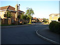
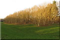
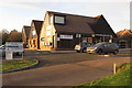
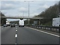
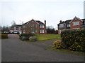
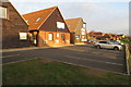
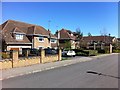
Photos of NN4 0TD


Area Information
Living in NN4 0TD means inhabiting a tightly knit residential cluster in England, where 1,343 people reside across just 2.3 hectares. This compact area is characterised by high population density — 59,043 people per square kilometre — suggesting a focus on residential living rather than sprawling development. The community is predominantly composed of adults aged 30–64, with a median age of 47, indicating a mature, stable demographic. Daily life here is likely shaped by proximity to essential services, including a railway station and multiple retail outlets. The area’s small size means amenities are within practical reach, though its limited footprint also means housing options are constrained. With no significant natural or protected sites nearby, the focus is on residential comfort and connectivity. For buyers, NN4 0TD offers a snapshot of a densely populated, family-oriented neighbourhood where proximity to schools and transport links may outweigh the lack of expansive green spaces.
- Area Type
- Postcode
- Area Size
- 2.3 hectares
- Population
- 1343
- Population Density
- 1925 people/km²
The property market in NN4 0TD is dominated by owner-occupied homes, with 88% of residents living in properties they own. This contrasts with areas where rental demand drives the market, indicating a preference for stability and long-term investment. The primary accommodation type is houses, which aligns with the area’s small size and high density — a paradox that suggests compact, possibly multi-unit housing stock. Given the postcode’s limited footprint, the housing stock is unlikely to be extensive, and buyers should consider the proximity to amenities as a key factor. The lack of flats or larger developments means properties here are likely to be family homes or single-unit residences. For those seeking a quiet, residential area with established neighbours, NN4 0TD offers a snapshot of a mature market where demand is driven by local needs rather than speculative growth.
House Prices in NN4 0TD
Showing 60 properties
| Address | Type | Beds | Baths | Last Sale Price | Last Sale Date | |
|---|---|---|---|---|---|---|
| 9 Downsway, Northampton, NN4 0TD | Detached | 4 | 2 | £375,000 | Jun 2025 | |
| 61 Downsway, Northampton, NN4 0TD | Semi-detached | 3 | 1 | £274,995 | Mar 2025 | |
| 49 Downsway, Northampton, NN4 0TD | Semi-detached | 3 | 1 | £290,000 | Oct 2024 | |
| 32 Downsway, Northampton, NN4 0TD | Retail | 3 | 1 | £275,000 | Oct 2023 | |
| 38 Downsway, Northampton, NN4 0TD | Semi-detached | 4 | 2 | £310,000 | Aug 2023 | |
| 37 Downsway, Northampton, NN4 0TD | Semi-detached | 3 | 1 | £292,500 | Dec 2022 | |
| 11 Downsway, Northampton, NN4 0TD | Detached | 3 | - | £445,000 | Aug 2022 | |
| 14 Downsway, Northampton, NN4 0TD | house | - | - | £342,000 | Jun 2022 | |
| 34 Downsway, Northampton, NN4 0TD | house | - | - | £259,995 | Aug 2021 | |
| 41 Downsway, Northampton, NN4 0TD | Semi-detached | 2 | - | £209,000 | Apr 2021 |
Energy Efficiency in NN4 0TD
The lifestyle in NN4 0TD is shaped by its proximity to essential retail and transport hubs. Nearby shops include Tesco East, Waitrose Wootton, and Tesco Northampton, offering a range of grocery and retail options within practical reach. The area’s rail link to Northampton Railway Station and bus services at Northampton Bus Interchange and University Bus Interchange provide convenient access to urban centres, cultural amenities, and employment opportunities. While the data does not mention parks or leisure facilities, the absence of protected natural sites suggests a focus on urban convenience rather than rural recreation. The compact nature of the area means residents can access shopping, transport, and basic services without long commutes, though the lack of specific leisure venues may require venturing slightly beyond the postcode for more diverse activities.
Amenities
Schools
The nearest school to NN4 0TD is East Hunsbury Primary School, which serves the area’s primary education needs. The data lists this school twice, but it is the only educational institution explicitly mentioned. As a primary school, it caters to younger children, though no secondary schools or Ofsted ratings are provided. Families with children under 11 may find this school convenient, but those requiring secondary education would need to look beyond the immediate area. The absence of additional schools suggests a reliance on nearby districts for higher-level education. For parents prioritising proximity to schools, East Hunsbury Primary School’s presence is a clear advantage, though the lack of diversity in educational options may be a consideration for growing families.
| Rank | School | Type | Entry gender | Ages |
|---|
Explore more schools in this area
Go to Schools tabDemographics
The population of NN4 0TD is overwhelmingly composed of adults aged 30–64, with a median age of 47, reflecting a mature, settled community. Home ownership is high, at 88%, and the primary accommodation type is houses, suggesting a preference for traditional, owner-occupied properties. The predominant ethnic group is White, though no specific data on diversity or deprivation is provided. The area’s high population density — 59,043 people per square kilometre — indicates a compact, possibly multi-generational living environment. This density may influence local dynamics, with shared community spaces and a reliance on nearby amenities. While no figures on income or deprivation are available, the high home ownership rate and age profile suggest a relatively stable, middle-income demographic. The absence of rental properties or younger households implies a focus on long-term residency rather than transient populations.
Household Size
Accommodation Type
Tenure
Ethnic Group
Religion
Household Composition
Age
Household Deprivation
NS-SEC
Explore more demographic insights in this area
Go to Demographics tabPlanning
Planning Constraints
- Flood RiskPremium
- Ramsar Wetland SitesPremium
- Area of Outstanding Natural BeautyPremium
- Protected Nature ReservePremium
- Protected WoodlandPremium