Area Overview for NN4 0TG
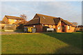
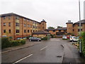
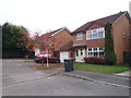
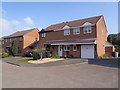
Photos of NN4 0TG


Area Information
Living in NN4 0TG offers a compact, residential experience shaped by its small area size of 9,842 square metres and a population of 1,423 people. The high population density of 144,584 people per square kilometre suggests a tightly knit community, where proximity to amenities and services is a defining feature. This postcode area, centred around a small cluster of homes, is predominantly occupied by adults aged 30–64, with a median age of 47. The area’s character is defined by its focus on home ownership, with 81% of residents living in their own homes. Daily life here is likely to revolve around local shops, transport links, and the surrounding infrastructure. The presence of nearby retail outlets such as Tesco East, Waitrose Wootton, and Co-op Wootten ensures convenience for everyday needs, while the area’s connectivity to Northampton Railway Station and multiple bus routes adds to its accessibility. NN4 0TG is a place where practicality and community coexist, offering a straightforward lifestyle for those seeking stability and proximity to essential services.
- Area Type
- Postcode
- Area Size
- 9842 m²
- Population
- 1423
- Population Density
- 3296 people/km²
The property market in NN4 0TG is characterised by a strong emphasis on home ownership, with 81% of residents living in their own homes. This suggests a market that prioritises long-term residency over rental investment, which may influence property values and availability. The accommodation type is predominantly houses, which is unusual for a small area with a high population density. This implies that homes here are likely to be family-sized properties, possibly with gardens or other features typical of single-family dwellings. Given the area’s compact size, the housing stock may be limited, making buyers reliant on the immediate surrounding areas for additional options. The high home ownership rate also indicates a stable market, where properties are less likely to be vacant or available for short-term lets. For buyers, this could mean a focus on established homes with potential for long-term value retention, though competition for available properties may be keen.
House Prices in NN4 0TG
No properties found in this postcode.
Energy Efficiency in NN4 0TG
The lifestyle in NN4 0TG is shaped by its proximity to essential retail and transport hubs. Five retail outlets, including Tesco East, Waitrose Wootton, and Co-op Wootten, provide a range of shopping options within practical reach, supporting everyday convenience. The two bus stops—Northampton Bus Interchange and University Bus Interchange—offer connections to local services and educational institutions, while Northampton Railway Station provides access to regional rail networks. This combination of retail and transport infrastructure ensures that residents can meet both daily needs and broader mobility requirements without significant travel. The area’s small size means that amenities are closely clustered, fostering a sense of immediacy in accessing services. Whether it’s grocery shopping, commuting, or connecting to larger urban centres, NN4 0TG offers a lifestyle that prioritises practicality and accessibility.
Amenities
Schools
| Rank | School | Type | Entry gender | Ages |
|---|
Explore more schools in this area
Go to Schools tabDemographics
The community in NN4 0TG is predominantly composed of adults aged 30–64, with a median age of 47. This suggests a mature population, likely with established careers and family structures. Home ownership is high, at 81%, indicating a stable residential base with long-term residents. The accommodation type is primarily houses, which aligns with the area’s small size and high density, suggesting compact, family-oriented living. The predominant ethnic group is White, reflecting a homogenous demographic profile. While the data does not specify deprivation levels, the high home ownership rate and age distribution imply a relatively settled population with fewer transient residents. This demographic structure supports a community with shared interests and needs, potentially fostering a cohesive local environment. The absence of detailed diversity metrics means the area’s cultural composition remains largely unexplored in the provided data.
Household Size
Accommodation Type
Tenure
Ethnic Group
Religion
Household Composition
Age
Household Deprivation
NS-SEC
Explore more demographic insights in this area
Go to Demographics tabPlanning
Planning Constraints
- Flood RiskPremium
- Ramsar Wetland SitesPremium
- Area of Outstanding Natural BeautyPremium
- Protected Nature ReservePremium
- Protected WoodlandPremium
- Crime RiskPremium