Area Overview for NN4 0BL
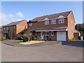
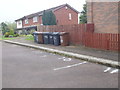
Photos of NN4 0BL


Area Information
NN4 0BL is a compact residential cluster in England, covering just 9.4 hectares and home to 1,423 residents. Its high population density of 15,124 people per square kilometre reflects a tightly knit community, where proximity to amenities and transport links is key. This area is ideal for those seeking a balance between urban convenience and residential tranquillity. Residents benefit from nearby retail hubs such as Tesco East and Waitrose Wootton, while the Northampton Railway Station offers direct connections to major cities. The area’s small size means daily life revolves around local shops, schools, and public transport. With a strong focus on home ownership—81% of residents own their homes—the community feels stable and long-term. However, the high flood risk score of 39.06 raises practical concerns for potential buyers, requiring careful consideration of property location and flood defences. Despite this, the area’s low crime risk and access to essential services make it a compelling choice for those prioritising connectivity and a sense of neighbourhood.
- Area Type
- Postcode
- Area Size
- 9.4 hectares
- Population
- 1423
- Population Density
- 3296 people/km²
NN4 0BL is predominantly an owner-occupied area, with 81% of residents living in homes they own. The housing stock consists almost entirely of houses, rather than flats or apartments, suggesting a focus on family-friendly, single-unit properties. This makes the area particularly appealing to buyers seeking stability and long-term investment. However, the small size of the postcode—just 9.4 hectares—means the housing market is limited in scale, with properties likely concentrated in a small geographic area. The high home ownership rate indicates strong community ties, but buyers should be mindful of the area’s flood risk, which could affect property value and insurance costs. For those prioritising proximity to transport and retail, the compact nature of NN4 0BL ensures homes are close to amenities, though the limited availability of properties may require swift decision-making.
House Prices in NN4 0BL
Showing 35 properties
| Address | Type | Beds | Baths | Last Sale Price | Last Sale Date | |
|---|---|---|---|---|---|---|
| 45 Colonial Drive, Northampton, NN4 0BL | Detached | 4 | 2 | £475,000 | Apr 2025 | |
| 33 Colonial Drive, Northampton, NN4 0BL | Detached | 4 | 2 | £470,000 | Feb 2024 | |
| 21 Colonial Drive, Northampton, NN4 0BL | Detached | 4 | 2 | £512,500 | Nov 2022 | |
| 12 Colonial Drive, Northampton, NN4 0BL | Bungalow | - | - | £460,000 | Aug 2022 | |
| 19 Colonial Drive, Northampton, NN4 0BL | Detached | 4 | - | £550,000 | Oct 2021 | |
| 41 Colonial Drive, Northampton, NN4 0BL | Detached | 4 | 2 | £540,000 | May 2021 | |
| 27 Colonial Drive, Northampton, NN4 0BL | Detached | 4 | 2 | £325,000 | Jul 2019 | |
| 59 Colonial Drive, Northampton, NN4 0BL | house | - | - | £465,000 | Sep 2016 | |
| 43 Colonial Drive, Northampton, NN4 0BL | house | - | - | £440,000 | Mar 2016 | |
| 3 Colonial Drive, Northampton, NN4 0BL | Detached | 4 | - | £480,000 | Aug 2015 |
Energy Efficiency in NN4 0BL
Living in NN4 0BL offers convenient access to essential amenities within walking or short driving distance. Retail options include major chains such as Tesco East, Waitrose Wootton, and Co-op Grange, ensuring a variety of shopping and dining choices. The Northampton Bus Interchange and University Bus Interchange provide reliable public transport links, while the Northampton Railway Station connects residents to cities like London and Birmingham. Though the area is small, its proximity to these hubs means residents can enjoy both local convenience and broader regional access. The compact nature of NN4 0BL fosters a community-oriented lifestyle, with daily errands and social activities easily achievable without long commutes. This blend of retail, transport, and connectivity makes the area practical for families and professionals alike, though the high population density may influence the pace of life.
Amenities
Schools
| Rank | School | Type | Entry gender | Ages |
|---|
Explore more schools in this area
Go to Schools tabDemographics
The population of NN4 0BL is predominantly adults aged 30–64, with a median age of 47. This suggests a mature, established community, likely with families and professionals. Home ownership is high at 81%, indicating a strong preference for long-term residency over renting. The area is characterised by houses rather than flats, reflecting a traditional, family-oriented housing stock. The predominant ethnic group is White, though specific data on diversity is not provided. The population density of 15,124 people per square kilometre is exceptionally high, which may influence the character of the neighbourhood, fostering a close-knit environment but potentially limiting personal space. For buyers, this demographic profile implies a community with stable property values and a focus on established living, though the high density could impact privacy and local amenities.
Household Size
Accommodation Type
Tenure
Ethnic Group
Religion
Household Composition
Age
Household Deprivation
NS-SEC
Explore more demographic insights in this area
Go to Demographics tabPlanning
Planning Constraints
- Flood RiskPremium
- Ramsar Wetland SitesPremium
- Area of Outstanding Natural BeautyPremium
- Protected Nature ReservePremium
- Protected WoodlandPremium