Area Overview for NN4 0QR
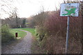
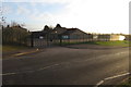
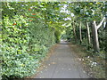
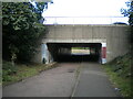
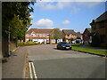
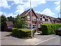
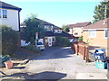
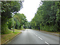
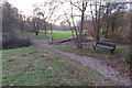
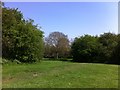
Photos of NN4 0QR

Area Information
NN4 0QR is a small, tightly packed residential area in England, spanning just 2.0 hectares and home to 1355 residents. Its high population density—69,205 people per square kilometre—reflects a compact, closely knit community. This postcode area is characterised by a mix of established housing, with 83% of properties owned by residents rather than rented. The median age of 47 suggests a mature demographic, with the majority of residents aged between 30 and 64. Daily life here is shaped by proximity to essential services, including multiple retail outlets and transport links. The area’s low flood risk and crime score of 95/100 make it an attractive option for those prioritising safety. While it lacks large-scale amenities, its practical size and accessibility to nearby towns like Northampton offer a balance between seclusion and connectivity. For buyers, NN4 0QR presents a chance to own a home in a stable, low-risk environment with a strong sense of local identity.
- Area Type
- Postcode
- Area Size
- 2.0 hectares
- Population
- 1355
- Population Density
- 1639 people/km²
The property market in NN4 0QR is dominated by owner-occupied homes, with 83% of properties owned outright. This high rate of home ownership suggests a stable, long-term resident base rather than a transient rental market. The accommodation type is predominantly houses, which is unusual for smaller postcode areas and may indicate a mix of semi-detached or terraced housing. Given the area’s compact size—just 2.0 hectares—buyers should expect limited new developments, with the housing stock likely to be established. The low crime risk and flood safety score may make this area appealing to those seeking secure, low-maintenance properties. However, the small size means the immediate surroundings are critical for finding additional options. For buyers, this area offers a chance to invest in a well-maintained, owner-occupied community with minimal planning constraints.
House Prices in NN4 0QR
Showing 10 properties
| Address | Type | Beds | Baths | Last Sale Price | Last Sale Date | |
|---|---|---|---|---|---|---|
| 7 Kites Close, Northampton, NN4 0QR | Detached | 4 | 2 | £490,000 | Nov 2025 | |
| 10 Kites Close, Northampton, NN4 0QR | Retail | 4 | 2 | £510,000 | Sep 2022 | |
| 5 Kites Close, Northampton, NN4 0QR | house | - | - | £385,000 | Oct 2019 | |
| 1 Kites Close, Northampton, NN4 0QR | house | 4 | 1 | £375,000 | Sep 2016 | |
| 9 Kites Close, Northampton, NN4 0QR | house | - | - | £410,000 | Nov 2015 | |
| 2 Kites Close, Northampton, NN4 0QR | house | 5 | - | £290,000 | May 2013 | |
| 3 Kites Close, Northampton, NN4 0QR | Bungalow | 4 | 2 | £329,950 | May 2006 | |
| 8 Kites Close, Northampton, NN4 0QR | house | - | - | £312,000 | Nov 2003 | |
| 6 Kites Close, Northampton, NN4 0QR | Detached | - | - | - | - | |
| 4 Kites Close, Northampton, NN4 0QR | Detached | - | - | - | - |
Energy Efficiency in NN4 0QR
Living in NN4 0QR offers access to essential retail and transport hubs within practical reach. Five notable retail outlets include Tesco Northampton, Tesco East, and Co-op Rothersthorpe, providing daily shopping needs. The area’s rail link to Northampton Railway Station and two bus interchanges—Northampton and University—ensure easy access to the city and surrounding areas. While the postcode itself lacks expansive parks or leisure facilities, its proximity to Northampton means residents can enjoy larger amenities nearby. The compact nature of the area fosters a convenient lifestyle, with services and transport options clustered closely. However, the absence of specific local parks or cultural venues means community activities may rely on nearby towns. For those valuing accessibility over standalone amenities, NN4 0QR’s practical layout is a key advantage.
Amenities
Schools
| Rank | School | Type | Entry gender | Ages |
|---|
Explore more schools in this area
Go to Schools tabDemographics
The community in NN4 0QR is predominantly composed of adults aged 30 to 64, with a median age of 47. This suggests a population that is largely established in careers and family life, contributing to a stable, mature neighbourhood. Home ownership is high, with 83% of residents owning their properties, indicating a strong sense of long-term commitment to the area. The accommodation type is primarily houses, which aligns with the higher proportion of owner-occupied homes compared to flats or rental properties. The predominant ethnic group is White, reflecting a homogenous demographic profile. While the data does not specify levels of deprivation, the high home ownership and low crime risk suggest a relatively secure and self-sufficient community. The absence of detailed diversity metrics means the area’s social fabric is defined more by age and tenure than by ethnic or cultural variety.
Household Size
Accommodation Type
Tenure
Ethnic Group
Religion
Household Composition
Age
Household Deprivation
NS-SEC
Explore more demographic insights in this area
Go to Demographics tabPlanning
Planning Constraints
- Flood RiskPremium
- Ramsar Wetland SitesPremium
- Area of Outstanding Natural BeautyPremium
- Protected Nature ReservePremium
- Protected WoodlandPremium