Area Overview for NN4 0JF
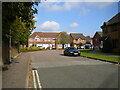
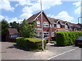
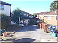
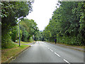
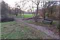
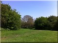
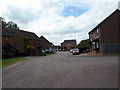
Photos of NN4 0JF

Area Information
NN4 0JF is a compact residential postcode in England, covering just 4.7 hectares and home to 1679 residents. Its high population density of 35,502 people per square kilometre reflects a tightly knit community, though the area’s small size means it is more of a cluster than a sprawling suburb. The postcode is served by key amenities like Tesco Northampton, Co-op Rothersthorpe, and Northampton Railway Station, making daily life convenient for those prioritising proximity to retail and transport. The median age of 47 suggests a mature demographic, with adults aged 30–64 forming the largest group. This creates a stable, established community, though the lack of large-scale green spaces or cultural hubs may appeal more to those seeking simplicity over urban vibrancy. For buyers, the area’s limited size means properties are likely to be in close proximity to one another, with homes predominantly being houses rather than flats. The broadband score of 100 ensures seamless digital connectivity, a key consideration for remote workers or tech-dependent households.
- Area Type
- Postcode
- Area Size
- 4.7 hectares
- Population
- 1679
- Population Density
- 3933 people/km²
The property market in NN4 0JF is characterised by a high rate of home ownership (63%) and a focus on houses rather than flats. This suggests a market skewed towards owner-occupied properties, likely attracting buyers seeking stability and long-term investment. The small area size means the housing stock is limited, which could lead to competition among buyers, particularly for properties near key amenities like Tesco Northampton or Northampton Railway Station. The absence of flats indicates a lack of high-density housing, which may appeal to those preferring larger homes but could limit options for renters or first-time buyers. Given the compact nature of the postcode, properties are likely to be closely spaced, with proximity to retail and transport hubs being a key selling point. For buyers, the challenge lies in navigating a small, saturated market where demand may outstrip supply, particularly for homes with specific features or locations.
House Prices in NN4 0JF
Showing 2 properties
| Address | Type | Beds | Baths | Last Sale Price | Last Sale Date | |
|---|---|---|---|---|---|---|
| Travel Money, Tesco Superstore, Clannell Road, Northampton, NN4 0JF | Retail | - | - | - | - | |
| Hand Car Wash, Hunsbury Centre, Clannell Road, Northampton, NN4 0JF | commercial | - | - | - | - |
Energy Efficiency in NN4 0JF
Living in NN4 0JF provides access to essential retail and transport hubs within short distances. The area is served by three notable supermarkets: Tesco Northampton, Co-op Rothersthorpe, and Tesco East, ensuring residents have multiple options for grocery shopping and daily essentials. The proximity to Northampton Railway Station and nearby bus interchanges, including the University Bus Interchange, facilitates easy travel to workplaces, educational institutions, or leisure destinations. While the area lacks large parks or cultural venues, its compact design ensures amenities are within practical reach, reducing the need for long commutes. The retail options and transport links contribute to a functional lifestyle, ideal for those prioritising convenience over expansive leisure spaces. For buyers, the presence of multiple supermarkets and transport nodes adds value, though the limited scope for outdoor recreation may require residents to seek larger green spaces beyond the immediate postcode.
Amenities
Schools
| Rank | School | Type | Entry gender | Ages |
|---|
Explore more schools in this area
Go to Schools tabDemographics
The population of NN4 0JF is predominantly adults aged 30–64, with a median age of 47. This suggests a community of established professionals and families, though the absence of data on younger or older demographics means the area’s full age range remains unclear. Home ownership is high at 63%, indicating a stable housing market where most residents are long-term property owners. The accommodation type is exclusively houses, which contrasts with areas where flats or apartments dominate. The predominant ethnic group is White, though no specific data on diversity or deprivation is provided. The high population density of 35,502 people per square kilometre implies a tightly packed residential environment, which may influence social dynamics and the availability of private outdoor space. For those prioritising a settled, mature community with strong property retention, NN4 0JF aligns with these preferences, though the lack of mixed-age demographics could be a consideration for families seeking schools or youth amenities.
Household Size
Accommodation Type
Tenure
Ethnic Group
Religion
Household Composition
Age
Household Deprivation
NS-SEC
Explore more demographic insights in this area
Go to Demographics tabPlanning
Planning Constraints
- Flood RiskPremium
- Ramsar Wetland SitesPremium
- Area of Outstanding Natural BeautyPremium
- Protected Nature ReservePremium
- Protected WoodlandPremium