Area Overview for NN3 9XA
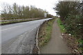
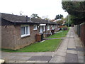
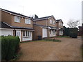
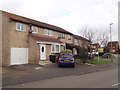
Photos of NN3 9XA


Area Information
Living in NN3 9XA means inhabiting a tightly packed residential cluster in England, where 1,597 people reside across just 1.7 hectares. This high population density creates a compact, closely knit community, though the area’s small size means every resident is within walking distance of local amenities. The postcode is predominantly occupied by adults aged 30-64, with a median age of 47, suggesting a mature, established population. Daily life here is defined by proximity to essential services, with shops, transport hubs, and schools all within practical reach. While the area lacks expansive green spaces or natural features, its strategic location near Northampton’s infrastructure ensures connectivity. The absence of planning constraints like protected woodlands or AONB designations means development is not restricted, though the limited size of NN3 9XA means housing stock is finite. For those seeking a quiet, residential setting with easy access to urban amenities, this postcode offers a balance of privacy and convenience.
- Area Type
- Postcode
- Area Size
- 1.7 hectares
- Population
- 1597
- Population Density
- 2657 people/km²
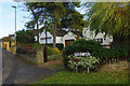
The property market in NN3 9XA is characterised by a strong emphasis on owner-occupation, with 64% of residents owning their homes. This contrasts with the 36% who rent, indicating a market skewed towards long-term residency rather than short-term lettings. The accommodation type is predominantly houses, which is notable in a small area with high population density. This suggests that properties here are likely to be family homes, potentially with gardens or larger living spaces, despite the compact footprint of the postcode. Given the limited area size, the housing stock is finite, which may make the market competitive for buyers. Those seeking homes in NN3 9XA should consider the proximity to Northampton’s amenities, as the area’s small size means immediate surroundings are critical. The absence of planning constraints like protected woodlands or AONB designations may also allow for development, though the small area size limits expansion.
House Prices in NN3 9XA
No properties found in this postcode.
Energy Efficiency in NN3 9XA
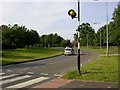
Daily life in NN3 9XA is shaped by its proximity to essential amenities. The nearby retail options include Lidl Lings, Tesco Northampton, and Aldi Headlands, providing convenient access to groceries and household goods. For transport, the University Bus Interchange and Northampton Bus Interchange offer regular services, while the Northampton Railway Station connects residents to broader regional networks. The area’s compact size means these amenities are within walking or short driving distance. However, the data does not mention parks, leisure facilities, or dining options, so the character of the area’s lifestyle remains focused on practicality rather than recreation. The presence of multiple retail outlets and transport hubs suggests a functional, service-oriented environment, though those prioritising green spaces or cultural amenities may need to look beyond the immediate postcode.
Amenities
Schools
The nearest school to NN3 9XA is Standens Barn Primary School, which serves the local community. The data lists this school twice, but it is the only primary education option explicitly mentioned. No secondary schools or other educational institutions are referenced, which may be a consideration for families with children at different stages of education. The presence of a primary school within the area suggests that local families have access to early education, though parents may need to travel further for secondary schooling. The lack of additional schools in the data means the educational landscape here is limited to primary provision. For those prioritising proximity to schools, Standens Barn Primary School is the key local resource, but further research would be needed to confirm its Ofsted rating or performance metrics.
| Rank | School | Type | Entry gender | Ages |
|---|---|---|---|---|
| 1 | Standens Barn Primary School | primary | N/A | N/A |
| 2 | Standens Barn Primary School | primary | N/A | N/A |
Explore more schools in this area
Go to Schools tabDemographics
The community in NN3 9XA is predominantly composed of adults aged 30-64, with a median age of 47. This suggests a population that is largely settled, with fewer young families or retirees. Home ownership is strong, with 64% of residents owning their properties, compared to 36% renting. The accommodation type is primarily houses, reflecting a preference for detached or semi-detached homes. The predominant ethnic group is White, though no specific data on diversity or deprivation levels is provided. The high population density—93,108 people per square kilometre—indicates a tightly packed living environment, which may influence the availability of larger homes or outdoor space. For residents, this density can mean a sense of community but also potential competition for local resources. The age profile suggests a stable, long-term population, which may contribute to a consistent demand for local services and amenities.
Household Size
Accommodation Type
Tenure
Ethnic Group
Religion
Household Composition
Age
Household Deprivation
NS-SEC
Explore more demographic insights in this area
Go to Demographics tabPlanning
Planning Constraints
- Flood RiskPremium
- Ramsar Wetland SitesPremium
- Area of Outstanding Natural BeautyPremium
- Protected Nature ReservePremium
- Protected WoodlandPremium
- Crime RiskPremium