Area Overview for NN3 9UH
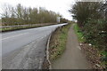
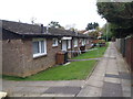
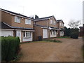
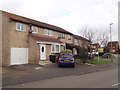
Photos of NN3 9UH


Area Information
Living in NN3 9UH means being part of a tightly knit residential cluster in England, where 1,597 people inhabit just 8,630 square metres. The area’s population density of 185,060 people per square kilometre reflects its compact nature, with homes clustered closely together. This small postcode area is likely to feel both intimate and convenient, with amenities within practical reach. The presence of Northampton Railway Station and nearby bus interchanges suggests easy access to regional transport networks, while the proximity of Standens Barn Primary School highlights the area’s appeal for families. With a median age of 47 and a population skewed toward adults aged 30–64, NN3 9UH is a mature community, likely dominated by owner-occupied homes. Daily life here balances proximity to retail hubs like Lidl Lings and Tesco Northampton with the quietude of a residential enclave. The area’s small size means residents are likely to know their neighbours, though the high density may also bring a sense of shared space.
- Area Type
- Postcode
- Area Size
- 8630 m²
- Population
- 1597
- Population Density
- 2657 people/km²
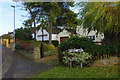
NN3 9UH is a predominantly owner-occupied area, with 64% of homes owned by residents rather than rented. The accommodation type is exclusively houses, which is unusual for a small postcode area but suggests a focus on family homes or single-family residences. This makes the property market here distinct from more urban areas where flats or apartments dominate. With a population density of 185,060 people per square kilometre, the housing stock is likely to be tightly packed, limiting availability for new buyers. The high home ownership rate indicates a stable market with long-term residents, but the small size of the area means there are few properties available for purchase. Buyers should consider the compact nature of the area and the limited scope for expansion, as the immediate surroundings may not offer additional housing options.
House Prices in NN3 9UH
Showing 23 properties
| Address | Type | Beds | Baths | Last Sale Price | Last Sale Date | |
|---|---|---|---|---|---|---|
| 19 Strelley Avenue, Northampton, NN3 9UH | Detached | - | - | £122,500 | Mar 2022 | |
| 18 Strelley Avenue, Northampton, NN3 9UH | Detached | 4 | - | £300,000 | Jul 2021 | |
| 1 Strelley Avenue, Northampton, NN3 9UH | Detached | 4 | 1 | £328,000 | Mar 2021 | |
| 15 Strelley Avenue, Northampton, NN3 9UH | Detached | 4 | 2 | £289,000 | Apr 2018 | |
| 23 Strelley Avenue, Northampton, NN3 9UH | house | - | - | £188,000 | Jun 2015 | |
| 4 Strelley Avenue, Northampton, NN3 9UH | house | - | - | £165,000 | May 2014 | |
| 17 Strelley Avenue, Northampton, NN3 9UH | house | - | - | £190,000 | Mar 2014 | |
| 12 Strelley Avenue, Northampton, NN3 9UH | Detached | 3 | - | £140,000 | Jun 2012 | |
| 9 Strelley Avenue, Northampton, NN3 9UH | house | 3 | - | £155,000 | Jul 2010 | |
| 22 Strelley Avenue, Northampton, NN3 9UH | house | - | - | £143,000 | Oct 2009 |
Energy Efficiency in NN3 9UH
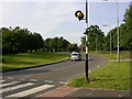
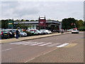
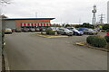
Life in NN3 9UH is shaped by its proximity to retail and transport hubs. The area’s retail offerings include Lidl Lings, Tesco Northampton, and Aldi Headlands, providing residents with easy access to grocery shopping and daily essentials. These stores are likely to cater to both routine needs and occasional shopping trips, reducing the need for travel beyond the area. The presence of the Northampton Bus Interchange and University Bus Interchange ensures reliable public transport for commuting or leisure activities. While the data does not mention parks or leisure facilities, the compact nature of the area suggests that residents may rely on nearby towns for recreational spaces. The combination of retail access and transport connectivity creates a lifestyle that balances convenience with the need for community amenities beyond NN3 9UH itself.
Amenities
Schools
The nearest school to NN3 9UH is Standens Barn Primary School, which serves the local community. This primary school is listed twice in the data, suggesting it is the only educational institution in close proximity. While no Ofsted rating is provided, the presence of a primary school indicates the area is suitable for families with young children. The absence of secondary schools or other educational facilities nearby means parents may need to look beyond NN3 9UH for comprehensive schooling. However, the proximity of Standens Barn Primary School reduces the need for long commutes, which is a practical advantage for families. The school’s role as the sole local institution underscores the importance of nearby transport links, such as the Northampton Railway Station, for accessing higher education or secondary schooling.
| Rank | School | Type | Entry gender | Ages |
|---|
Explore more schools in this area
Go to Schools tabDemographics
The population of NN3 9UH is predominantly adults aged 30–64, with a median age of 47. This suggests a community of established professionals, families, and retirees, rather than a student or younger demographic. Home ownership is high at 64%, indicating a stable, long-term resident base. The accommodation type is primarily houses, which aligns with the area’s residential character and the absence of flats or apartments. The predominant ethnic group is White, though no specific data on diversity or deprivation levels is provided. The high population density of 185,060 people per square kilometre implies a mix of single-family homes and shared spaces, potentially leading to a close-knit but potentially crowded environment. For buyers, this profile suggests a community focused on stability, with a focus on owner-occupied housing and limited rental availability.
Household Size
Accommodation Type
Tenure
Ethnic Group
Religion
Household Composition
Age
Household Deprivation
NS-SEC
Explore more demographic insights in this area
Go to Demographics tabPlanning
Planning Constraints
- Flood RiskPremium
- Ramsar Wetland SitesPremium
- Area of Outstanding Natural BeautyPremium
- Protected Nature ReservePremium
- Protected WoodlandPremium