Area Overview for NN3 9DF
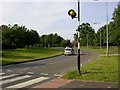
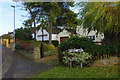
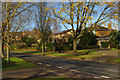
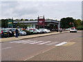
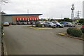
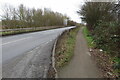
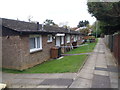
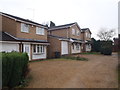
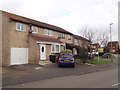
Photos of NN3 9DF


Area Information
NN3 9DF is a small residential cluster in England, covering just 2.2 hectares and home to 1597 people. Its population density of 74,045 people per square kilometre reflects a compact, tightly knit community. This area sits on the edge of Northampton, offering proximity to the city’s amenities while retaining a quieter, more residential character. Daily life here is shaped by its proximity to retail hubs like Lidl Lings, Tesco Northampton, and Aldi Headlands, which serve both residents and surrounding areas. The area’s small size means it is likely a mix of established homes and newer developments, though the exact age of properties is not specified. With no major planning constraints or environmental designations, NN3 9DF appears to be a straightforward, low-maintenance place to live. Its safety profile is strong, with a crime risk score of 77/100, and flood risk is negligible. For those seeking a place with practical amenities and a manageable footprint, this postcode offers a focused, community-oriented environment.
- Area Type
- Postcode
- Area Size
- 2.2 hectares
- Population
- 1597
- Population Density
- 2657 people/km²
The property market in NN3 9DF is characterised by high home ownership (64%) and a focus on houses rather than flats or apartments. This suggests a market that caters to families and individuals seeking more space and privacy. Given the area’s small size, the housing stock is likely limited, with properties concentrated in a tight geographical cluster. The lack of planning constraints or environmental designations may make it easier to buy or sell homes here, though the small footprint could limit availability. For buyers, this means a potentially competitive market with fewer options, but also the advantage of a stable, low-risk environment. The predominance of owner-occupied homes indicates a community of long-term residents, which may influence property values and local dynamics.
House Prices in NN3 9DF
Showing 67 properties
| Address | Type | Beds | Baths | Last Sale Price | Last Sale Date | |
|---|---|---|---|---|---|---|
| 86 Flaxwell Court, Northampton, NN3 9DF | house | - | - | £130,000 | Aug 2020 | |
| 75 Flaxwell Court, Northampton, NN3 9DF | Terraced | 3 | - | £122,000 | Jul 2020 | |
| 96 Flaxwell Court, Northampton, NN3 9DF | house | - | - | £176,000 | Jul 2020 | |
| 101 Flaxwell Court, Northampton, NN3 9DF | Terraced | 3 | - | £167,000 | Jan 2020 | |
| 85 Flaxwell Court, Northampton, NN3 9DF | Terraced | 2 | 1 | £130,000 | Apr 2019 | |
| 60 Flaxwell Court, Northampton, NN3 9DF | Terraced | 3 | 1 | £162,000 | Oct 2017 | |
| 71 Flaxwell Court, Northampton, NN3 9DF | Terraced | 2 | 1 | £131,000 | Oct 2017 | |
| 102 Flaxwell Court, Northampton, NN3 9DF | Terraced | 3 | 1 | £145,000 | Mar 2017 | |
| 99 Flaxwell Court, Northampton, NN3 9DF | Terraced | 2 | 1 | £119,999 | Nov 2016 | |
| 56 Flaxwell Court, Northampton, NN3 9DF | Terraced | 2 | - | £130,000 | Nov 2016 |
Energy Efficiency in NN3 9DF
Living in NN3 9DF offers access to a range of practical amenities within easy reach. Retail options include Lidl Lings, Tesco Northampton, and Aldi Headlands, providing grocery and daily essentials. The area’s transport links, such as the University and Northampton Bus Interchanges, and Northampton Railway Station, facilitate travel to nearby towns and cities. While parks or leisure facilities are not explicitly mentioned, the absence of environmental designations suggests that recreational spaces may be limited to nearby public areas. The compact nature of the area means that residents can access shopping, transport, and services without long commutes, contributing to a convenient, efficient lifestyle.
Amenities
Schools
The nearest schools to NN3 9DF are both Standens Barn Primary School, a primary school serving the local area. While the data lists the school twice, it is likely a single institution. The presence of a primary school suggests that the area is suitable for families with young children, though no secondary schools are mentioned. The lack of diversity in school types may mean that parents seeking a broader range of educational options would need to look beyond the immediate vicinity. For those prioritising primary education, Standens Barn offers a local resource, but further research would be needed to assess its performance or Ofsted rating.
| Rank | School | Type | Entry gender | Ages |
|---|
Explore more schools in this area
Go to Schools tabDemographics
The median age in NN3 9DF is 47, with the majority of residents falling into the 30-64 age range. This suggests a community dominated by working-age adults and families, rather than younger students or older retirees. Home ownership is high at 64%, indicating a stable, long-term resident base. The predominant accommodation type is houses, which aligns with the area’s residential character and likely contributes to a sense of privacy and space. The population is predominantly White, though no specific data on ethnic diversity is provided. With no mention of deprivation levels, it is reasonable to infer that the area’s quality of life is supported by its proximity to essential services and low crime rates. The demographic profile suggests a mature, settled community focused on family living and long-term investment.
Household Size
Accommodation Type
Tenure
Ethnic Group
Religion
Household Composition
Age
Household Deprivation
NS-SEC
Explore more demographic insights in this area
Go to Demographics tabPlanning
Planning Constraints
- Flood RiskPremium
- Ramsar Wetland SitesPremium
- Area of Outstanding Natural BeautyPremium
- Protected Nature ReservePremium
- Protected WoodlandPremium