Area Overview for NN3 9UG
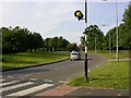
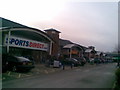
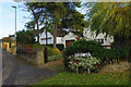
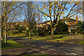
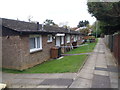
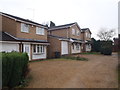
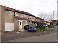
Photos of NN3 9UG

Area Information
NN3 9UG is a small, densely populated residential postcode in England, covering just 1.5 hectares and home to 1,597 people. With a population density of 108,295 people per square kilometre, this area is compact yet functional, designed for close-knit living. The community is predominantly composed of adults aged 30–64, with a median age of 47, suggesting a stable, mature demographic. Daily life here is shaped by proximity to essential services and transport links, making it practical for families and professionals alike. The area’s small size means residents are likely to know their neighbours, fostering a sense of community. While the housing stock is limited to individual homes, the high home ownership rate of 64% indicates a focus on long-term residency rather than transient rental markets. Living here offers a balance of convenience and quiet, with minimal environmental constraints and a low crime risk, making it a viable choice for those prioritising safety and accessibility.
- Area Type
- Postcode
- Area Size
- 1.5 hectares
- Population
- 1597
- Population Density
- 2657 people/km²
The property market in NN3 9UG is characterised by a high home ownership rate of 64%, indicating that most residents are owner-occupiers rather than renters. The area consists solely of houses, with no flats or apartments, which may appeal to those seeking larger, more traditional homes. This composition suggests a market focused on long-term residency rather than short-term rental opportunities. The small size of the area—just 1.5 hectares—means the housing stock is limited, potentially increasing competition for properties. Buyers should consider the proximity to essential amenities, such as schools, retail, and transport, which are all within practical reach. While the data does not specify property prices or trends, the combination of high home ownership and limited housing supply suggests a stable, possibly niche market. Those interested in this area may benefit from acting quickly, given the compact nature of the postcode and its immediate surroundings.
House Prices in NN3 9UG
Showing 22 properties
| Address | Type | Beds | Baths | Last Sale Price | Last Sale Date | |
|---|---|---|---|---|---|---|
| 11 Beeston Avenue, Northampton, NN3 9UG | Detached | 4 | 2 | £281,000 | Dec 2020 | |
| 16 Beeston Avenue, Northampton, NN3 9UG | Detached | 4 | 2 | £313,000 | Nov 2016 | |
| 8 Beeston Avenue, Northampton, NN3 9UG | house | - | - | £207,000 | May 2013 | |
| 9 Beeston Avenue, Northampton, NN3 9UG | house | - | - | £180,000 | Jun 2011 | |
| 7 Beeston Avenue, Northampton, NN3 9UG | Detached | - | - | £184,995 | Dec 2009 | |
| 5 Beeston Avenue, Northampton, NN3 9UG | house | - | - | £225,000 | Dec 2009 | |
| 21 Beeston Avenue, Northampton, NN3 9UG | Detached | - | - | £170,000 | Mar 2004 | |
| 1 Beeston Avenue, Northampton, NN3 9UG | Detached | - | - | £141,000 | Jul 2003 | |
| 14 Beeston Avenue, Northampton, NN3 9UG | Detached | - | - | £129,995 | Dec 2002 | |
| 3 Beeston Avenue, Northampton, NN3 9UG | Detached | - | - | £102,750 | May 2001 |
Energy Efficiency in NN3 9UG
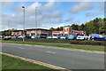
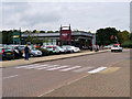
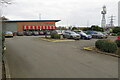
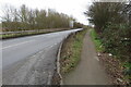
The lifestyle in NN3 9UG is supported by a range of nearby amenities, including five retail outlets such as Lidl Lings, Aldi Headlands, and Tesco Northampton, ensuring residents have easy access to grocery shopping and daily necessities. Public transport is conveniently available through two bus interchanges—University Bus Interchange and Northampton Bus Interchange—as well as Northampton Railway Station, which connects to broader regional networks. While the data does not specify leisure or recreational facilities, the proximity to retail and transport hubs suggests a practical, convenience-focused lifestyle. The area’s compact nature means residents can access these amenities without long commutes, fostering a sense of ease in daily routines. The presence of a primary school and low crime risk further enhances the appeal for families seeking a balanced, functional living environment.
Amenities
Schools
The nearest school to NN3 9UG is Standens Barn Primary School, a primary institution serving the local community. While the data lists this school twice, it is the only educational facility explicitly mentioned. As a primary school, it caters to younger children, making it a critical consideration for families with children under 11. The absence of secondary schools or other educational institutions in the data means that residents may need to travel further for secondary education. However, the presence of a primary school nearby offers convenience for young families, reducing the need for long commutes. The lack of additional school types—such as secondary or special needs schools—suggests that prospective buyers should investigate further to ensure their children’s long-term educational needs are met.
| Rank | School | Type | Entry gender | Ages |
|---|
Explore more schools in this area
Go to Schools tabDemographics
The population of NN3 9UG is 1,597, with a median age of 47, reflecting a community skewed towards adults aged 30–64. This age group dominates, suggesting a stable, established population with fewer young families or retirees. Home ownership is high at 64%, indicating a preference for long-term investment in property. The area is composed entirely of houses, not flats, which aligns with the demographic profile of older, likely family-oriented residents. The predominant ethnic group is White, though no specific data on diversity or minority representation is provided. The high population density—108,295 people per square kilometre—means the area is intensely populated for its size, which could influence local dynamics and the availability of shared spaces. While no deprivation data is available, the high home ownership and low crime risk suggest a relatively secure, self-sufficient community.
Household Size
Accommodation Type
Tenure
Ethnic Group
Religion
Household Composition
Age
Household Deprivation
NS-SEC
Explore more demographic insights in this area
Go to Demographics tabPlanning
Planning Constraints
- Flood RiskPremium
- Ramsar Wetland SitesPremium
- Area of Outstanding Natural BeautyPremium
- Protected Nature ReservePremium
- Protected WoodlandPremium