Area Overview for NN3 9UP
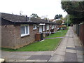
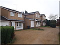
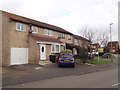
Photos of NN3 9UP

Area Information
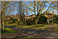
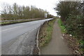
NN3 9UP is a compact residential postcode area in England, covering just 1.7 hectares with a population of 1597 people. This means the area is densely populated, with over 92,000 people per square kilometre, creating a tight-knit community feel. The area is small but functional, designed for residents who value proximity to essential services. Daily life here is shaped by its size and the surrounding infrastructure. With a median age of 47 and a population skewed toward adults aged 30–64, the area reflects a mature demographic. Most homes are owner-occupied, and the housing stock is predominantly houses rather than flats, suggesting a stable, long-term resident base. The postcode’s proximity to Northampton and its transport links make it accessible to nearby amenities, while the low flood risk and crime scores indicate a safe, secure environment. For those seeking a quiet yet connected neighbourhood, NN3 9UP offers a balance of practicality and livability.
- Area Type
- Postcode
- Area Size
- 1.7 hectares
- Population
- 1597
- Population Density
- 2657 people/km²
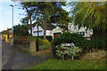
The property market in NN3 9UP is characterised by high home ownership, with 64% of residents owning their homes. This suggests a strong preference for long-term residency rather than rental living, which is typical of established communities. The accommodation type is predominantly houses, not flats, indicating a housing stock that may be older and more traditional. Given the area’s small size and high population density, the housing stock is likely limited, making it a niche market for buyers seeking owner-occupied properties. The concentration of houses may also reflect a lower demand for modern, high-density developments. For buyers, this means a focus on individual homes rather than apartments, with potential for family-oriented living. However, the limited size of the area may restrict availability, requiring buyers to consider nearby postcode areas for more options.
House Prices in NN3 9UP
Showing 24 properties
| Address | Type | Beds | Baths | Last Sale Price | Last Sale Date | |
|---|---|---|---|---|---|---|
| 10 Portchester Gardens, Northampton, NN3 9UP | Semi-detached | 4 | 2 | £300,000 | Mar 2025 | |
| 27 Portchester Gardens, Northampton, NN3 9UP | Semi-detached | 2 | 1 | £220,000 | Feb 2025 | |
| 3 Portchester Gardens, Northampton, NN3 9UP | Semi-detached | 3 | 1 | £186,000 | Aug 2019 | |
| 12 Portchester Gardens, Northampton, NN3 9UP | Semi-detached | 2 | - | £179,950 | Mar 2018 | |
| 19 Portchester Gardens, Northampton, NN3 9UP | Semi-detached | 2 | 1 | £130,000 | Feb 2018 | |
| 28 Portchester Gardens, Northampton, NN3 9UP | Semi-detached | 2 | - | £121,000 | Oct 2013 | |
| 26 Portchester Gardens, Northampton, NN3 9UP | Terraced | 2 | - | £109,500 | Dec 2009 | |
| 24 Portchester Gardens, Northampton, NN3 9UP | Semi-detached | 2 | 1 | £72,000 | Jun 2007 | |
| 9 Portchester Gardens, Northampton, NN3 9UP | house | - | - | £125,000 | Apr 2006 | |
| 5 Portchester Gardens, Northampton, NN3 9UP | Semi-detached | - | - | £129,000 | Jun 2005 |
Energy Efficiency in NN3 9UP
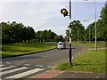
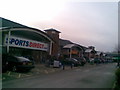
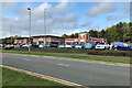
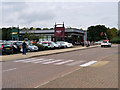
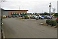
Living in NN3 9UP offers access to a range of amenities within close proximity. The area is served by five retail outlets, including Aldi Headlands, Lidl Lings, and Tesco Northampton, providing convenience for grocery shopping and daily errands. Public transport is well-connected, with two bus interchanges and a railway station offering links to Northampton and beyond. For those who prefer driving, the area’s small size means most amenities are within a short journey. The presence of a primary school ensures children have access to local education, though secondary schooling may require travel. The community’s compact nature fosters a sense of closeness, with residents likely to know their neighbours. While the area lacks large parks or leisure facilities, its proximity to Northampton means residents can access larger recreational spaces, dining options, and cultural attractions. The blend of practical amenities and connectivity supports a lifestyle that balances convenience with the ability to explore nearby opportunities.
Amenities
Schools
The nearest school to NN3 9UP is Standens Barn Primary School, which serves the local community. As a primary school, it caters to children aged 4–11, providing essential education for families in the area. The presence of a primary school is a key factor for parents seeking a convenient and accessible education system. However, the data does not mention secondary schools or other educational institutions, meaning families may need to look further afield for secondary education. The availability of a primary school supports the area’s appeal to families with young children, though the absence of higher-level schooling could be a consideration for those planning for long-term educational needs. The school’s proximity to the postcode area ensures that children can attend without long commutes, contributing to the area’s family-friendly profile.
| Rank | School | Type | Entry gender | Ages |
|---|
Explore more schools in this area
Go to Schools tabDemographics
The population of NN3 9UP is 1597, with a median age of 47. This suggests a mature community, as the most common age range is adults aged 30–64, indicating a stable, established resident base. Home ownership is high at 64%, which is above the national average, reflecting a preference for long-term residency over rental properties. The area is predominantly composed of houses, not flats, which aligns with the owner-occupied trend. The predominant ethnic group is White, and while no specific data on diversity is provided, the absence of notable minority groups is implied. The high home ownership rate and mature age profile suggest a low turnover of residents, fostering a sense of continuity. However, the lack of detailed diversity data means the community’s full demographic composition remains unclear. The area’s safety profile, with a crime risk score of 77 (low risk), supports a quality of life that appeals to families and professionals seeking stability.
Household Size
Accommodation Type
Tenure
Ethnic Group
Religion
Household Composition
Age
Household Deprivation
NS-SEC
Explore more demographic insights in this area
Go to Demographics tabPlanning
Planning Constraints
- Flood RiskPremium
- Ramsar Wetland SitesPremium
- Area of Outstanding Natural BeautyPremium
- Protected Nature ReservePremium
- Protected WoodlandPremium