Area Overview for NN3 9SZ
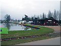
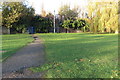
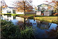
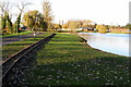
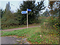
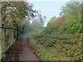
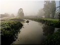
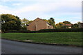
Photos of NN3 9SZ


Area Information
Living in NN3 9SZ means being part of a tightly packed residential cluster in England, where 1,597 people reside across just 1.2 hectares. The area’s high population density—129,253 people per square kilometre—reflects a compact, closely knit community. This small postcode area is defined by its residential character, with homes predominantly occupied by owners. Daily life here is shaped by proximity to essential services, including retail outlets, public transport hubs, and a primary school. While the area is small, it offers a mix of practical amenities within walking or short driving distance. The presence of Northampton Railway Station and multiple bus interchanges ensures connectivity to nearby towns. For those seeking a quiet, community-focused environment with access to urban conveniences, NN3 9SZ balances residential peace with the vibrancy of nearby Northampton.
- Area Type
- Postcode
- Area Size
- 1.2 hectares
- Population
- 1597
- Population Density
- 2657 people/km²
NN3 9SZ is primarily an owner-occupied area, with 64% of properties owned by residents rather than rented. The housing stock consists mainly of houses, which is unusual for a small postcode area but may indicate a mix of older, family homes. This composition suggests a market where buyers are likely to seek long-term stability rather than short-term investment. The limited size of the area means the housing stock is finite, so buyers should consider proximity to nearby towns for additional options. The presence of nearby amenities and transport links may enhance the appeal of properties here, particularly for those prioritising convenience over expansive living space.
House Prices in NN3 9SZ
Showing 34 properties
| Address | Type | Beds | Baths | Last Sale Price | Last Sale Date | |
|---|---|---|---|---|---|---|
| 18 Sladeswell Court, Northampton, NN3 9SZ | house | - | - | £164,000 | Oct 2019 | |
| 5 Sladeswell Court, Northampton, NN3 9SZ | Terraced | 3 | 1 | £130,000 | Jul 2019 | |
| 3 Sladeswell Court, Northampton, NN3 9SZ | house | - | - | £141,500 | Nov 2017 | |
| 31 Sladeswell Court, Northampton, NN3 9SZ | Flat | - | - | £95,000 | Aug 2017 | |
| 19 Sladeswell Court, Northampton, NN3 9SZ | Terraced | 3 | - | £164,995 | Jul 2017 | |
| 22 Sladeswell Court, Northampton, NN3 9SZ | Terraced | 3 | 2 | £115,000 | May 2015 | |
| 23 Sladeswell Court, Northampton, NN3 9SZ | house | - | - | £136,750 | Feb 2008 | |
| 1 Sladeswell Court, Northampton, NN3 9SZ | house | - | - | £116,500 | Apr 2007 | |
| 8 Sladeswell Court, Northampton, NN3 9SZ | house | - | - | £88,750 | Sep 2003 | |
| 21 Sladeswell Court, Northampton, NN3 9SZ | Terraced | 3 | 1 | £36,000 | Mar 1997 |
Energy Efficiency in NN3 9SZ
The lifestyle in NN3 9SZ is shaped by its proximity to a range of amenities. Within practical reach are five retail venues, including Lidl Lings, Tesco Northampton, and Co-op Bellinge, offering everyday shopping needs. Public transport hubs like the University Bus Interchange and Northampton Bus Interchange provide reliable connections to nearby destinations, while Northampton Railway Station facilitates travel further afield. Although the area is small, its access to these amenities ensures a balance between residential tranquillity and urban convenience. The presence of a primary school and nearby retail options makes it appealing for families seeking a self-contained yet connected lifestyle.
Amenities
Schools
The nearest school to NN3 9SZ is Standens Barn Primary School, which serves the local community with primary education. While no secondary schools are listed in the data, the presence of a primary school indicates that the area caters to families with younger children. The absence of secondary schools may mean residents must travel to nearby towns for further education. For families, this could be a consideration when evaluating the area’s suitability, particularly if children require access to a broader range of educational institutions.
| Rank | School | Type | Entry gender | Ages |
|---|
Explore more schools in this area
Go to Schools tabDemographics
The population of NN3 9SZ is predominantly adults aged 30–64, with a median age of 47. This suggests a mature, stable community where many residents are likely to be established professionals or families. Home ownership is high at 64%, indicating a strong presence of long-term residents. The area is largely composed of houses, not flats, which aligns with the demographic profile of older, family-oriented households. The predominant ethnic group is White, reflecting a homogenous community. With no data on deprivation levels, it is difficult to assess socioeconomic challenges, but the high home ownership rate and age profile suggest a relatively settled population with established ties to the area.
Household Size
Accommodation Type
Tenure
Ethnic Group
Religion
Household Composition
Age
Household Deprivation
NS-SEC
Explore more demographic insights in this area
Go to Demographics tabPlanning
Planning Constraints
- Flood RiskPremium
- Ramsar Wetland SitesPremium
- Area of Outstanding Natural BeautyPremium
- Protected Nature ReservePremium
- Protected WoodlandPremium