Area Overview for NN3 9DJ
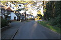
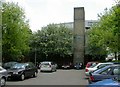
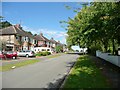
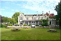
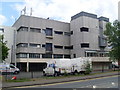
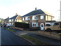
Photos of NN3 9DJ


Area Information
NN3 9DJ is a small, tightly knit residential area in England, covering just 1.5 hectares and home to 1,643 people. Its high population density of 107,106 people per square kilometre suggests a compact, possibly multi-generational community. This postcode area is distinct for its size — equivalent to a small village — yet it supports a population comparable to a larger town. Daily life here is likely characterised by close proximity to essential services, with the area’s limited footprint meaning residents may share communal spaces or walkable routes. The absence of major planning constraints, such as protected woodlands or AONB designations, suggests a practical, low-maintenance environment. For those seeking a quiet, manageable neighbourhood without the sprawl of larger towns, NN3 9DJ offers a self-contained living experience. Its proximity to Northampton’s retail and transport hubs, however, ensures access to broader amenities without the need for long commutes. This balance of seclusion and connectivity makes it a compelling choice for those prioritising convenience and community.
- Area Type
- Postcode
- Area Size
- 1.5 hectares
- Population
- 1643
- Population Density
- 7717 people/km²
NN3 9DJ is primarily a house-dominated area, with 44% of properties owned by residents. This suggests a mix of owner-occupied homes and rental properties, though the exact split between the two is not specified. The prevalence of houses over flats or apartments indicates a preference for standalone, private living spaces, which may appeal to families or those seeking space. Given the area’s small size and high density, properties are likely to be closely spaced, potentially offering garden access in a compact setting. For buyers, this means a market where homes are likely to be individually owned rather than part of larger developments. The limited size of the postcode area also means that property choices are constrained to a small cluster, requiring buyers to consider proximity to nearby towns for additional options.
House Prices in NN3 9DJ
Showing 47 properties
| Address | Type | Beds | Baths | Last Sale Price | Last Sale Date | |
|---|---|---|---|---|---|---|
| 23 Logwell Court, Northampton, NN3 9DJ | Bungalow | 1 | - | £138,000 | Jun 2020 | |
| 29 Logwell Court, Northampton, NN3 9DJ | house | - | - | £170,000 | Apr 2019 | |
| 34 Logwell Court, Northampton, NN3 9DJ | Terraced | 3 | - | £156,000 | Sep 2017 | |
| 32 Logwell Court, Northampton, NN3 9DJ | house | 3 | - | £152,000 | Mar 2017 | |
| 11 Logwell Court, Northampton, NN3 9DJ | Terraced | 3 | - | £146,000 | Nov 2016 | |
| 16 Logwell Court, Northampton, NN3 9DJ | Terraced | 2 | - | £125,000 | Oct 2016 | |
| 12 Logwell Court, Northampton, NN3 9DJ | house | - | - | £150,000 | Oct 2016 | |
| 37 Logwell Court, Northampton, NN3 9DJ | Terraced | 3 | 1 | £134,000 | Sep 2016 | |
| 10 Logwell Court, Northampton, NN3 9DJ | house | - | - | £130,000 | Sep 2016 | |
| 40 Logwell Court, Northampton, NN3 9DJ | house | - | - | £114,000 | Dec 2015 |
Energy Efficiency in NN3 9DJ
Residents of NN3 9DJ have access to a range of retail and transport amenities within easy reach. Nearby supermarkets include Lidl Lings, Tesco Northampton, and Aldi Headlands, offering daily essentials and convenience shopping. The University Bus Interchange and Northampton Bus Interchange provide regular connections to surrounding areas, while Northampton Railway Station offers direct rail links. Though the area itself is small, its proximity to Northampton ensures residents can access broader leisure, dining, and cultural options without long journeys. This blend of local convenience and regional accessibility supports a lifestyle that balances self-sufficiency with the vibrancy of nearby towns.
Amenities
Schools
| Rank | School | Type | Entry gender | Ages |
|---|
Explore more schools in this area
Go to Schools tabDemographics
The median age in NN3 9DJ is 47, with the majority of residents aged between 30 and 64. This suggests a mature, stable population, likely with established careers and family structures. Home ownership sits at 44%, indicating a mix of owner-occupied properties and rental units. The predominant accommodation type is houses, which may reflect a preference for private, standalone living spaces. The White ethnic group forms the largest demographic, though specific diversity figures are not provided. With 44% of homes owned outright, the area may offer predictable property values and a sense of permanence. The age profile implies a community focused on long-term stability rather than transient lifestyles. For prospective buyers, this demographic profile suggests a neighbourhood with lower turnover and a focus on practical, family-friendly living.
Household Size
Accommodation Type
Tenure
Ethnic Group
Religion
Household Composition
Age
Household Deprivation
NS-SEC
Explore more demographic insights in this area
Go to Demographics tabPlanning
Planning Constraints
- Flood RiskPremium
- Ramsar Wetland SitesPremium
- Area of Outstanding Natural BeautyPremium
- Protected Nature ReservePremium
- Protected WoodlandPremium