Area Overview for NN3 9PJ
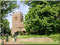
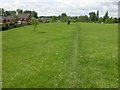
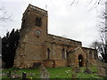
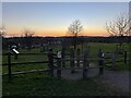
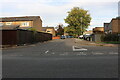
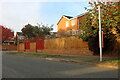
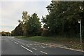
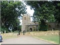
Photos of NN3 9PJ


Area Information
Living in NN3 9PJ offers a compact, tightly knit residential experience within a small cluster of homes. The area covers 4,611 square metres and is home to 1,575 residents, creating a high population density of 341,597 people per square kilometre. This suggests a closely connected community where proximity to amenities and neighbours is a daily reality. The area is characterised by its mix of practicality and accessibility, with nearby retail hubs like Co-op Bellinge, Lidl Lings, and Tesco Northampton within practical reach. For commuters, the University Bus Interchange and Northampton Bus Interchange provide reliable links, while Northampton Railway Station offers regional connectivity. The demographic profile leans towards adults aged 30–64, reflecting a mature population with established routines. While the area lacks large-scale natural or protected landscapes, its strength lies in its convenience and the balance between residential tranquillity and urban accessibility. For those seeking a self-contained, community-focused environment with minimal travel to essential services, NN3 9PJ presents a compelling option.
- Area Type
- Postcode
- Area Size
- 4611 m²
- Population
- 1575
- Population Density
- 3454 people/km²
The property market in NN3 9PJ is dominated by owner-occupied homes, with 80% of residents living in properties they own. This contrasts with areas where rental markets dominate, suggesting a community of long-term residents rather than short-term tenants. The accommodation type is primarily houses, which is unusual for a small postcode area but may reflect a focus on single-family homes. Given the area’s limited size, the housing stock is likely constrained, meaning buyers should consider the proximity to nearby towns like Northampton for broader options. The high home ownership rate indicates a stable market, but the small scale of NN3 9PJ means property availability may be limited. For buyers seeking a quiet, self-contained home with easy access to urban amenities, this area could be appealing, though competition for existing properties may be keen.
House Prices in NN3 9PJ
Showing 7 properties
| Address | Type | Beds | Baths | Last Sale Price | Last Sale Date | |
|---|---|---|---|---|---|---|
| 6 Vokes Close, Northampton, NN3 9PJ | Detached | 4 | 2 | £405,000 | Jul 2025 | |
| 5 Vokes Close, Northampton, NN3 9PJ | house | - | - | £370,000 | Mar 2021 | |
| 1 Vokes Close, Northampton, NN3 9PJ | Detached | 4 | 1 | £218,000 | Dec 2013 | |
| 2 Vokes Close, Northampton, NN3 9PJ | Detached | - | - | £246,000 | Jul 2008 | |
| 4 Vokes Close, Northampton, NN3 9PJ | Detached | - | - | £151,000 | Jun 2002 | |
| 7 Vokes Close, Northampton, NN3 9PJ | Detached | - | - | - | - | |
| 3 Vokes Close, Northampton, NN3 9PJ | Detached | - | - | - | - |
Energy Efficiency in NN3 9PJ
Daily life in NN3 9PJ is shaped by its proximity to essential retail and transport hubs. The Co-op Bellinge, Lidl Lings, and Tesco Northampton provide a range of shopping options, from groceries to household essentials, reducing the need for long trips. For commuters, the University Bus Interchange and Northampton Bus Interchange offer regular services, while Northampton Railway Station provides regional rail links. Though the area lacks dedicated parks or leisure facilities, its compact design ensures that residents can access urban amenities quickly. The presence of major supermarkets and transport points contributes to a practical, convenience-focused lifestyle. While the area may not cater to those seeking extensive recreational spaces, its accessibility to larger towns like Northampton means residents can enjoy a broader range of cultural and leisure opportunities without significant travel.
Amenities
Schools
| Rank | School | Type | Entry gender | Ages |
|---|
Explore more schools in this area
Go to Schools tabDemographics
The community in NN3 9PJ is predominantly composed of adults aged 30–64, with a median age of 47. This suggests a population that is largely settled, with many likely to be in their prime working years or nearing retirement. Home ownership is high at 80%, indicating a stable, long-term resident base rather than a transient rental market. The accommodation type is primarily houses, which aligns with the area’s compact layout and suggests a focus on family-friendly living. The predominant ethnic group is White, reflecting a homogenous demographic profile. While the data does not specify deprivation levels, the high home ownership and mature age range imply a community with established economic stability. However, the absence of detailed diversity metrics means the area’s cultural composition remains largely unexplored in the provided data.
Household Size
Accommodation Type
Tenure
Ethnic Group
Religion
Household Composition
Age
Household Deprivation
NS-SEC
Explore more demographic insights in this area
Go to Demographics tabPlanning
Planning Constraints
- Flood RiskPremium
- Ramsar Wetland SitesPremium
- Area of Outstanding Natural BeautyPremium
- Protected Nature ReservePremium
- Protected WoodlandPremium