Area Overview for NN3 9AT
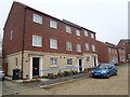
Photos of NN3 9AT


Area Information
NN3 9AT is a compact residential area in England, covering just 2 hectares and home to 1,575 residents. Its high population density of 80,401 people per square kilometre reflects a tightly knit community, where proximity to amenities and transport links is a defining feature. The area’s small size means it is likely centred around a specific cluster of homes, possibly with shared green spaces or communal areas. Daily life here is shaped by its connectivity to nearby towns and services. With a median age of 47 and a population skewed toward adults aged 30–64, the area is likely to have a stable, established demographic. Residents benefit from proximity to retail hubs like Tesco Northampton and transport nodes such as Northampton Railway Station, making it practical for commuters or those seeking access to urban amenities without the congestion of a larger city. The area’s compact nature ensures a balance between residential tranquillity and the vibrancy of nearby urban centres.
- Area Type
- Postcode
- Area Size
- 2.0 hectares
- Population
- 1575
- Population Density
- 3454 people/km²
The property market in NN3 9AT is characterised by high home ownership, with 80% of residents owning their homes. This suggests a stable, long-term market rather than a transient rental-focused area. The predominant accommodation type is houses, which may indicate a mix of semi-detached or terraced properties given the area’s small size. As a compact postcode covering only 2 hectares, the housing stock is likely limited, which could create competition among buyers. The high proportion of owner-occupied homes may also mean that properties are less frequently available for purchase, requiring buyers to consider nearby areas for more options. For those seeking a family home, the area’s focus on houses may offer greater space and privacy, though the small size of NN3 9AT means buyers should explore adjacent postcode areas for a broader range of properties.
House Prices in NN3 9AT
Showing 44 properties
| Address | Type | Beds | Baths | Last Sale Price | Last Sale Date | |
|---|---|---|---|---|---|---|
| 14 Knights Court, Northampton, NN3 9AT | house | - | - | £240,000 | Jan 2025 | |
| 18 Knights Court, Northampton, NN3 9AT | Terraced | 3 | 1 | £230,000 | Nov 2024 | |
| 20 Knights Court, Northampton, NN3 9AT | house | 3 | 1 | £223,000 | Oct 2024 | |
| 39 Knights Court, Northampton, NN3 9AT | Terraced | 3 | 1 | £240,000 | Feb 2024 | |
| 16 Knights Court, Northampton, NN3 9AT | Terraced | 3 | 1 | £230,000 | Jan 2023 | |
| 36 Knights Court, Northampton, NN3 9AT | Retail | 3 | 1 | £245,000 | Aug 2022 | |
| 2 Knights Court, Northampton, NN3 9AT | house | - | - | £270,000 | Oct 2021 | |
| 27 Knights Court, Northampton, NN3 9AT | house | - | - | £200,500 | Mar 2021 | |
| 28 Knights Court, Northampton, NN3 9AT | Terraced | 3 | 1 | £192,000 | Sep 2020 | |
| 15 Knights Court, Northampton, NN3 9AT | house | - | - | £175,000 | May 2020 |
Energy Efficiency in NN3 9AT
The lifestyle in NN3 9AT is supported by nearby amenities within practical reach. Retail options include Co-op Bellinge, Lidl Lings, and Tesco Northampton, ensuring residents have access to essential shopping and food services. The area’s transport links, such as the University and Northampton Bus Interchanges, provide convenient access to public transport, facilitating travel to larger towns or cities. While the data does not specify parks or leisure facilities directly, the proximity to Northampton suggests opportunities for recreation, dining, and cultural activities in the surrounding area. The compact nature of NN3 9AT means that daily errands and social activities can be managed without long commutes, contributing to a balanced lifestyle. The availability of both local shops and regional transport options ensures a mix of convenience and connectivity for residents.
Amenities
Schools
| Rank | School | Type | Entry gender | Ages |
|---|
Explore more schools in this area
Go to Schools tabDemographics
The community in NN3 9AT is predominantly composed of adults aged 30–64, with a median age of 47. This suggests a mature, stable population, likely with established careers and families. Home ownership is high at 80%, indicating a preference for long-term residency over rental properties. The accommodation type is primarily houses, which aligns with the area’s residential character and may contribute to a sense of privacy and space. The predominant ethnic group is White, reflecting a homogeneous demographic profile. While no specific data on deprivation is provided, the high home ownership rate and age range suggest a community with relatively stable economic conditions. The absence of detailed diversity metrics means the area’s cultural makeup remains less defined in the data, but the focus on family-oriented living and long-term occupancy implies a cohesive, low-turnover neighbourhood.
Household Size
Accommodation Type
Tenure
Ethnic Group
Religion
Household Composition
Age
Household Deprivation
NS-SEC
Explore more demographic insights in this area
Go to Demographics tabPlanning
Planning Constraints
- Flood RiskPremium
- Ramsar Wetland SitesPremium
- Area of Outstanding Natural BeautyPremium
- Protected Nature ReservePremium
- Protected WoodlandPremium