Area Overview for NN3 8XY
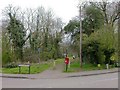
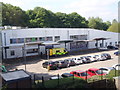
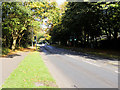
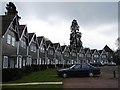
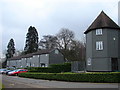
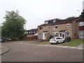
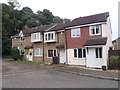
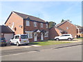
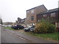
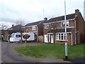
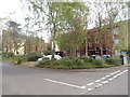
Photos of NN3 8XY

Area Information
Living in NN3 8XY means inhabiting a tightly packed residential cluster in England, where 1,598 people reside across just 2.1 hectares. The area’s density is striking — 77,885 people per square kilometre — creating a compact, closely knit community. This postcode is not a sprawling suburb but a focused cluster of homes, likely centred around local amenities. Daily life here is shaped by proximity to retail and transport hubs, with Co-op Northampton, Tesco Northampton, and Lidl Lings within practical reach. The area’s character is defined by its accessibility: a railway station, two bus interchanges, and a broadband score of 100, which ensures seamless digital connectivity. While the population skews towards middle-aged adults, the mix of home ownership and rental properties suggests a balance between long-term residents and those seeking temporary housing. NN3 8XY is not a place for sprawling estates or isolated villas — it is a small, intensely lived-in space where convenience and community are paramount.
- Area Type
- Postcode
- Area Size
- 2.1 hectares
- Population
- 1598
- Population Density
- 4940 people/km²
The property market in NN3 8XY is characterised by a low home ownership rate of 43%, indicating that less than half of properties are owner-occupied. The accommodation type is predominantly houses, which is unusual for a densely packed area but may reflect the presence of older, single-family homes. This suggests a market that is not driven by high demand for rental properties but rather by a mix of long-term residents and those seeking temporary housing. The small area size and high population density imply limited new development, meaning buyers must consider the existing stock. For those interested in purchasing, the focus would be on individual houses rather than apartments or shared spaces. The area’s compact nature means that proximity to amenities is a key selling point, though the lack of detailed data on property prices or trends leaves gaps in understanding the market’s dynamics.
House Prices in NN3 8XY
Showing 58 properties
| Address | Type | Beds | Baths | Last Sale Price | Last Sale Date | |
|---|---|---|---|---|---|---|
| 30 Dryleys Court, Northampton, NN3 8XY | house | - | - | £180,000 | Jul 2018 | |
| 43 Dryleys Court, Northampton, NN3 8XY | Terraced | 6 | 1 | £155,000 | Feb 2018 | |
| 19 Dryleys Court, Northampton, NN3 8XY | Terraced | 3 | 1 | £145,000 | Jul 2017 | |
| 36 Dryleys Court, Northampton, NN3 8XY | Terraced | 3 | - | £124,000 | Jul 2016 | |
| 21 Dryleys Court, Northampton, NN3 8XY | Terraced | 3 | 1 | £100,000 | May 2016 | |
| 6 Dryleys Court, Northampton, NN3 8XY | Terraced | 3 | 1 | £136,000 | Mar 2016 | |
| 25 Dryleys Court, Northampton, NN3 8XY | Terraced | 3 | - | £108,000 | Mar 2016 | |
| 11 Dryleys Court, Northampton, NN3 8XY | Terraced | 3 | 1 | £113,000 | Aug 2015 | |
| 17 Dryleys Court, Northampton, NN3 8XY | house | - | - | £110,000 | Dec 2014 | |
| 32 Dryleys Court, Northampton, NN3 8XY | Terraced | 3 | - | £100,000 | Mar 2013 |
Energy Efficiency in NN3 8XY
Life in NN3 8XY is shaped by its proximity to retail and transport hubs. The Co-op Northampton, Tesco Northampton, and Lidl Lings provide essential shopping, while the University Bus Interchange and Northampton Bus Interchange offer access to broader networks. The Northampton Railway Station adds regional connectivity, making it easier to commute to nearby cities. Though the area itself is small, its integration with these amenities ensures that daily needs are met without long journeys. The retail options suggest a focus on convenience over luxury, with no indication of high-end shopping or dining. Parks or leisure facilities are not explicitly listed, but the absence of environmental constraints like protected woodlands or AONB status implies space for informal recreation. The lifestyle here is practical, prioritising accessibility over expansive amenities, with a clear reliance on nearby urban infrastructure.
Amenities
Schools
| Rank | School | Type | Entry gender | Ages |
|---|
Explore more schools in this area
Go to Schools tabDemographics
The community in NN3 8XY is predominantly middle-aged, with a median age of 47 and most residents falling within the 30-64 age range. Home ownership here is relatively low at 43%, suggesting a mix of renters and owner-occupiers. The area is largely composed of houses, not flats or apartments, which may reflect its residential, rather than high-density, character. Ethnically, the population is predominantly White, though specific diversity metrics are not provided. The high population density — 77,885 people per square kilometre — implies shared spaces and a reliance on communal amenities. This density, combined with the age profile, suggests a stable, mature demographic with established routines. However, the lack of detailed data on deprivation or income levels means the area’s socioeconomic challenges remain unexplored. What is clear is that NN3 8XY is a place where proximity to services and transport is more critical than private space.
Household Size
Accommodation Type
Tenure
Ethnic Group
Religion
Household Composition
Age
Household Deprivation
NS-SEC
Explore more demographic insights in this area
Go to Demographics tabPlanning
Planning Constraints
- Flood RiskPremium
- Ramsar Wetland SitesPremium
- Area of Outstanding Natural BeautyPremium
- Protected Nature ReservePremium
- Protected WoodlandPremium