Area Overview for NN3 8TJ
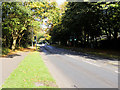
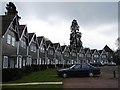
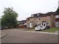
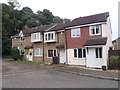
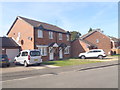
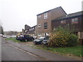
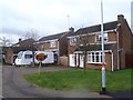
Photos of NN3 8TJ


Area Information
NN3 8TJ is a small residential postcode area in England, covering just 1.3 hectares and home to 1,738 residents. Its compact size means it is a tightly knit community, with a high population density of 136,068 people per square kilometre. This area is distinct for its focus on single-family homes, as the predominant accommodation type is houses, reflecting a stable, long-term resident base. The median age of 47 suggests a mature population, with the majority aged between 30 and 64. Daily life here is characterised by proximity to essential services, including retail outlets like Co-op Northampton and Aldi Overstone, which are within practical reach. The area’s small footprint means it is likely integrated into nearby urban hubs, offering residents access to broader amenities without the isolation of more rural settings. For those considering living in NN3 8TJ, the blend of residential tranquillity and urban connectivity is a key draw, though the compact nature of the area means it is best suited for those prioritising convenience over expansive living spaces.
- Area Type
- Postcode
- Area Size
- 1.3 hectares
- Population
- 1738
- Population Density
- 3575 people/km²
The property market in NN3 8TJ is defined by a high rate of home ownership—62% of residents own their homes—suggesting a stable, long-term community with limited rental activity. The area is primarily composed of houses, which contrasts with regions where flats or apartments dominate. This housing stock implies a focus on family-friendly or semi-detached properties, likely appealing to those seeking private, spacious living arrangements. Given the area’s small size—just 1.3 hectares—the housing stock is limited, which may mean that buyers must consider nearby areas for more options. The high proportion of owner-occupied homes also suggests that the market is less influenced by short-term rental demand, potentially offering greater stability for long-term investors. However, the compact nature of NN3 8TJ means that property availability is constrained, and buyers may need to look beyond the immediate postcode for broader choices.
House Prices in NN3 8TJ
Showing 27 properties
| Address | Type | Beds | Baths | Last Sale Price | Last Sale Date | |
|---|---|---|---|---|---|---|
| 25 Farndon Close, Northampton, NN3 8TJ | Detached | 4 | 1 | £325,000 | Jul 2024 | |
| 23 Farndon Close, Northampton, NN3 8TJ | Detached | 3 | - | £215,000 | Jul 2019 | |
| 14 Farndon Close, Northampton, NN3 8TJ | Detached | 1 | 1 | £213,000 | Apr 2019 | |
| 3 Farndon Close, Northampton, NN3 8TJ | Semi-detached | 1 | 1 | £100,000 | Oct 2018 | |
| 21 Farndon Close, Northampton, NN3 8TJ | house | - | - | £216,000 | Jul 2018 | |
| 15 Farndon Close, Northampton, NN3 8TJ | Detached | 3 | 1 | £184,000 | May 2017 | |
| 9 Farndon Close, Northampton, NN3 8TJ | Semi-detached | 1 | 1 | £106,000 | Jan 2017 | |
| 8 Farndon Close, Northampton, NN3 8TJ | Terraced | 1 | 1 | £111,000 | Dec 2016 | |
| 7 Farndon Close, Northampton, NN3 8TJ | Terraced | 1 | 1 | £96,000 | Oct 2016 | |
| 18 Farndon Close, Northampton, NN3 8TJ | Detached | 3 | 1 | £179,995 | Oct 2016 |
Energy Efficiency in NN3 8TJ
Living in NN3 8TJ offers access to a range of essential amenities within practical reach. Retail options include major chains such as Co-op Northampton, Aldi Overstone, and Tesco Northampton, ensuring residents have convenient access to groceries and daily necessities. The area’s transport links, including the University Bus Interchange and Northampton Bus Interchange, provide connectivity to broader retail and leisure hubs. While the postcode itself is small, the presence of Northampton Railway Station allows for easy travel to larger cities and cultural centres. The proximity to these services suggests a lifestyle that balances local convenience with regional accessibility. For those prioritising practicality over sprawling green spaces, the area’s compact nature means amenities are not distant, though the lack of named parks or recreational facilities in the data implies that outdoor leisure may require travel to nearby locations.
Amenities
Schools
| Rank | School | Type | Entry gender | Ages |
|---|
Explore more schools in this area
Go to Schools tabDemographics
The community in NN3 8TJ is predominantly composed of adults aged 30 to 64, with a median age of 47. This suggests a population that is largely established, with many residents likely in their prime working years or approaching retirement. Home ownership is high, at 62%, indicating a stable, long-term demographic with a strong presence of owner-occupied properties. The area is characterised by houses rather than flats or apartments, which aligns with the higher proportion of private residences. The predominant ethnic group is White, though no specific data on other groups is provided. The high population density—136,068 people per square kilometre—suggests that while the area is small, it is intensely populated, which may influence the pace of life and availability of shared resources. This density does not necessarily correlate with deprivation, but it does mean that infrastructure and services must cater to a concentrated population.
Household Size
Accommodation Type
Tenure
Ethnic Group
Religion
Household Composition
Age
Household Deprivation
NS-SEC
Explore more demographic insights in this area
Go to Demographics tabPlanning
Planning Constraints
- Flood RiskPremium
- Ramsar Wetland SitesPremium
- Area of Outstanding Natural BeautyPremium
- Protected Nature ReservePremium
- Protected WoodlandPremium