Area Overview for NN3 8TE
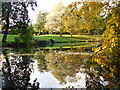
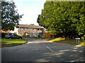
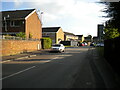
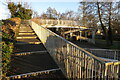
Photos of NN3 8TE


Area Information
Living in NN3 8TE offers a compact, tightly knit residential experience within a small cluster of homes. The area spans 6,335 square metres and is home to 1,684 residents, creating a high population density of 265,843 people per square kilometre. This density reflects a community that is both intimate and efficient, with services and amenities within close reach. The area’s demographic profile skews towards adults aged 30–64, suggesting a mix of established professionals and families. With 59% of homes owner-occupied and a focus on houses rather than flats, NN3 8TE feels stable and rooted. Daily life here is shaped by proximity to retail, transport, and low environmental risks. The area’s safety credentials—low flood risk, no protected natural sites, and a crime score of 71—make it an appealing choice for those prioritising security and practicality. While small, NN3 8TE balances convenience with a sense of quiet normality, ideal for those seeking a manageable, well-connected neighbourhood.
- Area Type
- Postcode
- Area Size
- 6335 m²
- Population
- 1684
- Population Density
- 6086 people/km²
The property market in NN3 8TE is characterised by a strong emphasis on owner-occupation, with 59% of homes owned by residents. The accommodation type is predominantly houses, which contrasts with areas where flats or apartments dominate. This suggests a market skewed towards families or individuals seeking more space and privacy. Given the small area size and high population density, the housing stock is limited, making NN3 8TE a niche market with few properties available. Buyers should consider that the area’s compact nature may restrict options, though existing homes are likely well-maintained. The focus on houses also implies lower rental demand, as owner-occupation is the norm. For those prioritising security and stability, NN3 8TE’s property market offers a straightforward, if limited, selection.
House Prices in NN3 8TE
Showing 23 properties
| Address | Type | Beds | Baths | Last Sale Price | Last Sale Date | |
|---|---|---|---|---|---|---|
| 7 Thornapple Close, Northampton, NN3 8TE | Semi-detached | 3 | 1 | £237,000 | Dec 2023 | |
| 17 Thornapple Close, Northampton, NN3 8TE | Terraced | - | - | £92,500 | Sep 2020 | |
| 1 Thornapple Close, Northampton, NN3 8TE | house | - | - | £196,000 | Jan 2019 | |
| 9 Thornapple Close, Northampton, NN3 8TE | Terraced | - | - | £160,000 | Jan 2016 | |
| 14 Thornapple Close, Northampton, NN3 8TE | Terraced | 3 | - | £158,000 | Nov 2014 | |
| 18 Thornapple Close, Northampton, NN3 8TE | Terraced | 3 | - | £134,000 | Nov 2014 | |
| 21 Thornapple Close, Northampton, NN3 8TE | house | - | - | £120,000 | Dec 2013 | |
| 11 Thornapple Close, Northampton, NN3 8TE | house | - | - | £124,500 | Apr 2008 | |
| 16 Thornapple Close, Northampton, NN3 8TE | Terraced | - | - | £119,995 | Jun 2006 | |
| 15 Thornapple Close, Northampton, NN3 8TE | Terraced | - | - | £117,000 | Aug 2005 |
Energy Efficiency in NN3 8TE
Daily life in NN3 8TE is shaped by its proximity to essential amenities. Retail options include five venues, notably Co-op Northampton and Tesco Northampton, offering convenience for shopping needs. The area’s transport hubs—University Bus Interchange, Northampton Bus Interchange, and Northampton Railway Station—provide easy access to public transport, facilitating travel to nearby destinations. While the data does not mention parks or leisure facilities, the compact layout ensures that essential services are within practical reach. The combination of retail, transport, and low environmental risks creates a functional lifestyle, ideal for those prioritising accessibility and efficiency. The area’s small size means everything is close, though it may lack expansive recreational spaces.
Amenities
Schools
The nearest school to NN3 8TE is Blackthorn Middle School, a primary school serving the local community. While no Ofsted rating is provided, the presence of a primary school indicates that families with young children have access to local education. The absence of secondary schools or additional educational institutions within the area means parents may need to consider commuting for higher education. The single primary school suggests a focused but limited educational landscape, which could be a consideration for families requiring a broader range of school options. However, the proximity of Blackthorn Middle School ensures that daily school runs are feasible, supporting a balance between convenience and local provision.
| Rank | School | Type | Entry gender | Ages |
|---|
Explore more schools in this area
Go to Schools tabDemographics
The community in NN3 8TE is predominantly composed of adults aged 30–64, with a median age of 47. This suggests a population of established professionals and families, rather than students or retirees. Home ownership rates stand at 59%, with the majority of properties being houses rather than flats. The predominant ethnic group is White, reflecting a homogenous demographic profile. The high population density—265,843 people per square kilometre—means the area is compact, with limited space for expansion. While no specific data on deprivation is provided, the high home ownership and age profile imply a relatively stable, middle-income community. The absence of significant diversity data means the area’s social fabric is defined by its core demographic, with little indication of cultural or socioeconomic variation.
Household Size
Accommodation Type
Tenure
Ethnic Group
Religion
Household Composition
Age
Household Deprivation
NS-SEC
Explore more demographic insights in this area
Go to Demographics tabPlanning
Planning Constraints
- Flood RiskPremium
- Ramsar Wetland SitesPremium
- Area of Outstanding Natural BeautyPremium
- Protected Nature ReservePremium
- Protected WoodlandPremium