Area Overview for NN3 8PF
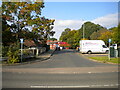
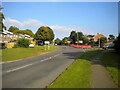
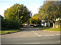
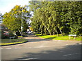
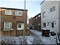
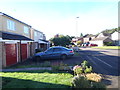
Photos of NN3 8PF


Area Information
NN3 8PF is a compact residential postcode area in England, covering 6,133 square metres and home to 1,604 residents. Its high population density of 261,539 people per square kilometre reflects a tightly knit community, though the area remains small enough to feel intimate. The postcode includes a cluster of homes, with the majority being owner-occupied properties. Daily life here is shaped by proximity to essential services, including retail hubs like Co-op Northampton and Tesco, as well as transport links such as Northampton Railway Station. The area’s demographics suggest a mature population, with a median age of 47 and a strong presence of adults aged 30–64. While the postcode lacks large-scale amenities, its practical reach includes bus interchanges and a mix of local shops, making it suitable for those prioritising convenience over sprawling infrastructure. The absence of natural constraints like AONB or protected woodlands means development is unencumbered, though the area’s small size limits expansion. For buyers seeking a quiet, compact living environment with access to core services, NN3 8PF offers a balance of practicality and proximity.
- Area Type
- Postcode
- Area Size
- 6133 m²
- Population
- 1604
- Population Density
- 6303 people/km²
The property market in NN3 8PF is characterised by a 51% home ownership rate, with houses forming the primary accommodation type. This suggests a market skewed towards owner-occupied properties rather than a rental-heavy area, though the exact number of rental units is not specified. The small size of the postcode—just 6,133 square metres—means the housing stock is limited, likely comprising a mix of single-family homes and possibly terraced properties. Buyers should consider the area’s compact nature, which may limit availability of new builds or larger properties. The presence of nearby amenities like Co-op Northampton and Northampton Railway Station adds value, particularly for those prioritising convenience over expansive living spaces. However, the small size of NN3 8PF means the immediate surroundings, rather than the postcode itself, may hold more significant property diversity. For buyers seeking a low-maintenance, service-proximate environment, the area offers practicality, though competition for available homes may be keen.
House Prices in NN3 8PF
Showing 17 properties
| Address | Type | Beds | Baths | Last Sale Price | Last Sale Date | |
|---|---|---|---|---|---|---|
| 6 Tinsley Close, Northampton, NN3 8PF | house | - | - | £245,000 | Aug 2022 | |
| 2 Tinsley Close, Northampton, NN3 8PF | Semi-detached | 3 | - | £215,000 | Mar 2021 | |
| 16 Tinsley Close, Northampton, NN3 8PF | house | - | - | £150,000 | Jan 2020 | |
| 14 Tinsley Close, Northampton, NN3 8PF | house | - | - | £209,000 | Dec 2019 | |
| 7 Tinsley Close, Northampton, NN3 8PF | house | 3 | - | £213,000 | Oct 2019 | |
| 4 Tinsley Close, Northampton, NN3 8PF | Semi-detached | 3 | 1 | £210,000 | Sep 2019 | |
| 11 Tinsley Close, Northampton, NN3 8PF | Detached | 4 | - | £280,000 | May 2018 | |
| 18 Tinsley Close, Northampton, NN3 8PF | house | - | - | £145,000 | Jun 2014 | |
| 10 Tinsley Close, Northampton, NN3 8PF | house | 3 | 1 | £139,995 | May 2007 | |
| 5 Tinsley Close, Northampton, NN3 8PF | Semi-detached | - | - | £128,500 | Nov 2006 |
Energy Efficiency in NN3 8PF
The lifestyle in NN3 8PF is defined by its proximity to essential amenities within practical reach. Residents have access to five retail outlets, including Co-op Northampton, Co-op Bellinge, and Tesco Northampton, ensuring everyday shopping needs are met. The area’s transport links, such as the University Bus Interchange and Northampton Railway Station, provide connectivity to nearby employment hubs and leisure destinations. While the data does not mention parks or recreational spaces, the absence of natural constraints like AONB or protected woodlands suggests opportunities for local green spaces may exist. The compact nature of the postcode means residents can walk or cycle to shops, public transport, and the railway station, fostering a convenient, low-maintenance lifestyle. The mix of retail and transport options supports a practical, community-focused daily rhythm, ideal for those valuing accessibility over expansive infrastructure.
Amenities
Schools
The nearest school to NN3 8PF is St Peter’s Independent School, a fee-paying institution. No other schools are listed in the data, meaning families reliant on state education may need to look beyond the immediate postcode for options. The presence of an independent school suggests the area may attract households prioritising private education, though it does not indicate the availability of state-funded schools nearby. For parents seeking a broad range of educational choices, the lack of additional schools in the data implies that proximity to a school network is limited. The absence of information on Ofsted ratings or curriculum specifics means further research would be necessary to assess the quality of education available. Those considering NN3 8PF as a family home should factor in the potential need to travel beyond the postcode for state school options.
| Rank | School | Type | Entry gender | Ages |
|---|
Explore more schools in this area
Go to Schools tabDemographics
The population of NN3 8PF is 1,604, with a median age of 47, indicating a mature demographic. The majority of residents fall within the 30–64 age range, suggesting a community of established professionals and families. Home ownership stands at 51%, with houses being the predominant accommodation type. This implies a mix of owner-occupied properties and rental units, though the exact proportion of renters is not specified. The predominant ethnic group is White, though no further breakdown of diversity is provided. The high population density of 261,539 people per square kilometre points to a densely populated, possibly urbanised environment. While no data on deprivation or income levels is available, the demographic profile suggests a stable, middle-aged population with established ties to the area. The absence of specific data on socioeconomic factors means assumptions about quality of life must remain cautious, though the presence of retail and transport infrastructure hints at a functional, service-oriented community.
Household Size
Accommodation Type
Tenure
Ethnic Group
Religion
Household Composition
Age
Household Deprivation
NS-SEC
Explore more demographic insights in this area
Go to Demographics tabPlanning
Planning Constraints
- Flood RiskPremium
- Ramsar Wetland SitesPremium
- Area of Outstanding Natural BeautyPremium
- Protected Nature ReservePremium
- Protected WoodlandPremium