Area Overview for NN3 8SX
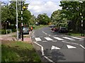
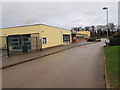
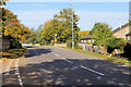
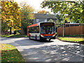
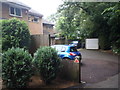
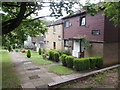
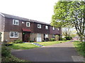
Photos of NN3 8SX

Area Information
Living in NN3 8SX means being part of a tightly knit residential cluster in England, where 1,832 people reside across 5,099 square metres. This small postcode area is densely populated, with 359,314 people per square kilometre, reflecting a compact, community-oriented layout. The area is predominantly home to adults aged 30–64, with a median age of 47, suggesting a mature, stable population. Most residents own their homes, with 72% of properties in private ownership, and the accommodation is largely houses rather than flats. Daily life here is shaped by proximity to essential services, including retail outlets, public transport hubs, and schools. The area’s small size means it is practical for those who value convenience and a sense of familiarity, though its density may feel limiting for those seeking expansive living spaces. NN3 8SX is not a sprawling suburb but a focused cluster, ideal for those prioritising accessibility over isolation.
- Area Type
- Postcode
- Area Size
- 5099 m²
- Population
- 1832
- Population Density
- 5296 people/km²
The property market in NN3 8SX is characterised by a high rate of home ownership, with 72% of properties in private hands. This suggests the area is not a rental hotspot but rather a place where residents have long-term commitments. The accommodation type is predominantly houses, which contrasts with areas where flats dominate. Given the small area size of 5,099 square metres, the housing stock is limited, potentially restricting the availability of properties. Buyers should consider that the market is likely to be competitive, with demand outpacing supply. The focus on owner-occupation also means that rental options may be scarce, though this could be advantageous for those seeking stability. For those considering the area, the compact nature of NN3 8SX means proximity to amenities is a key selling point, even if the range of properties is constrained.
House Prices in NN3 8SX
Showing 23 properties
| Address | Type | Beds | Baths | Last Sale Price | Last Sale Date | |
|---|---|---|---|---|---|---|
| 17 Verwood Close, Northampton, NN3 8SX | Semi-detached | 2 | 1 | £201,500 | Mar 2025 | |
| 20 Verwood Close, Northampton, NN3 8SX | house | - | - | £230,000 | Aug 2022 | |
| 3 Verwood Close, Northampton, NN3 8SX | Terraced | 1 | - | £208,000 | Mar 2022 | |
| 18 Verwood Close, Northampton, NN3 8SX | Semi-detached | 2 | 1 | £158,000 | May 2019 | |
| 2 Verwood Close, Northampton, NN3 8SX | Terraced | 1 | 1 | £157,000 | Oct 2018 | |
| 8 Verwood Close, Northampton, NN3 8SX | Semi-detached | 3 | 1 | £165,000 | Jul 2017 | |
| 7 Verwood Close, Northampton, NN3 8SX | Terraced | 3 | - | £163,000 | Jun 2017 | |
| 6 Verwood Close, Northampton, NN3 8SX | house | 3 | - | £165,000 | May 2017 | |
| 19 Verwood Close, Northampton, NN3 8SX | house | 2 | - | £107,500 | Jun 2015 | |
| 23 Verwood Close, Northampton, NN3 8SX | Terraced | 3 | - | £135,000 | Oct 2014 |
Energy Efficiency in NN3 8SX
The lifestyle in NN3 8SX is shaped by its proximity to essential amenities. Retail options include major chains like Co-op Northampton, Tesco Northampton, and Aldi Overstone, offering a range of goods and services. Public transport hubs such as the University Bus Interchange and Northampton Bus Interchange provide connectivity to surrounding areas, while Northampton Railway Station links to regional destinations. Though the area lacks expansive parks or leisure facilities, the compact layout ensures that daily needs are met without lengthy commutes. The presence of multiple schools and shops creates a self-contained environment, ideal for those valuing convenience. The high broadband score also supports a modern lifestyle, enabling seamless online activities. This mix of practicality and accessibility defines daily life in NN3 8SX.
Amenities
Schools
Residents of NN3 8SX have access to three primary schools within practical reach: Woodvale Primary School, Goldings Middle School, and Woodvale Primary Academy. The latter holds an Ofsted rating of 'good', indicating a school that meets national standards for teaching quality and student outcomes. The presence of multiple primary schools suggests a strong focus on education for young families, though the absence of secondary schools may require commuting for older students. The mix of schools includes both traditional and academically oriented institutions, offering parents choices in their children’s education. For families prioritising proximity to schools, NN3 8SX’s offerings are robust, though the lack of higher education facilities nearby could be a consideration for those planning for long-term family needs.
| Rank | School | Type | Entry gender | Ages |
|---|
Explore more schools in this area
Go to Schools tabDemographics
The community in NN3 8SX is defined by its demographic profile: 72% of residents own their homes, a figure that suggests long-term settlement and financial stability. The area is predominantly occupied by adults aged 30–64, with a median age of 47, indicating a population that is neither young nor elderly. This age group typically prioritises family-oriented living, which aligns with the presence of multiple primary schools in the vicinity. The predominant ethnic group is White, reflecting a homogenous demographic. The high population density of 359,314 people per square kilometre means the area is intensely populated, which can influence local dynamics, from social interactions to infrastructure demands. Despite this, the 72% home ownership rate suggests a degree of economic resilience, with residents likely to have established roots in the area.
Household Size
Accommodation Type
Tenure
Ethnic Group
Religion
Household Composition
Age
Household Deprivation
NS-SEC
Explore more demographic insights in this area
Go to Demographics tabPlanning
Planning Constraints
- Flood RiskPremium
- Ramsar Wetland SitesPremium
- Area of Outstanding Natural BeautyPremium
- Protected Nature ReservePremium
- Protected WoodlandPremium