Area Overview for NN3 8SF
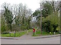
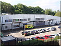
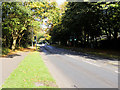
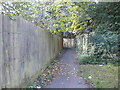
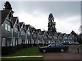
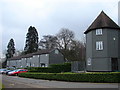
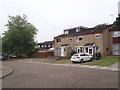
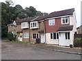
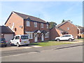
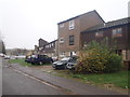
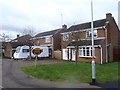
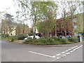
Photos of NN3 8SF
Area Information
NN3 8SF is a compact residential postcode in England, covering just 1.6 hectares and home to 1,981 people. Its high population density of 122,381 people per square kilometre reflects a tightly knit community. The area is characterised by its small-scale living, with homes predominantly in the form of traditional houses. Daily life here is shaped by proximity to essential services, including retail outlets like Co-op Northampton and Aldi Overstone, as well as transport hubs such as Northampton Bus Interchange and Northampton Railway Station. The area’s schools, including Greenfields School and Sports College, cater to specific educational needs, making it a practical choice for families. While the population is largely composed of adults aged 30–64, the median age of 47 suggests a mature, established community. Living here offers convenience, though the small size means residents must balance proximity to amenities with limited space for expansion.
- Area Type
- Postcode
- Area Size
- 1.6 hectares
- Population
- 1981
- Population Density
- 4951 people/km²
The property market in NN3 8SF is defined by a 47% home ownership rate, with houses being the primary accommodation type. This suggests a community where many residents own their homes, though nearly half of properties are likely rented. The presence of traditional houses indicates a focus on family-friendly or long-term living, which may appeal to buyers seeking stability. However, the small area size of 1.6 hectares means the housing stock is limited, potentially increasing competition among buyers. The compact nature of the postcode also means that properties are likely close to amenities, which could be a draw for those prioritising convenience. For buyers, this area may offer a blend of established housing and proximity to services, though the limited space may restrict future development or expansion.
House Prices in NN3 8SF
Showing 23 properties
| Address | Type | Beds | Baths | Last Sale Price | Last Sale Date | |
|---|---|---|---|---|---|---|
| 21 Faramir Place, Northampton, NN3 8SF | Terraced | - | - | £175,020 | Oct 2025 | |
| 17 Faramir Place, Northampton, NN3 8SF | house | - | - | £210,000 | Jan 2022 | |
| 16 Faramir Place, Northampton, NN3 8SF | house | - | - | £184,995 | Sep 2021 | |
| 15 Faramir Place, Northampton, NN3 8SF | Terraced | 3 | 1 | £167,500 | Nov 2020 | |
| 14 Faramir Place, Northampton, NN3 8SF | Terraced | 3 | 1 | £185,000 | Feb 2020 | |
| 23 Faramir Place, Northampton, NN3 8SF | Terraced | 3 | 1 | £170,000 | Jan 2019 | |
| 12 Faramir Place, Northampton, NN3 8SF | Terraced | 3 | 1 | £170,000 | Nov 2018 | |
| 6 Faramir Place, Northampton, NN3 8SF | house | 3 | - | £168,500 | Oct 2018 | |
| 13 Faramir Place, Northampton, NN3 8SF | Terraced | 3 | 1 | £170,000 | Mar 2018 | |
| 18 Faramir Place, Northampton, NN3 8SF | Terraced | 3 | 1 | £125,000 | Nov 2016 |
Energy Efficiency in NN3 8SF
The lifestyle in NN3 8SF is shaped by its proximity to essential amenities. Retail options include Co-op Northampton, Aldi Overstone, and Tesco Northampton, providing convenience for grocery shopping. The area’s transport links, such as the University Bus Interchange and Northampton Railway Station, facilitate easy access to nearby towns and cities. While the data does not mention parks or leisure facilities, the presence of multiple retail and transport points suggests a practical, service-oriented daily life. The compact nature of the postcode means amenities are within walking or short driving distance, though residents may need to travel further for broader leisure or recreational opportunities.
Amenities
Schools
The schools nearest to NN3 8SF include Greenfields School and Sports College, a special school, and Greenfields Specialist School for Communication, also designated as special. These institutions cater to students with specific educational needs, making the area suitable for families requiring tailored support. The presence of two special schools suggests a focus on inclusivity and specialised education, though it may not provide a broad range of mainstream schooling options. Parents seeking a mix of school types may need to consider commuting to nearby areas for additional choices. The schools’ roles are clearly defined, which could be advantageous for families with children who benefit from targeted resources.
| Rank | School | Type | Entry gender | Ages |
|---|
Explore more schools in this area
Go to Schools tabDemographics
The population of NN3 8SF is predominantly adults aged 30–64, with a median age of 47. This suggests a community of middle-aged residents, many of whom may be in their peak working years. Home ownership stands at 47%, indicating a mix of owner-occupied properties and rental units. The area is largely composed of houses, reflecting a traditional housing stock. The predominant ethnic group is White, with no data provided on other demographics. The high population density of 122,381 people per square kilometre implies a compact, possibly urbanised setting, which may influence social dynamics and access to shared resources. While the data does not specify deprivation levels, the high density and moderate home ownership rate suggest a balance between affordability and space, though potential challenges in overcrowding or resource strain may exist.
Household Size
Accommodation Type
Tenure
Ethnic Group
Religion
Household Composition
Age
Household Deprivation
NS-SEC
Explore more demographic insights in this area
Go to Demographics tabPlanning
Planning Constraints
- Flood RiskPremium
- Ramsar Wetland SitesPremium
- Area of Outstanding Natural BeautyPremium
- Protected Nature ReservePremium
- Protected WoodlandPremium