Area Overview for NN3 8QD
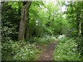
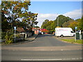
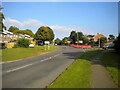
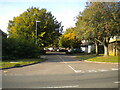
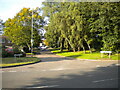
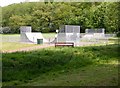
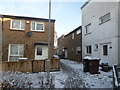
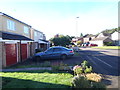
Photos of NN3 8QD

Area Information
NN3 8QD is a compact residential postcode in England, covering just 2.0 hectares and home to 1604 residents. Its high population density of 79,458 people per square kilometre reflects a tightly knit community, likely centred around local amenities and transport hubs. The area’s proximity to Northampton’s infrastructure, including retail centres and public transport, suggests it is well integrated into the city’s broader network. Daily life here is shaped by its small scale and practical accessibility, with residents benefiting from nearby services. The presence of St Peter’s Independent School and multiple retail options within walking distance indicates a focus on family-friendly living. While the area is small, its strategic location offers convenience without the sprawl of larger suburbs. For those seeking a community with a balance of urban connectivity and residential tranquillity, NN3 8QD presents a distinct character, blending proximity to amenities with a close-knit demographic profile.
- Area Type
- Postcode
- Area Size
- 2.0 hectares
- Population
- 1604
- Population Density
- 6303 people/km²
The property market in NN3 8QD is characterised by a 51% home ownership rate, indicating that nearly half of the area’s housing stock is owner-occupied. The predominant accommodation type is houses, which suggests a focus on family homes rather than flats or apartments. This mix of ownership and rental properties may appeal to both long-term residents and those seeking investment opportunities. Given the area’s small size—just 2.0 hectares—the housing stock is likely limited, with properties concentrated around key amenities. Buyers should consider the proximity to Northampton’s transport and retail networks, which may enhance property value. However, the compact nature of the area means competition for available homes could be fierce. For those prioritising space and family-friendly living, the presence of houses in NN3 8QD offers a practical option, though the market’s small scale may require a targeted search.
House Prices in NN3 8QD
Showing 45 properties
| Address | Type | Beds | Baths | Last Sale Price | Last Sale Date | |
|---|---|---|---|---|---|---|
| 16 Longmead Court, Northampton, NN3 8QD | Terraced | 3 | - | £143,000 | Dec 2019 | |
| 3 Longmead Court, Northampton, NN3 8QD | Terraced | 1 | - | £105,000 | Dec 2014 | |
| 40 Longmead Court, Northampton, NN3 8QD | Terraced | 3 | 1 | £100,000 | Nov 2014 | |
| 15 Longmead Court, Northampton, NN3 8QD | house | 3 | 1 | £85,000 | Feb 2010 | |
| 41 Longmead Court, Northampton, NN3 8QD | Terraced | - | - | £90,000 | Oct 2006 | |
| 31 Longmead Court, Northampton, NN3 8QD | house | - | - | £31,490 | Sep 2002 | |
| 12 Longmead Court, Northampton, NN3 8QD | Terraced | 3 | - | £26,840 | Sep 2002 | |
| 14 Longmead Court, Northampton, NN3 8QD | house | - | - | £49,995 | Aug 2002 | |
| 30 Longmead Court, Northampton, NN3 8QD | Terraced | 3 | 2 | - | - | |
| Gas Governor, Longmead Court, Northampton, NN3 8QD | Industrial | - | - | - | - |
Energy Efficiency in NN3 8QD
Living in NN3 8QD offers access to a range of practical amenities within easy reach. Retail options include Co-op Northampton, Tesco Northampton, and Co-op Bellinge, providing essential shopping and services. Public transport is well served by the University Bus Interchange, Northampton Bus Interchange, and Northampton Railway Station, facilitating travel to the city’s cultural and commercial centres. While the data does not mention parks or leisure facilities, the area’s focus on retail and transport suggests a lifestyle prioritising convenience over expansive recreational spaces. The presence of St Peter’s Independent School adds to the area’s appeal for families, though the limited diversity of schools may require additional commuting. Overall, the lifestyle in NN3 8QD balances proximity to services with the compact nature of the postcode, making it suitable for those valuing accessibility over sprawling amenities.
Amenities
Schools
The nearest school to NN3 8QD is St Peter’s Independent School, an independent institution. While no Ofsted rating is provided, the school’s presence suggests the area caters to families seeking private education. The absence of state schools in the data means the local education landscape is limited to this single option. For families prioritising independent schooling, this could be a significant factor, though it also highlights a lack of diversity in educational choices. Parents may need to look beyond the immediate area for state school options, which could affect commuting times. The school’s type and the area’s demographics—predominantly adults aged 30–64—suggest a focus on older children, possibly reflecting the community’s family-oriented profile.
| Rank | School | Type | Entry gender | Ages |
|---|
Explore more schools in this area
Go to Schools tabDemographics
The community in NN3 8QD is predominantly composed of adults aged 30–64, with a median age of 47. This suggests a mature, stable population, likely with established careers and families. Home ownership rates stand at 51%, indicating a mix of owner-occupied properties and rentals. The accommodation type is primarily houses, reflecting a residential area suited to family living. The predominant ethnic group is White, though no specific data on diversity or deprivation is provided. The high population density—79,458 people per square kilometre—implies a compact, possibly multi-generational living environment. This density may contribute to a strong sense of community but could also mean limited private space. The age profile suggests a need for amenities catering to both working professionals and families, which aligns with the presence of nearby schools and retail hubs.
Household Size
Accommodation Type
Tenure
Ethnic Group
Religion
Household Composition
Age
Household Deprivation
NS-SEC
Explore more demographic insights in this area
Go to Demographics tabPlanning
Planning Constraints
- Flood RiskPremium
- Ramsar Wetland SitesPremium
- Area of Outstanding Natural BeautyPremium
- Protected Nature ReservePremium
- Protected WoodlandPremium