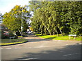
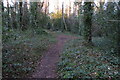
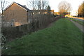
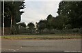
Area Overview for NN3 8EP
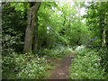
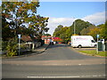
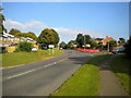
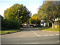
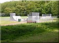
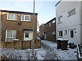
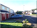
Photos of NN3 8EP

Area Information
Living in NN3 8EP means inhabiting a compact, residential cluster in England’s Northamptonshire region. The area covers just 1.5 hectares, housing 1,506 residents in a densely packed community. With a population density of 103,685 people per square kilometre, this is a small, tightly knit postcode where proximity to amenities and neighbours is a defining feature. The area is predominantly occupied by adults aged 30–64, with a median age of 47, suggesting a stable, mature demographic. Daily life here is shaped by its limited size — everything from schools to shops is within practical reach. While the area lacks sprawling green spaces or major landmarks, its strength lies in its accessibility. Residents benefit from strong digital connectivity and transport links, though the small footprint means the community is both intimate and, by necessity, closely connected. For buyers seeking a compact, well-served area with a focus on convenience over space, NN3 8EP offers a distinct proposition.
- Area Type
- Postcode
- Area Size
- 1.5 hectares
- Population
- 1506
- Population Density
- 5421 people/km²
The property market in NN3 8EP is characterised by a low home ownership rate of 30%, indicating that the majority of housing stock is likely rented out. The accommodation type is predominantly houses, which is noteworthy given the area’s small size and high density. This suggests that properties here may be older, larger, or built in a way that accommodates family living despite spatial constraints. For buyers, this dynamic creates a unique challenge: the area’s limited footprint means there are few new developments, and the existing stock is likely to be in high demand. The rental market may dominate, potentially driving up prices for owner-occupiers. However, the presence of houses rather than flats or apartments implies a focus on private, family-oriented living. Buyers should consider the area’s compact nature when evaluating property value, as the market may be influenced more by location-specific factors than by broader regional trends.
House Prices in NN3 8EP
Showing 27 properties
| Address | Type | Beds | Baths | Last Sale Price | Last Sale Date | |
|---|---|---|---|---|---|---|
| 10 Waingrove, Northampton, NN3 8EP | Terraced | 5 | 1 | £245,000 | Oct 2024 | |
| 2 Waingrove, Northampton, NN3 8EP | Terraced | 3 | 1 | £210,000 | Nov 2023 | |
| 5 Waingrove, Northampton, NN3 8EP | house | - | - | £89,240 | Sep 2010 | |
| 14 Waingrove, Northampton, NN3 8EP | house | - | - | £85,000 | Oct 2008 | |
| 20 Waingrove, Northampton, NN3 8EP | Flat | 2 | 1 | £60,000 | Mar 2007 | |
| 19 Waingrove, Northampton, NN3 8EP | house | - | - | £26,750 | Jun 2000 | |
| 4 Waingrove, Northampton, NN3 8EP | house | 5 | - | - | - | |
| 11 Waingrove, Northampton, NN3 8EP | house | - | - | - | - | |
| 12 Waingrove, Northampton, NN3 8EP | house | - | - | - | - | |
| 15 Waingrove, Northampton, NN3 8EP | house | - | - | - | - |
Energy Efficiency in NN3 8EP
The lifestyle in NN3 8EP is shaped by its proximity to essential amenities. Retail options include Co-op Northampton, Tesco Northampton, and Co-op Bellinge, ensuring residents have access to grocery and daily needs without long commutes. The area’s small size means these shops are within practical reach, fostering a convenient, self-contained environment. Public transport is centred on two major bus interchanges and a single rail station at Northampton, connecting residents to broader networks. While the data does not mention parks or leisure facilities, the absence of protected natural areas or planning constraints suggests a focus on urban living. The character of the area is defined by its compactness — everything needed for daily life is nearby, though the limited retail and recreational options may require residents to venture slightly further for variety. This makes NN3 8EP ideal for those prioritising accessibility over expansive amenities.
Amenities
Schools
The nearest schools to NN3 8EP are all Blackthorn Primary School, a primary school with an Ofsted rating of ‘good’. This single institution serves the area’s children, offering a consistent educational option for families. While the data lists the same school three times, it underscores the school’s central role in the community. The absence of secondary schools or other educational institutions nearby means families may need to travel for secondary education. However, the ‘good’ Ofsted rating suggests a reliable standard of teaching and facilities. For parents, this provides a clear benefit: a well-regarded primary school is within immediate reach. The concentration of school provision at the primary level may also reflect the area’s demographic profile, which skews towards adults in their 30s and 40s, many of whom may have children in primary education.
| Rank | School | Type | Entry gender | Ages |
|---|
Explore more schools in this area
Go to Schools tabDemographics
The community in NN3 8EP is predominantly composed of adults aged 30–64, making up the most common age range. With a median age of 47, the area reflects a mature demographic, suggesting a population that is likely to be established in careers and family life. Home ownership here is relatively low at 30%, indicating a rental market that may cater to professionals or those seeking flexibility. The accommodation type is primarily houses, which is unusual for a small, high-density postcode but may reflect older properties or specific planning constraints. The predominant ethnic group is White, though no data on diversity or deprivation is provided. The population density of 103,685 people per square kilometre implies a tightly packed community, which can foster a strong local identity but may also limit personal space. For buyers, this suggests a market where proximity to services and a stable, middle-aged population are key considerations.
Household Size
Accommodation Type
Tenure
Ethnic Group
Religion
Household Composition
Age
Household Deprivation
NS-SEC
Explore more demographic insights in this area
Go to Demographics tabPlanning
Planning Constraints
- Flood RiskPremium
- Ramsar Wetland SitesPremium
- Area of Outstanding Natural BeautyPremium
- Protected Nature ReservePremium
- Protected WoodlandPremium