Area Overview for NN3 8PD
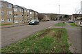
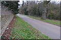
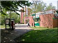
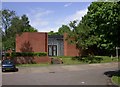
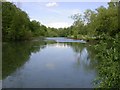
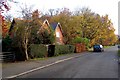
Photos of NN3 8PD

Area Information
Living in NN3 8PD means being part of a tightly packed residential cluster in England, where 1,916 people reside across 3,620 square metres. This small area, while compact, offers a mix of everyday conveniences and practical connectivity. The high population density of 529,295 people per square kilometre reflects a community that thrives on proximity to essential services. Residents benefit from nearby schools, retail outlets, and transport hubs, creating a self-contained environment. The area’s character is defined by its balance of residential tranquillity and accessible infrastructure, making it suitable for those prioritising convenience without sacrificing space. With no major planning constraints like protected woodlands or AONBs, development here is unencumbered. However, its small size means the community is intimate, with limited expansion potential. For buyers, this postcode represents a focused, functional living space where proximity to amenities outweighs the need for sprawling surroundings.
- Area Type
- Postcode
- Area Size
- 3620 m²
- Population
- 1916
- Population Density
- 3417 people/km²
NN3 8PD’s property market is characterised by a 37% home ownership rate, placing it firmly in the rental market’s orbit. The accommodation type is predominantly houses, which, given the area’s small size, suggests a concentration of family homes or multi-generational dwellings. This contrasts with areas dominated by flats or high-density housing. The limited size of NN3 8PD means the housing stock is finite, with little scope for new developments. For buyers, this creates a niche market where properties are likely to be older or require renovation. The low ownership rate also implies a transient population, which could affect property values and demand. Prospective buyers should consider the area’s constraints, as its immediate surroundings offer few alternatives, making it a specific choice for those prioritising proximity to schools and transport over expansive living space.
House Prices in NN3 8PD
Showing 8 properties
| Address | Type | Beds | Baths | Last Sale Price | Last Sale Date | |
|---|---|---|---|---|---|---|
| Flat 8, 11 Emmanuel Gardens, Northampton, NN3 8PD | Flat | - | - | - | - | |
| Flat 7, 11 Emmanuel Gardens, Northampton, NN3 8PD | Flat | - | - | - | - | |
| Flat 1, 11 Emmanuel Gardens, Northampton, NN3 8PD | Flat | - | - | - | - | |
| Flat 2, 11 Emmanuel Gardens, Northampton, NN3 8PD | Flat | - | - | - | - | |
| Flat 5, 11 Emmanuel Gardens, Northampton, NN3 8PD | Flat | - | - | - | - | |
| Flat 6, 11 Emmanuel Gardens, Northampton, NN3 8PD | Flat | - | - | - | - | |
| Flat 4, 11 Emmanuel Gardens, Northampton, NN3 8PD | Flat | - | - | - | - | |
| Flat 3, 11 Emmanuel Gardens, Northampton, NN3 8PD | Flat | - | - | - | - |
Energy Efficiency in NN3 8PD
The lifestyle in NN3 8PD is shaped by its proximity to retail, transport, and educational hubs. Residents have access to five retail outlets, including major chains like Tesco and Lidl, ensuring everyday shopping needs are met. The University Bus Interchange and Northampton Bus Interchange provide reliable links to surrounding areas, while Northampton Railway Station offers direct connections to further destinations. For leisure, the area’s schools and community spaces form the backbone of social interaction. The compact nature of NN3 8PD means amenities are clustered closely, reducing travel time for errands or meetings. While the data does not mention parks or leisure facilities explicitly, the absence of planning constraints like AONBs or protected woodlands suggests open spaces may be limited. Nonetheless, the area’s practical layout ensures daily life remains efficient, with most essentials within walking or short driving distance.
Amenities
Schools
Residents of NN3 8PD have access to a range of schools, including Lumbertubs Primary School, Lings Upper School, Emmanuel CofE Voluntary Aided Middle School, and Billing Brook Special School. Northampton Academy, an academy with an outstanding Ofsted rating, is also nearby. This mix of primary, middle, and special schools caters to diverse educational needs, from early years to secondary education. The presence of an outstanding-rated academy suggests high academic standards in the area, while the special school provides tailored support for students with additional needs. Families seeking a variety of options will find NN3 8PD well-served, though the proximity of these institutions may influence local housing demand. The cluster of schools also indicates a focus on education within the community, reinforcing its appeal for families.
| Rank | School | Type | Entry gender | Ages |
|---|
Explore more schools in this area
Go to Schools tabDemographics
The population of NN3 8PD skews towards adults aged 30–64, with a median age of 47. This suggests a mature, stable community where families and long-term residents predominate. Home ownership here is relatively low at 37%, indicating a higher proportion of renters compared to owner-occupiers. The area’s accommodation is primarily houses, which, combined with the high population density, implies smaller properties or shared living spaces. The predominant ethnic group is White, with no specific data on other demographics provided. While the data does not quantify deprivation levels, the age profile and housing stock suggest a mix of established residents and those in transitional life stages. The lack of younger households may influence local amenities and services, shaping a community focused on continuity rather than rapid growth.
Household Size
Accommodation Type
Tenure
Ethnic Group
Religion
Household Composition
Age
Household Deprivation
NS-SEC
Explore more demographic insights in this area
Go to Demographics tabPlanning
Planning Constraints
- Flood RiskPremium
- Ramsar Wetland SitesPremium
- Area of Outstanding Natural BeautyPremium
- Protected Nature ReservePremium
- Protected WoodlandPremium