Area Overview for NN3 8PA
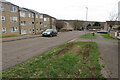
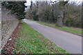
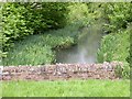
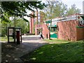
Photos of NN3 8PA

Area Information
Living in NN3 8PA means inhabiting a tightly packed residential cluster in England, where 1,916 people reside across just 2,881 square metres. This results in a population density of 665,112 people per square kilometre, reflecting a compact, closely knit community. The area is characterised by its small scale, with homes predominantly in private ownership and a median age of 47, suggesting a stable population of adults aged 30–64. Daily life here is shaped by proximity to essential services, including five retail outlets like Tesco Northampton and Lidl Lings, and transport links such as Northampton Bus Interchange. While the area lacks large-scale amenities, its density ensures convenience for nearby essentials. Residents benefit from excellent broadband connectivity, scoring 100 out of 100, though mobile coverage is slightly lower at 84. The presence of schools like Northampton Academy, rated outstanding by Ofsted, adds to the appeal for families. However, the high crime risk score of 13/100 means safety remains a concern for potential buyers. NN3 8PA is a small, densely populated area where proximity to services and schools is balanced by practical limitations in space and security.
- Area Type
- Postcode
- Area Size
- 2881 m²
- Population
- 1916
- Population Density
- 3417 people/km²
The property market in NN3 8PA is defined by its small size and high population density. With 37% of households owning their homes, the area leans more towards rental than owner-occupied properties, which may indicate limited housing availability or a transient population. The accommodation type is predominantly houses, which is unusual for a densely packed postcode but suggests a mix of smaller, family-friendly homes. Given the area’s compact nature, the housing stock is likely limited, meaning buyers may face competition for properties. The high population density of 665,112 people per square kilometre further restricts space, potentially reducing the appeal for those seeking larger homes or gardens. For buyers, this means the immediate surroundings may hold more options, but within NN3 8PA itself, properties are likely to be closely spaced. The mix of owner-occupied and rental homes could also influence local demand, with renters possibly prioritising proximity to schools and transport over property size.
House Prices in NN3 8PA
No properties found in this postcode.
Energy Efficiency in NN3 8PA
The lifestyle in NN3 8PA is defined by its proximity to essential retail and transport hubs. Nearby shops include Tesco Northampton, Lidl Lings, and Co-op Bushland, providing access to groceries and daily necessities without long commutes. The area’s compact nature means these amenities are within practical reach, supporting a convenience-focused lifestyle. For transport, the University Bus Interchange and Northampton Bus Interchange offer connections to broader networks, while the Northampton Railway Station provides rail access. Though the area lacks parks or leisure facilities, its density ensures residents can quickly reach larger centres for recreation. The mix of retail and transport options makes NN3 8PA suitable for those prioritising accessibility over expansive green spaces. However, the absence of specific data on dining or cultural venues means the character of local leisure is unclear. For buyers, the balance of convenience and space is critical, as the area’s limitations in size and amenities may influence long-term suitability.
Amenities
Schools
Residents of NN3 8PA have access to a range of schools, including Lumbertubs Primary School, Lings Upper School, and Emmanuel CofE Voluntary Aided Middle School, all of which cater to primary education. For special needs, Billing Brook Special School provides tailored support. The area also benefits from Northampton Academy, a secondary academy with an outstanding Ofsted rating. This mix of school types ensures families can find options from early years through to secondary education. The presence of an outstanding-rated academy may attract families seeking high-quality secondary schooling, while the primary schools offer nearby, accessible education for younger children. However, the lack of data on school catchment areas or pupil numbers means it is unclear how demand compares to supply. For prospective buyers, the proximity to these schools is a key consideration, particularly for those prioritising education quality. The variety of school types also suggests a diverse educational landscape, though the small area may limit the number of students per school.
| Rank | School | Type | Entry gender | Ages |
|---|---|---|---|---|
| 1 | Lumbertubs Primary School | primary | N/A | N/A |
| 2 | Lings Upper School | primary | N/A | N/A |
| 3 | Emmanuel CofE Voluntary Aided Middle School | primary | N/A | N/A |
| 4 | Billing Brook Special School | special | N/A | N/A |
| 5 | Northampton Academy | academy | N/A | N/A |
Explore more schools in this area
Go to Schools tabDemographics
The community in NN3 8PA is predominantly composed of adults aged 30–64, with a median age of 47. This suggests a mature, established population with a strong presence of middle-aged residents. Home ownership stands at 37%, indicating that nearly two-thirds of households are renters, which may reflect the area’s compact nature and limited housing stock. The accommodation type is primarily houses, aligning with the small, residential character of the postcode. The predominant ethnic group is White, with no specific data provided on other demographics. The high population density of 665,112 people per square kilometre implies a tightly packed community, which may influence social dynamics and access to shared spaces. While the data does not include deprivation metrics, the combination of high density and limited housing options could impact quality of life, particularly for those seeking larger properties or lower population pressure. The age profile suggests a stable, long-term resident base, though the lack of younger families may affect local amenities and school populations.
Household Size
Accommodation Type
Tenure
Ethnic Group
Religion
Household Composition
Age
Household Deprivation
NS-SEC
Explore more demographic insights in this area
Go to Demographics tabPlanning
Planning Constraints
- Flood RiskPremium
- Ramsar Wetland SitesPremium
- Area of Outstanding Natural BeautyPremium
- Protected Nature ReservePremium
- Protected WoodlandPremium
- Crime RiskPremium