Area Overview for NN3 8JF
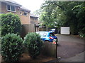
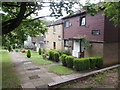
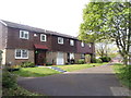
Photos of NN3 8JF

Area Information
Living in NN3 8JF means inhabiting a compact, densely populated residential cluster in England. With a population of 1,832 spread across 9,616 square metres, this area is characterised by high density and a focus on housing. The community is predominantly composed of adults aged 30–64, reflecting a mature, stable demographic. Daily life here is shaped by proximity to essential services, including three primary schools and nearby retail hubs like Tesco Northampton and Co-op Northampton. The area’s small size means amenities are within practical reach, though the population density suggests a tightly knit, possibly family-oriented environment. While no major natural or protected sites are present, the area benefits from low flood risk and a safety score of 70/100, indicating a generally secure living environment. Residents here are likely to value convenience, with homes primarily occupied by owners and a strong emphasis on local schools and transport links. The compact nature of NN3 8JF makes it a practical choice for those seeking a mix of residential comfort and accessibility to urban resources.
- Area Type
- Postcode
- Area Size
- 9616 m²
- Population
- 1832
- Population Density
- 5296 people/km²
The property market in NN3 8JF is defined by a high rate of home ownership—72%—and a focus on houses rather than flats or apartments. This suggests a market that caters to families and long-term residents seeking stability and space. With a population density of nearly 190,000 people per square kilometre, the area’s small size means housing stock is limited, and properties are likely to be in close proximity to one another. The predominance of houses indicates a preference for private, standalone homes, which may appeal to buyers looking for traditional family homes. However, the compact nature of the area means that the immediate surroundings are also densely developed, limiting potential for expansion or new builds. For prospective buyers, this suggests a market where properties are in demand, but competition may be fierce, particularly for homes near schools or transport links. The high ownership rate also implies that rental options are scarce, making NN3 8JF more attractive to those seeking to buy rather than rent.
House Prices in NN3 8JF
Showing 15 properties
| Address | Type | Beds | Baths | Last Sale Price | Last Sale Date | |
|---|---|---|---|---|---|---|
| 14 North Hayes Court, Northampton, NN3 8JF | Detached | 4 | 2 | £261,500 | Oct 2017 | |
| 4 North Hayes Court, Northampton, NN3 8JF | Detached | 4 | - | £225,000 | Apr 2016 | |
| 10 North Hayes Court, Northampton, NN3 8JF | Detached | - | - | £170,000 | Mar 2012 | |
| 15 North Hayes Court, Northampton, NN3 8JF | Detached | - | - | £205,000 | May 2007 | |
| 9 North Hayes Court, Northampton, NN3 8JF | Detached | - | - | £190,000 | May 2006 | |
| 12 North Hayes Court, Northampton, NN3 8JF | Detached | 4 | 1 | £167,000 | Jun 2005 | |
| 3 North Hayes Court, Northampton, NN3 8JF | house | - | - | £185,000 | Jul 2004 | |
| 11 North Hayes Court, Northampton, NN3 8JF | Detached | - | - | £170,000 | Jul 2004 | |
| 8 North Hayes Court, Northampton, NN3 8JF | Detached | - | - | £143,000 | Sep 2002 | |
| 13 North Hayes Court, Northampton, NN3 8JF | house | - | - | £59,000 | Oct 1995 |
Energy Efficiency in NN3 8JF
The lifestyle in NN3 8JF is shaped by its proximity to retail, transport, and community hubs. Residents have access to five retail outlets within practical reach, including major chains like Tesco Northampton and Co-op Northampton, as well as smaller stores such as Lidl Lings. These shops provide convenience for daily errands, reducing the need for longer trips. The area’s transport infrastructure includes two bus interchanges and a railway station, facilitating easy movement to nearby towns and cities. While the data does not mention parks or leisure facilities, the presence of multiple schools and retail options suggests a focus on family-friendly amenities. The compact nature of the area means that essential services are close, fostering a sense of community. However, the high population density may limit opportunities for open space or recreational areas, which could be a consideration for those prioritising outdoor activities. Overall, the lifestyle here is practical and service-oriented, catering to those who value accessibility over expansive natural environments.
Amenities
Schools
Residents of NN3 8JF have access to three primary schools within practical reach: Woodvale Primary School, Goldings Middle School, and Woodvale Primary Academy, which holds an Ofsted rating of ‘good’. The presence of multiple primary schools suggests a focus on early education, which is likely to be a key consideration for families. The inclusion of a school with a ‘good’ rating indicates a reasonably high standard of education in the area, though the absence of secondary schools means parents may need to look further afield for secondary education. The concentration of primary schools also implies that the area is well-served for younger children, which could be a draw for families with school-age dependents. However, the lack of diversity in school types—only primary schools are listed—means that the educational landscape is limited to early years, requiring additional planning for older children.
| Rank | School | Type | Entry gender | Ages |
|---|
Explore more schools in this area
Go to Schools tabDemographics
The community in NN3 8JF is predominantly composed of adults aged 30–64, with a median age of 47. This suggests a population that is largely established, with fewer young families or retirees compared to other areas. Home ownership is high, at 72%, and the accommodation type is primarily houses, indicating a preference for single-family homes over flats or shared housing. The predominant ethnic group is White, reflecting a homogenous demographic profile. The population density of 190,519 people per square kilometre is exceptionally high, which may influence the character of daily life, with limited open space but a concentration of services and amenities. This density also means that the area is likely to have a strong local identity, though it may lack the diversity seen in larger urban centres. For buyers, the high home ownership rate and focus on houses suggest a market skewed towards owner-occupiers rather than renters, which could affect property values and availability.
Household Size
Accommodation Type
Tenure
Ethnic Group
Religion
Household Composition
Age
Household Deprivation
NS-SEC
Explore more demographic insights in this area
Go to Demographics tabPlanning
Planning Constraints
- Flood RiskPremium
- Ramsar Wetland SitesPremium
- Area of Outstanding Natural BeautyPremium
- Protected Nature ReservePremium
- Protected WoodlandPremium